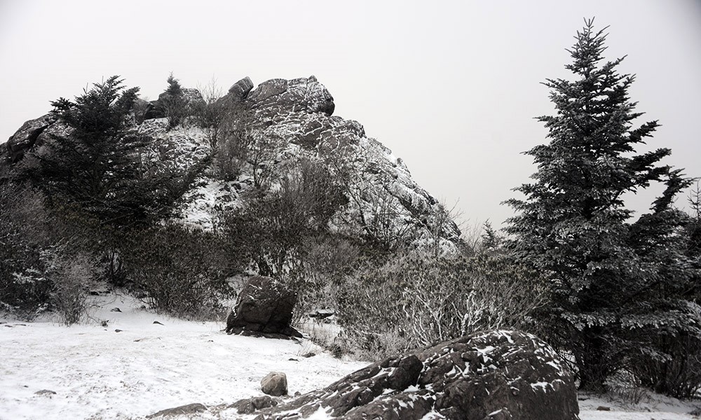
Rhododendron Gap
Jefferson National Forests
5162 Valleypointe Parkway
Roanoke, VA 24019
540-265-5100
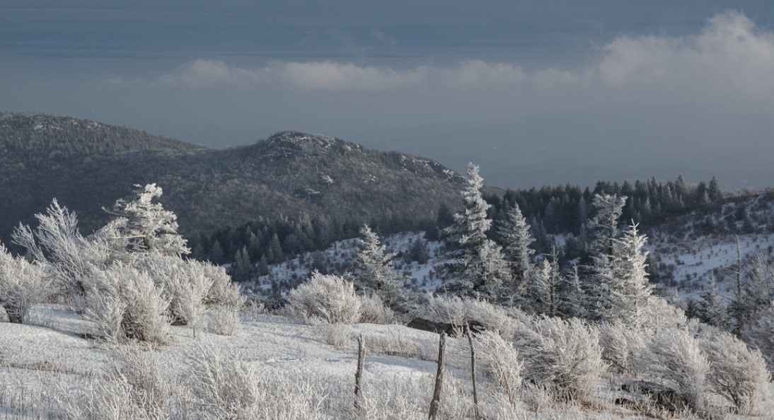
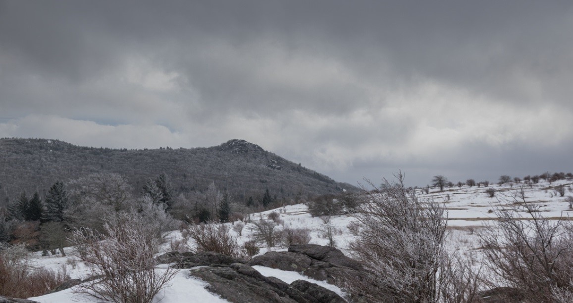
The Mount Rogers National Recreation Area (NRA), a part of the George Washington and Jefferson National Forest, covers over 140,000 acres of high mountain lands in southwest Virginia. The high country consists of three areas which include the Lewis Fork Wilderness, the Little Wilson Creek Wilderness, and the Crest Zone. The Lewis Fork and Little Wilson Creek Wilderness are two federally designated wildernesses that total about 10,000 acres of primitive backcountry. These two areas are forested in northern hardwoods with red spruce and Fraser Fir at the highest elevations. The Crest Zone includes the open areas on Brier Ridge, Cabin Ridge, Wilburn Ridge, Stone Mountain, and Pine Mountain which total about 2,000 acres. The views here are spectacular, with rocky ridges and grassy areas. The area was once heavily forested, but heavy logging by private companies during the early 1900’s and wildfires created the balds. The grazing by domestic livestock kept them open, and The USDA Forest Service acquired the property during the 1960’s. Today the balds are kept open through prescribed burning and regulated cattle grazing by private farmers who lease grazing rights. Two herds of free-roaming ponies make their home in the high country, and also help to keep the balds clear.
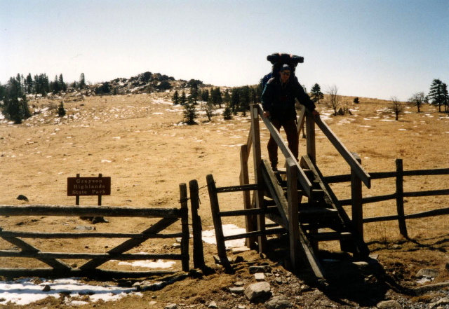
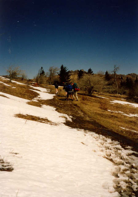
There are over 400 miles of designated trails on the Mount Rogers National Recreation Area, and they range from primitive single-track paths to old logging roads and railroad grades. Some are for foot only, others allow horse and/or bicycle use. Plan your trip carefully if you are looking for solitude. Trails in the high country as well as the Virginia Creeper and Appalachian Trail are popular destinations, particularly on weekends. Grayson Highland State Park is more akin to the grasslands of Montana than the typical meadows of Southwestern Virginia. There are magnificent views from the wide open areas in the park and from the numerous rock outcroppings along the trail. Herds of wild ponies roam these lands and are often seen in the area. I’ve hiked this area numerous times, and prefer the loop hikes using the Appalachian and Pine Mountain Trails. This trip, however, we did a shuttle hike across Rhododendron Gap where we got hit by a blizzard and had to set-up camp for the night before we reached our destination. The snow was heavy above 5000 feet, but non-existent in the lower areas.
- click for a Daytimer report of this backpacking trip to Rhododendron Gap: October 28, 1995 (password required)
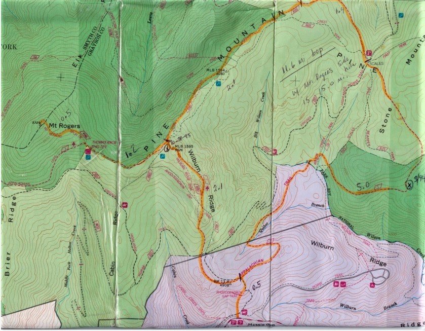
- click for a topographical map of the Appalachian-Pine Mountain Loop
- click for a topo and profile map of this loop hike with a side trip to Mount Rogers (password required)
- click for a video from a summer trip to Grayson Highlands State Park in August 2021
- click for more backpacking trips in the Grayson Highlands in August 1993, March 1994, October 1995, August 2021
- click for more information on the Appalachian Trail
- click for Appalachian Trail hiking and backpacking books
- click for Virginia hiking and backpacking books