Mount Rogers
Jefferson National Forests
5162 Valleypointe Parkway
Roanoke, VA 24019
540-265-5100
At Rhododendron Gap, the Appalachian Trail makes a hard turn to the right for the northbound hiker and heads into Grayson Highlands State Park. The park is adjacent to the Mount Rogers National Recreation Area, a part of the Jefferson National Forest. Grayson Highlands, originally named Mount Rogers State Park, was established in 1965. The community overwhelmingly supported this park, beginning with a fund-raising effort for land acquisition and continuing with the donation of items on exhibit in the visitor center. Many areas in the park are named after early settlers. Massie Gap takes its name from Lee Massey, who lived in the gap with his wife and five children in the late 1800s and early 1900s. Wilburn Ridge is named after the famed hunter Wilburn Waters. His reputation as a bear hunter and wolf trapper made him renowned throughout the region.
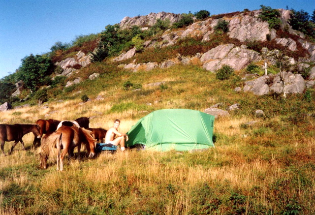
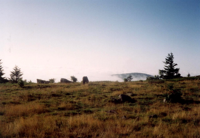
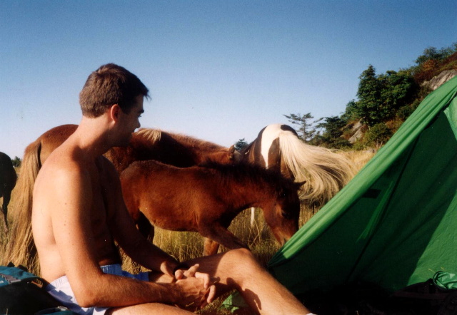
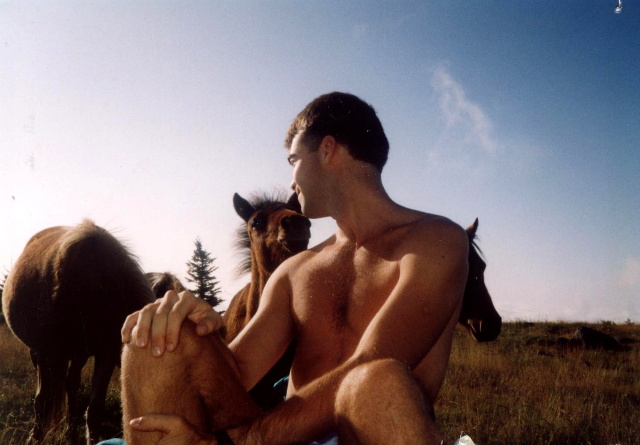
Grayson Highland State Park is more akin to the grasslands of Montana than the typical meadows of Southwestern Virginia. There are magnificent views from the wide open areas in the park and from the numerous rock outcroppings along the trail. Herds of wild ponies roam these lands and are often seen not far from the trail. Slawdog and I combined the Appalachian Trail with some side trails in the Grayson Highlands State Park and the Mount Rogers National Recreation Area to complete a fifteen mile overnight hike in the area. We also climbed a short 0.4 mile side trail to the 5,729 feet summit of Mount Rogers which is the highest mountain in Virginia and is home to the northernmost Fraser Firs on the Appalachian Trail.
- click for more photos from this backpacking trip to Mount Rogers: August 13, 1993
- click for a Daytimer report from this hike in Grayson Highlands State Park: August 13, 1993 (password required)
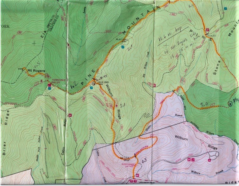
- click for a topographical map of the Appalachian-Pine Mountain Loop
- click for a topo and profile map of this loop hike with a side trip to Mount Rogers (password required)
- click for a video from a summer trip to Grayson Highlands State Park in August 2021
- click for more backpacking trips in the Grayson Highlands in August 1993, March 1994, October 1995, August 2021
- click for the guidebook Hiking Virginia for more hikes in the State
- click for Virginia hiking and backpacking books
- click for more information on the Appalachian Trail
- click for Appalachian Trail hiking and backpacking books