Springer Mountain (via Big Stamp Gap)
Chattahoochee-Oconee National Forests
1755 Cleveland Highway
Gainesville, GA 30501
770 297-3000

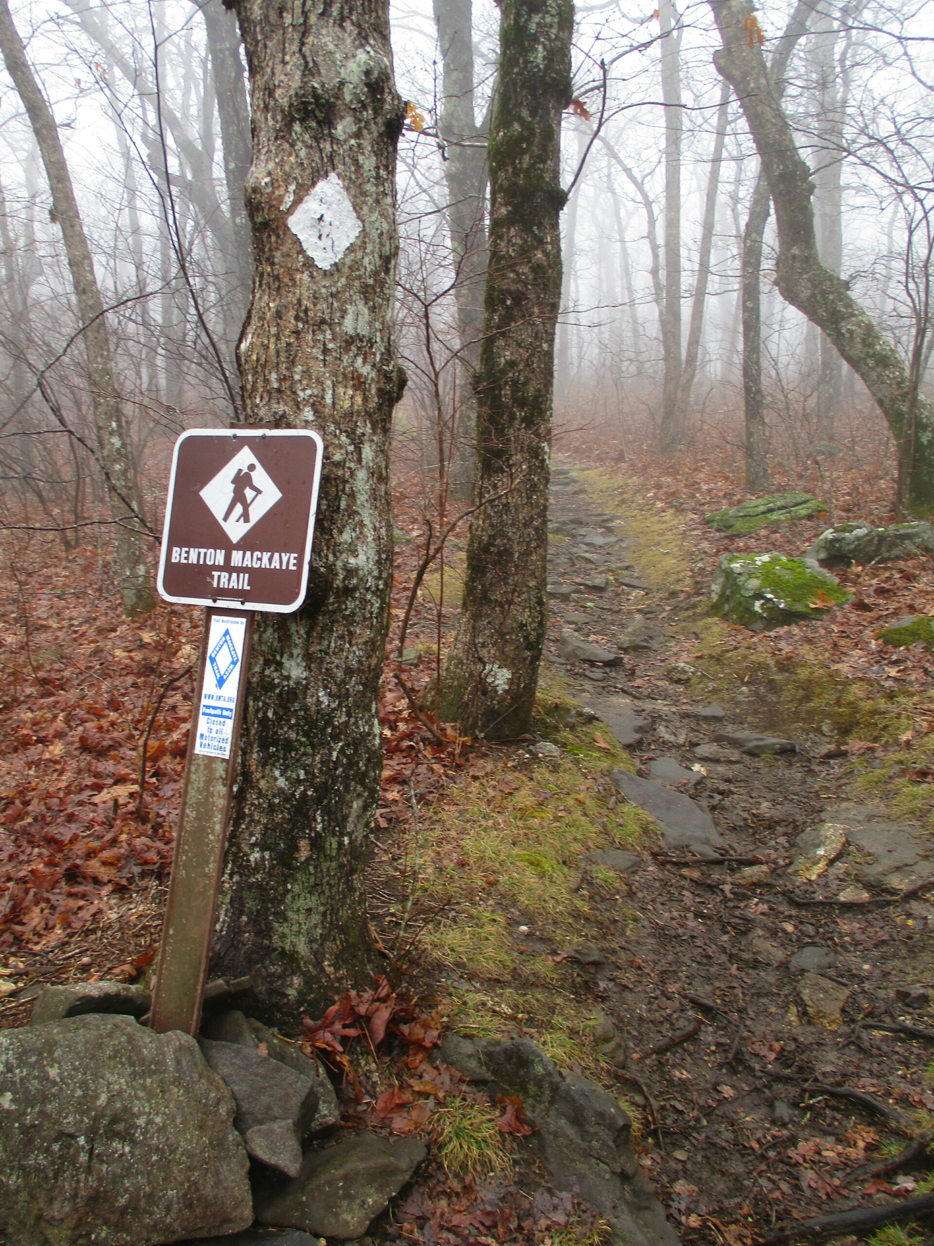
The Benton MacKaye Trail is a work in progress, and it currently runs nearly 100 miles from the southern terminus at Springer Mountain, Georgia, to US Hwy 64 & 74 near the Ocoee River in Tennessee. The trail is named for Benton MacKaye, who first published a proposal for the creation of the Appalachian Trail in the early 1900’s while hiking in Vermont. The current plan is for the Benton MacKaye Trail to continue through the Cherokee National Forest in Tennessee and eventually reach the Great Smoky Mountains National Park in North Carolina and rejoin with the Appalachian Trail. (For more information, you can visit the Benton MacKaye Trail Association website. Its members volunteer for trail development, construction, maintenance and repair.)
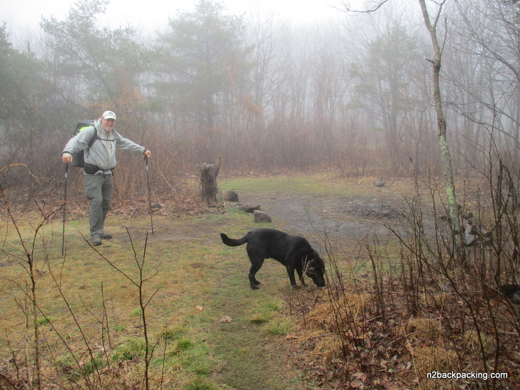
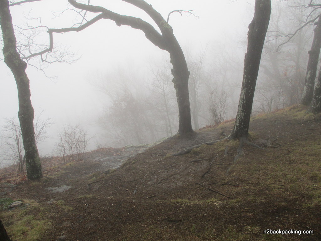
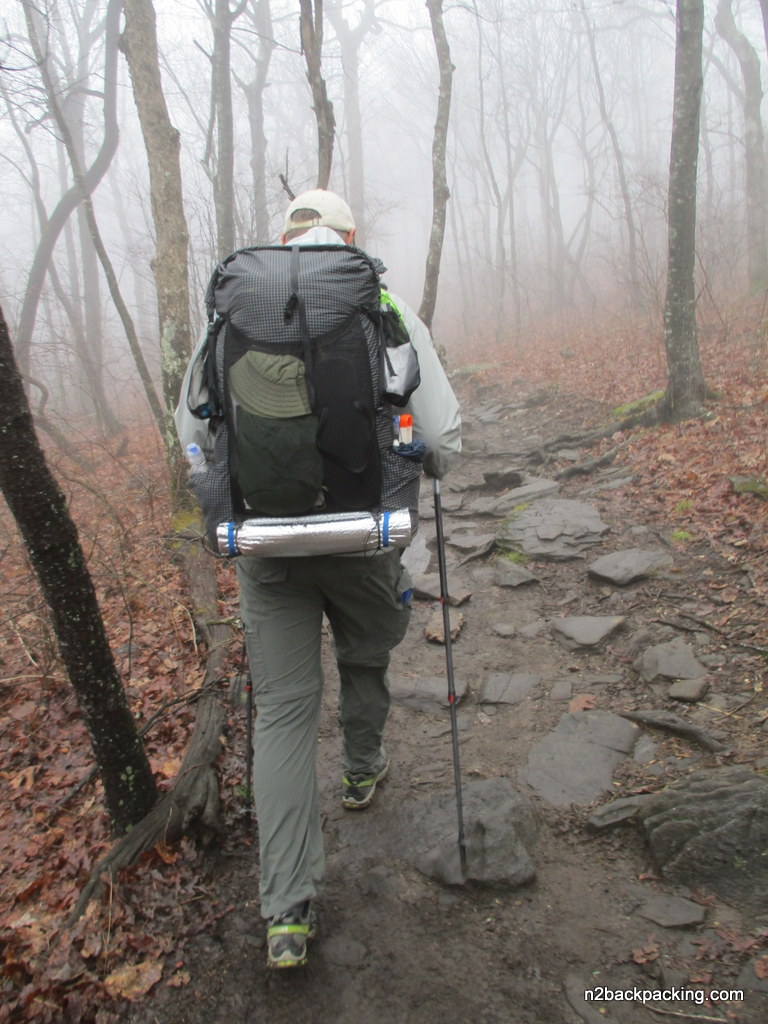
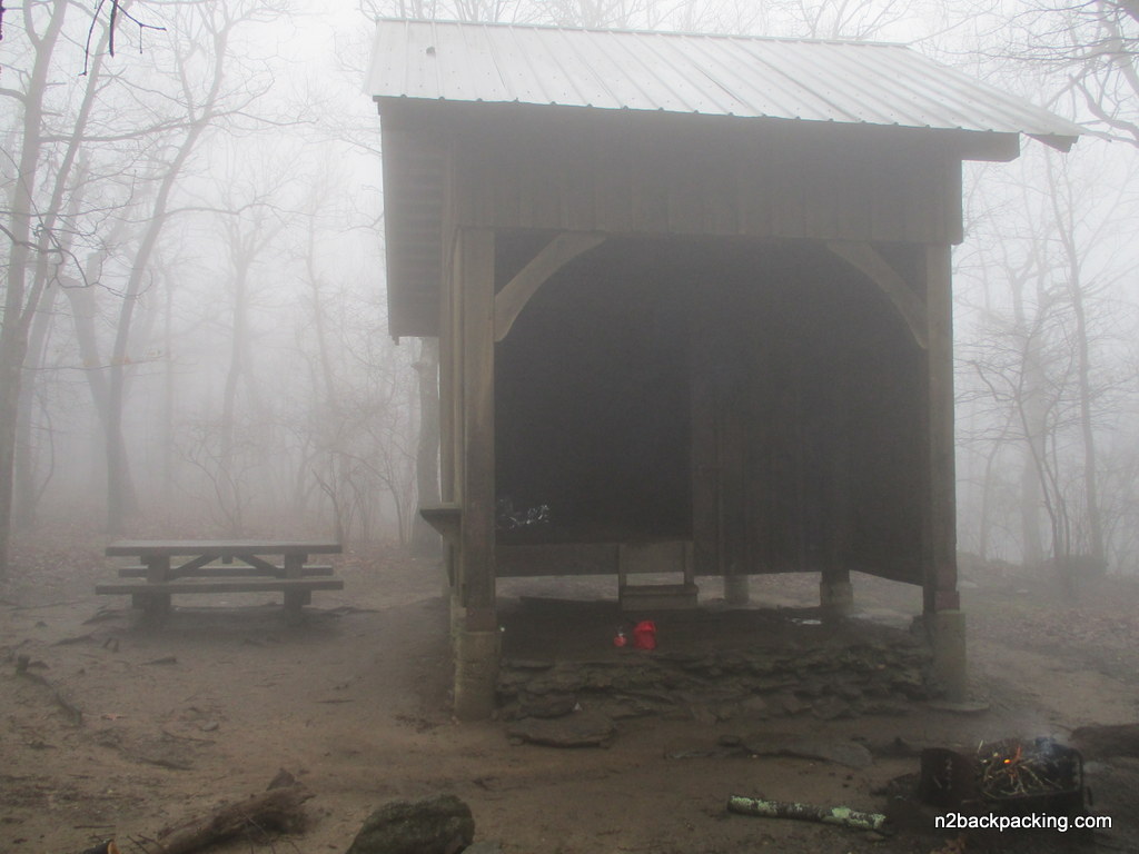
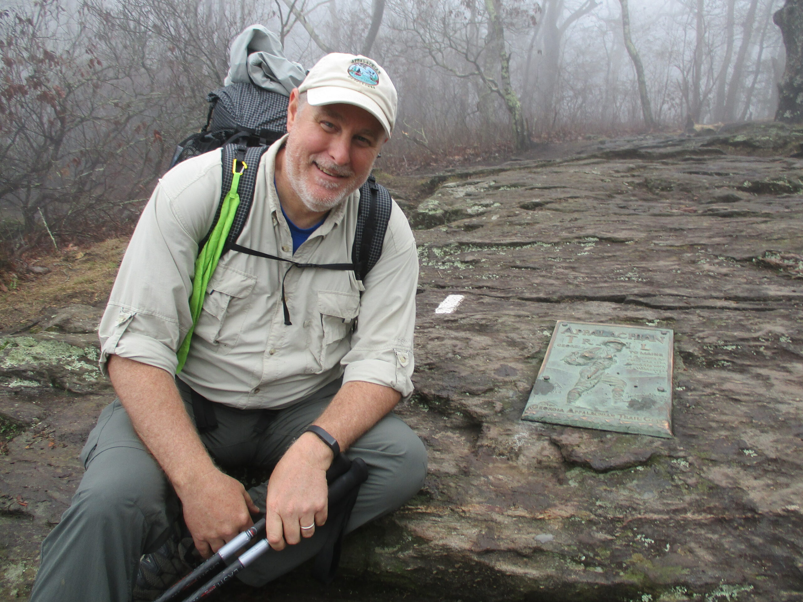
I’ve hiked this section of the Benton MacKaye Trail (BMT) a few times. In 1997, we hiked a four mile loop that that started at USFS 42, climbed to Springer Mountain, dropped to Big Stamp Gap, then finished back at the A.T. parking area on USFS 42. In 1999, we camped at Big Stamp Gap, hiked up to Springer Mountain, then backtracked to our campsite. Both hikes are fairly easy and take you to the southern terminus of both the Appalachian and Benton MacKaye Trails where there are nice views to the south. This short section of the Benton MacKaye Trail starts at Springer Mountain, the southern terminus of both the Benton MacKaye and Appalachian Trails and descends gradually for about 700 feet. There are outstanding views to the south from the bronze plaque and first white blaze at Springer Mountain, and there is also a nice vista to the east just past Ball Mountain on the BMT. At Big Stamp Gap, the Benton MacKaye Trail crosses USFS 42 and a nice drive-in campsite and continues northbound.
- click for a video from Springer Mountain Shelter near the start of the Benton MacKaye Trail
- click for more photos of this day hike on section one of the Benton MacKaye Trail: March 26, 2017
- click for a trip report from this hike to Springer Mountain at Big Stamp Gap: March 26, 2017 (password required)
- click for a Trails Illustrated map of this area between Amicalola Falls & Springer Mountain
- click for a topographical map of section one of the Benton MacKaye Trail (password required)
- click for a topographical map of this loop hike on the A.T. and Benton MacKaye Trail (password required)
- click for a topographical map of the Springer Mountain area (password required)
- click for a loop hike starting at Big Stamp Gap that uses both the Appalachian and Benton MacKaye Trails (password required)
- click for a trail map of the entire Benton MacKaye Trail (password required)
- click for another map of the entire Benton MacKaye Trail (password required)
- click for a profile map of this hike from Springer Mountain to Big Stamp Gap (password required)
- click for a profile map of section one of the Benton MacKaye Trail (password required)
- click for trail notes from section one of the Benton MacKaye Trail (password required)
- click for an article about the campsites at Springer Mountain
- click for more hikes to Springer from Big Stamp Gap in October 1997, December 1999, and March 2017
- click for the guidebook Best Hikes With Dogs Georgia And South Carolina which has details on this area
- click for more information on the Benton MacKaye Trail