Rim Lake
White River National Forest
900 Grand Ave.
P.O. Box 948
Glenwood Springs CO 81602
970-945-2521
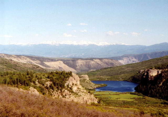
When the National Wilderness Preservation System was established in 1964, one of its earliest and most significant designations was the Flat Tops Wilderness, a vast and rugged landscape spanning more than 235,000 acres within the Routt National Forest and White River National Forest. Situated on the White River Plateau, roughly 20 miles north of Glenwood Springs and 30 miles southwest of Steamboat Springs, this wilderness is known for its distinctive high-elevation terrain. Unlike the jagged peaks typically associated with the Rockies, the Flat Tops are defined by broad, table-like summits—remnants of ancient volcanic activity that left behind layers of hardened lava capping a massive uplifted dome. This unique geology is especially evident along features like the Chinese Wall, a striking escarpment that stretches for miles, and the narrow, dramatic Devils Causeway, where a thin ridge separates the headwaters of the East Fork of the Williams Fork River from the North Fork of the White River, offering both breathtaking views and an airy, unforgettable traverse.
Our hike through this remote terrain followed portions of the Sweetwater Trail and the Rim Lake Trail, with the goal of pushing above 10,000 feet to fish for high-country trout in Shepherd and Rim Lakes. Early season conditions, however, had other plans—lingering snowfields still blanketed the upper elevations, obscuring the trails and making travel slow and uncertain. Rather than force the route, we adjusted and settled into a quieter rhythm, eventually finding an ideal campsite along a clear, cold stream at around 9,500 feet. Tucked beside a wide alpine meadow dotted with wildflowers just beginning to emerge, the site offered both solitude and scenery, with open views of the surrounding plateau and the soothing sound of running water nearby. Though we never reached the lakes, the experience captured the essence of the Flat Tops: remote, unpredictable, and rewarding in ways that go beyond simply reaching a destination.
- click for a video of our cross-country road trip during the summer of 1998
- click for a podcast Episode 14 about our cross-country road trip in the summer of 1998
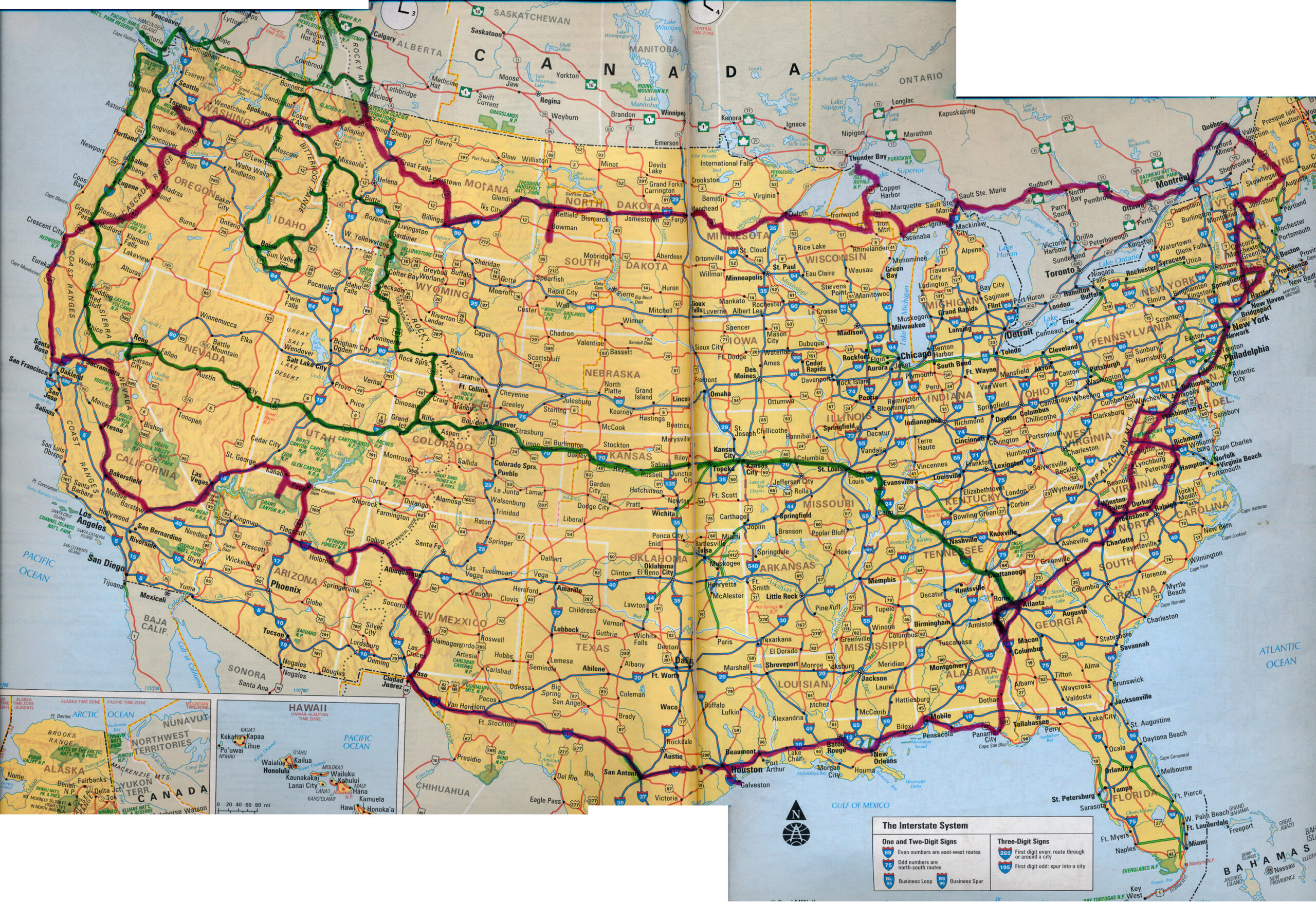
- click for a map of our cross-country routes in the summer of 1996 (red line) and 1998 (green line)
- click for more photos from this hike to Rim Lake: June 19, 1998
- click for a Backpacker Log from this hike on the Sweetwater Trail: June 19, 1998
- click for a Daytimer report from this backpacking in the Flat Top Wilderness (password required)
- click for a topo and profile map for this hike to Rim Lake (password required)
- click for a marked trail map from this backpacking trip in the White River National Forest (password required)
- click for hikes to Rim Lake, Bradley Lake, Hellroaring Canyon, Fish Lake, and Bench Lake in June 1998
- click for Hiking Colorado: A Guide To The State’s Greatest Hiking Adventures (State Hiking Guides Series)
- click for more hikes in the State of Colorado


