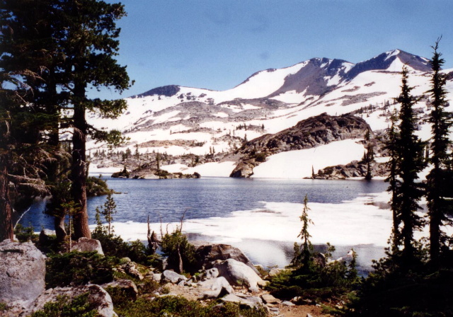
Velma Lake
El Dorado National Forest
Lake Tahoe Basin Management Unit
P.O. Box 8465
South Lake Tahoe, CA 95731
(916) 544-6420
The Eldorado National Forest is a beautiful and diverse national forest located in the central Sierra Nevada of California. Covering about 596,724 acres, it is known for its stunning alpine lakes, rugged mountains, dense forests, and abundant outdoor recreation opportunities. The forest is located in the central Sierra Nevada with portions of Alpine, Amador, El Dorado, and Placer counties within the boundary. The forest is has the Tahoe National Forest to the north, the Lake Tahoe Basin Management Unit on the east, the Humboldt-Toiyabe to the southeast, and the Stanislaus National Forest to the south. Eldorado ranges in elevation from 1,000 feet in the foothills to more than 10,000 feet above sea level along the Sierra crest.
The Desolation Wilderness is located in the forest and it is a popular backpacking and hiking destination with granite peaks and crystal-clear lakes. The mountainous topography is broken by the steep canyons of the Mokelumne, Cosumnes, American, and Rubicon rivers. Plateaus of generally moderate relief are located between these steep canyons. The Eldorado National Forest has a network of trails totaling 349 miles. I hiked it with The Ox during a cross-country road-trip in 1998 and we decided to explore the Desolation Wilderness which is a section near Lake Tahoe. Although we passed a number of day hikers and backpackers during the trip, we had Velma Lake all to ourselves during our visit.
- click for a video of our cross-country road trip during the summer of 1998
- click for a podcast Episode 14 about our cross-country road trip in the summer of 1998
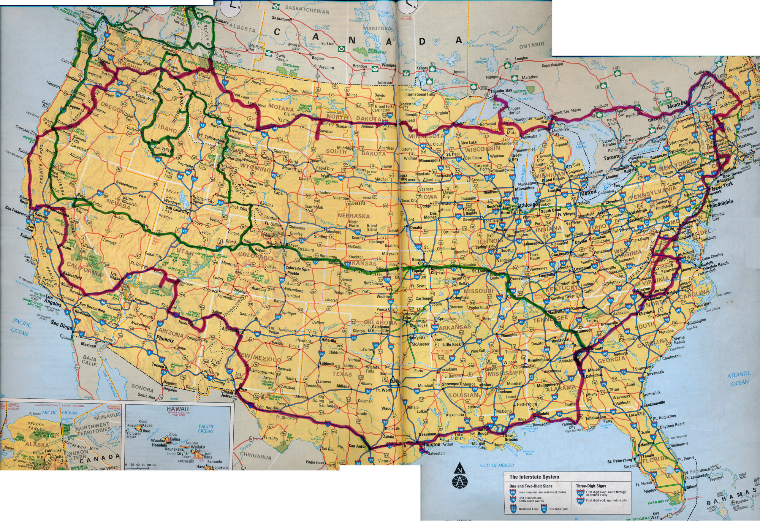
- click for a map of our cross-country routes in the summer of 1996 (red line) and 1998 (green line)
- click for more photos from this hike in the Eldorado National Forest: July 19, 1998
- click for a Daytimer report from this backpacking trip in the Eldorado National Forest (password required)
- click for a detailed trip report from this backpacking trip to Upper Velma Lake: July 19, 1998 (password required)
- click for a Backcountry Log from this hike to Upper Velma Lake: July 19, 1998
- click for an area map of the Eldorado National Forest
- click for a topo and profile map of this hike to the Velma Lakes (password required)
- click for a topographical map of our hike in the Desolation Wilderness (password required)
- click for more hikes to the Salmo River, Gunsight Pass, Cape Alva, Velma Lake, and Buckskin Pass in July 1998
- click for hikes to Rim Lake, Bradley Lake, Hellroaring Canyon, Fish Lake, and Bench Lake in June 1998
- click for the guidebook 100 Classic Hikes in Northern California which has details on this destination
- click for other California hiking and backpacking books
- click for more hikes in the State of California


