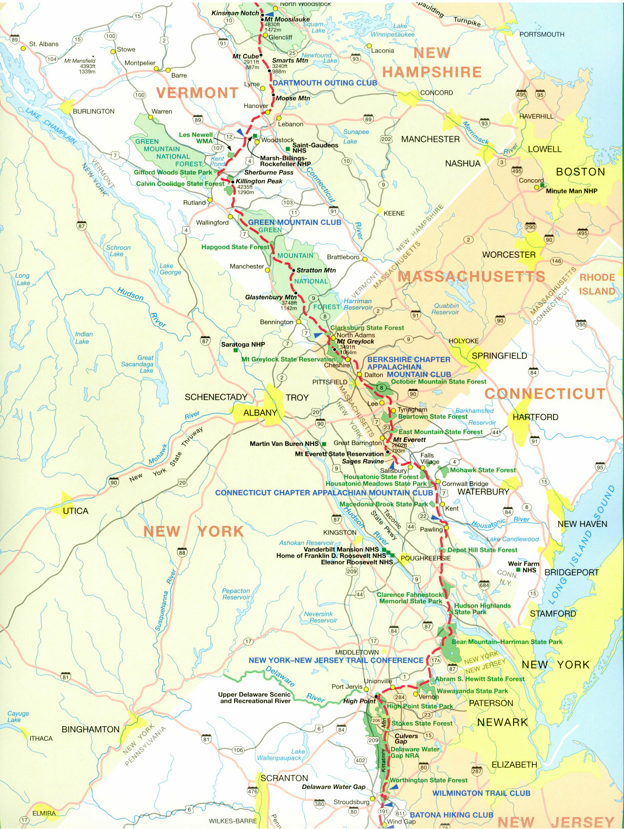
Appalachian Trail #3 (Stratton Mountain to VT 103)
Appalachian Trail Conservancy
799 West Washington Street
Harpers Ferry, WV 25425
(304) 535-6331

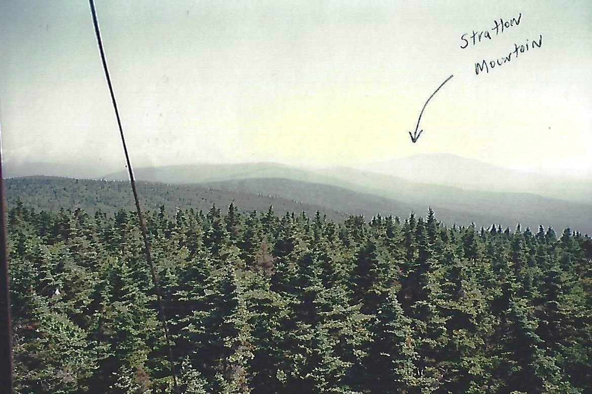
Stratton Mountain at 3,936 feet is likely the birthplace of the Appalachian Trail. Benton MacKaye, who first published a proposal for the creation of the A.T. is thought to have come up with the idea during a hike on this mountain. A cabin with a summer caretaker is near the summit for overnight use, and a side trail leads a short distance to the Stratton Ski Area where a gondola provides access to the base of the mountain. Stratton Pond is located just north of Stratton Mountain, and it has two shelters, a swimming area, and a camping area. The pond is one of the busiest areas on the entire Long Trail and a caretaker is on site to manage the site.
The Appalachian Trail continues from here to the town of Manchester Center, then climbs up Bromley Mountain which is topped by a fire tower and a warming hut. If you follow the chair lifts down the ski slope, there is an alpine slide that starts half way up the mountain. Tired Dogs, Laid Back Sue, and I took multiple rides on it, and I highly recommended it. The Trail continues in this section past two alpine campsites, Griffin Lake Campsite and Little Rock Pond. It then passes near the town of South Wallingford and eventually drops down to Clarendon Gorge. A suspension bridge crosses the Mill River here, and it’s only a short distance from it to VT 103 and the town of North Clarendon. Overall, this section is known for classic Green Mountain hiking—quiet woods, soft treadway, frequent wet areas, and a steady rhythm of shelters—providing a long, immersive stretch of Vermont wilderness before the trail continues toward Killington and the central Green Mountains.
- click for a short video slideshow of my 1994 thru-hike on the Appalachian Trail
- click for more photos from this hike on the A.T. in Vermont: August 25-29, 1994
- click for a Daytimer report from this section of the A.T. in Vermont (password required)
- click for a trail journal from my thru-hike through Vermont (password protected)
- click for a day-by-day summary of BirdShooter’s 1994 Appalachian Trail thru-hike
- click for a trail map of the Appalachian Trail in Vermont
- click for a trail map of the entire ~2200 mile Appalachian Trail
- click for the guidebook Appalachian Trail: New Hampshire – Vermont for more hikes in this area
- click for Appalachian Trail hiking and backpacking books
- click for more information on the Appalachian Trail
- click for more hiking and backpacking trips in the State of Vermont