Lake Grapevine
Grapevine Lake Project Office
110 Fairway Drive
Grapevine, TX
817-865-2600
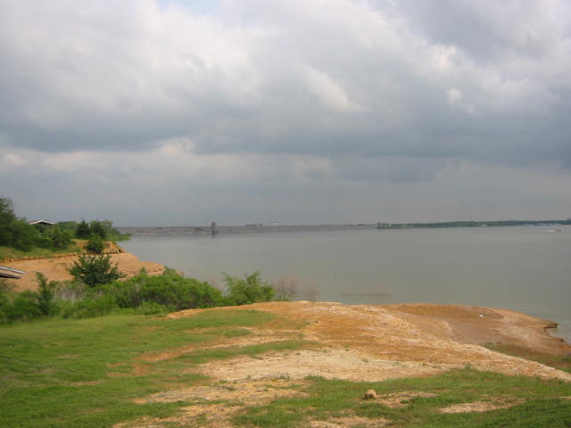
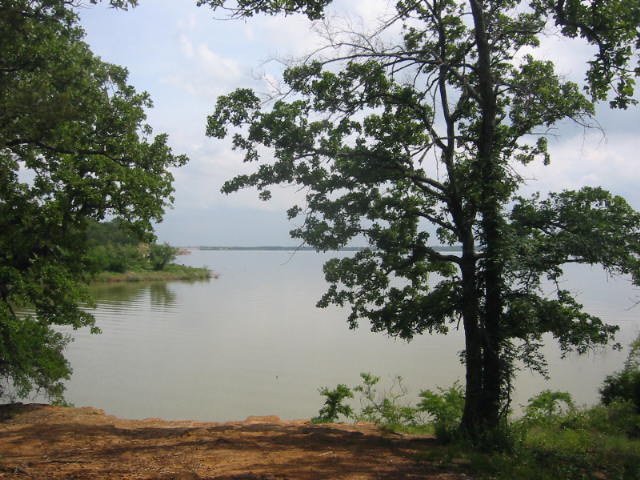
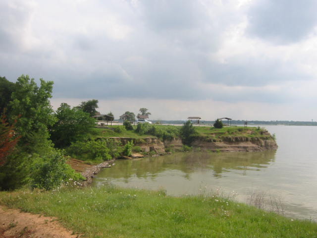
Lake Grapevine is a scenic reservoir in North Texas, situated approximately 20 miles northwest of Dallas and northeast of Fort Worth. Created in 1952 by the U.S. Army Corps of Engineers through the damming of Denton Creek, a tributary of the Trinity River, the lake serves multiple purposes including flood control, municipal water supply, and recreation. The lake spans about 7,280 acres with nearly 60 miles of shoreline at its conservation level. Lake Grapevine borders the Dallas/Fort Worth International Airport to the northwest, making it a prominent landmark for travelers. Notable trails at the lake include the 9-mile Northshore Trail, 5-mile Crosstimbers Horse Trail, 4-mile Knob Hill Trail, and 3-mile Rocky Point Trail. The adjacent city of Grapevine offers various amenities, including the Gaylord Texan Resort & Convention Center, known for its holiday festivities and proximity to the lake.
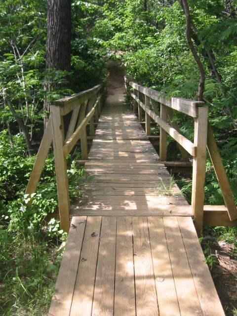
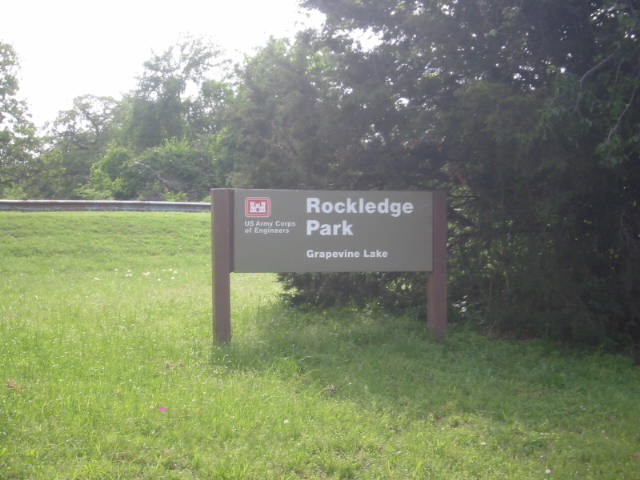
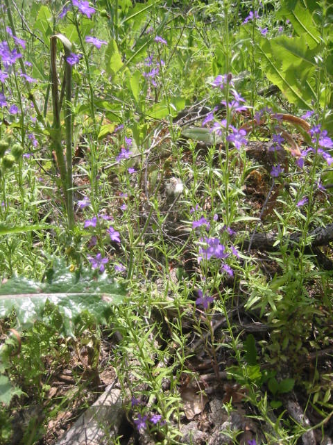
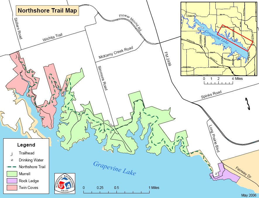
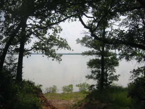
Rockledge Park is located on Fairway Drive in Grapevine, on the North side of Grapevine Lake. The park is a U.S. Army Corps of Engineers facility and it is popular with both mountain bikers and hikers due to the nine mile Northshore Trail. The trail winds along the banks of Grapevine Lake with excellent views at various points along the route. It is near the DFW airport, so don’t be surprised to see some large 767’s passing overhead, and there are often bass fisherman tucked in the coves along the path. However, the trail wanders in/out of a heavily wooded forest that hugs the water, so it is an enjoyable and somewhat wild experience only a short distance from a major metropolitan area.
- click for a trip report from this hike at Lake Grapevine: May 2, 2007 (password required)
- click for a trail map of the nine mile Northshore Trail
- click for a topographical and profile map of this hike at Rockledge Park (password required)
- click for another hike in Texas at the Bartron Creek in December 2008
- click for another hike we did this month at Tray Spur
- click for the guidebook Hiking Texas with more hikes in the State
- click for links to other outdoor books and magazines
- click for more hikes in the State of Texas