Ellis Dam
Muskingum River State Parkway
7924 Cutler Lake Road
Blue Rock, OH 43720-9728
(740) 674-4794

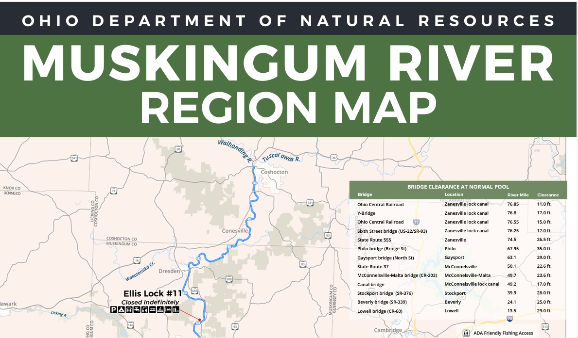
The Muskingum River Parkway and its 160-year-old navigation system were designated a National Historic Civil Engineering Landmark by the American Society of Civil Engineers in July 2001. Along with such majestic institutions as Hoover Dam, The Empire State Building and the Golden Gate Bridge, the Muskingum River’s 10 hand-operated locks are now recognized as one of America’s great engineering accomplishments. In its day, the system of locks and dams that extends 112 miles through southeastern Ohio, helped open the state and the entire Midwest to trade and development.
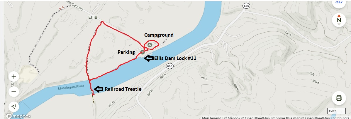
Today, the Muskingum River Parkway serves the needs of more than 7,000 recreational boaters each year who come to fish, picnic and play in the scenic Muskingum Valley. The area has been placed on the National Register of Historic Places and will be recognized as the Muskingum River Navigation Historic District. This hike starts at the parking area for the State park and follows Ellis Dam road west to a bike trail which is located about 0.3 miles before you reach the campground and parking area. The bike trail continues another 0.3 miles to a railroad trestle on the Muskingum River that has excellent views back to the dam and Ellis Lock #11. From the trestle you can either backtrack to the parking area or hug the river bank and return to the lock.
- click for more photos from this hike along the Muskingum River: May 9, 2009
- click for a trip report from this hike to the trestle at Ellis Dam: May 9, 2009 (password required)
- click for a region map of the Muskingum River
- click for a park map from Muskingum River State Park
- click for a topo map of this hike at Ellis Dam to the Muskingum River trestles
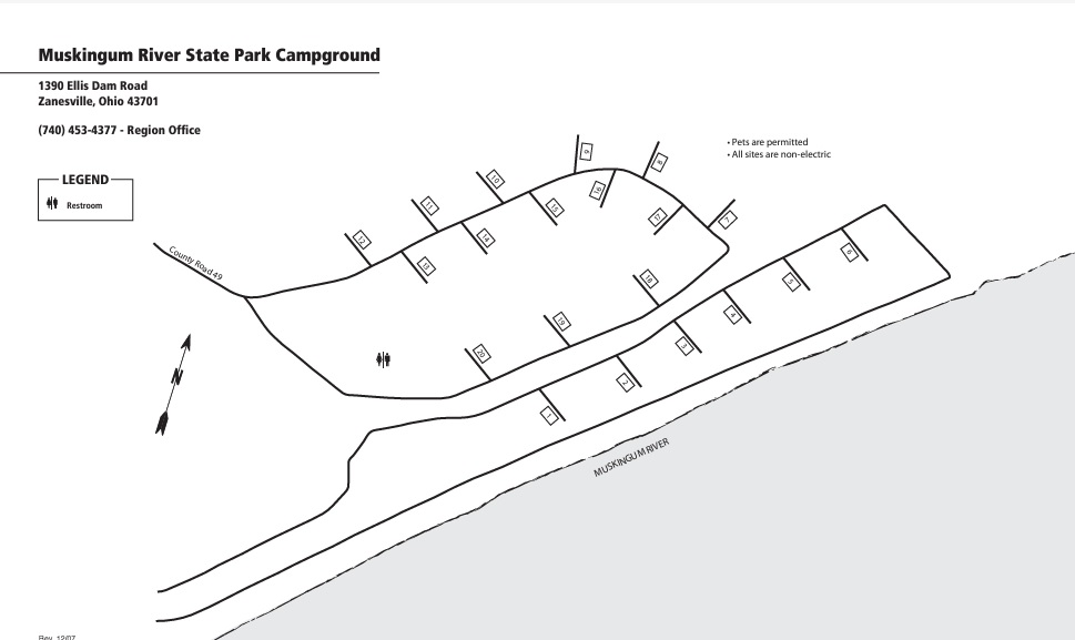
- click for a campground map of Muskingum River State Park at Ellis Dam
- click for another trip to the Muskingum River State Park at Ellis Dam in August 2024
- click for a hike this weekend in nearby Zanesville on the Gorsuch Fitness Trail
- click for a hike this weekend at Dillon Lake on the Ruffled Grouse Nature Trail
- click for a hike this weekend near Newark at Flint Ridge State Park
- click for a hike this week at the Paul Yost Recreation Area
- click for the guidebook Hiking Ohio which has more hikes in this area
- click for more hiking and backpacking trips in the State of Ohio