Horsepasture River (via NC 281)
Gorges State Park
P.O. Box 100
976 Grassy Ridge Road
Sapphire, NC 29774
(828) 966-9099
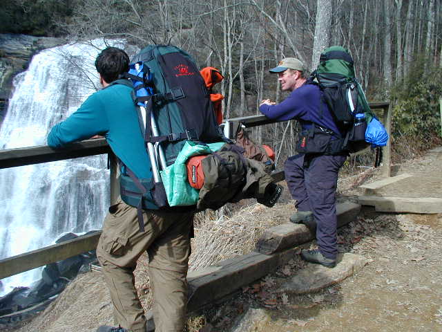
Gorges State Park is one of North Carolina’s newest and most rugged state parks, protecting more than 7,000 acres of steep mountain terrain along the escarpment where the Blue Ridge Mountains drop sharply toward South Carolina. The land was acquired from Duke Energy and also includes a nearby 2,900-acre game land managed by the North Carolina Wildlife Resources Commission. The park is known for its dramatic topography, which features deep river gorges, towering rock faces, dense hardwood forests, and numerous waterfalls fed by the heavy rainfall common in this region of the southern Appalachians. In fact, the area receives some of the highest annual rainfall totals in the eastern United States, creating a lush environment filled with moss-covered boulders, rushing rivers, and thick vegetation. Gorges State Park is also nationally recognized for its biodiversity and contains one of the highest concentrations of rare plant and animal species in the eastern U.S., including several species typically found much farther north. Remote and wild in character, the park offers visitors a backcountry feel despite its growing popularity, with opportunities for hiking, backpacking, fishing, mountain biking, horseback riding, and waterfall exploration throughout the surrounding landscape.
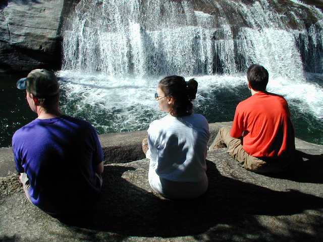
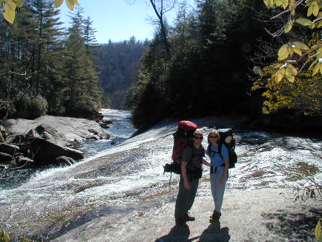
This hike along the Horsepasture River begins at the Grassy Ridge Trailhead inside Gorges State Park, which now serves as the primary access point for some of the region’s most spectacular waterfalls. In the past, many hikers parked along North Carolina Highway 281 for easier river access, but roadside parking is now prohibited, making the state park trail system the standard route. From the trailhead, hikers follow the well-built Rainbow Falls Trail through rhododendron tunnels and mixed hardwood forest before descending steeply toward the river gorge. The trail eventually reaches a series of breathtaking waterfalls along the Horsepasture River, beginning with the powerful and scenic Rainbow Falls, where water plunges over a wide cliff into a mist-filled gorge below. Although Rainbow Falls is the first and most dramatic waterfall encountered, hikers with additional energy can continue upstream to see Turtleback Falls and Drift Falls, both of which are popular swimming and photography destinations during warmer months. Interestingly, while the trail begins inside the state park, the waterfalls themselves are actually located within adjacent national forest lands. Because of the popularity of these falls — especially during weekends, holidays, and the busy summer season — hikers should expect heavy trail traffic and crowded viewing areas. The return hike can also be surprisingly strenuous since the route climbs steadily back out of the gorge, so allowing extra time and carrying plenty of water is highly recommended.
- click for more photos from this hike along the Horsepasture River: February 10, 2001 (password required)
- click for a detailed trip report from this backpacking trip in the Nantahala National Forest: February 10, 2001 (password required)
- click for a trip report from this hike to both Rainbow and Windy Falls: February 10, 2001(password required)
- click for a park map of Gorges State Park printed in 2023
- click for a park map of Gorges State Park from 2013
- click for a topo and profile map of this backpacking trip to Rainbow Falls via NC 281 (password required)
- click for a topo and profile map of this hike to Rainbow and Turtleback Falls (via the Grassy Branch trailhead) (password required)
- click for a hike to the nearby Rainbow Falls via NC 281 in February 2001 and August 2008
- click for a hike to the Rainbow Falls via the Grassy Ridge parking area in November 2019 and January 2022
- click for the guidebook North Carolina Hiking Trails which has details on this destination
- click for other North Carolina hiking and backpacking books
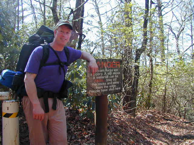


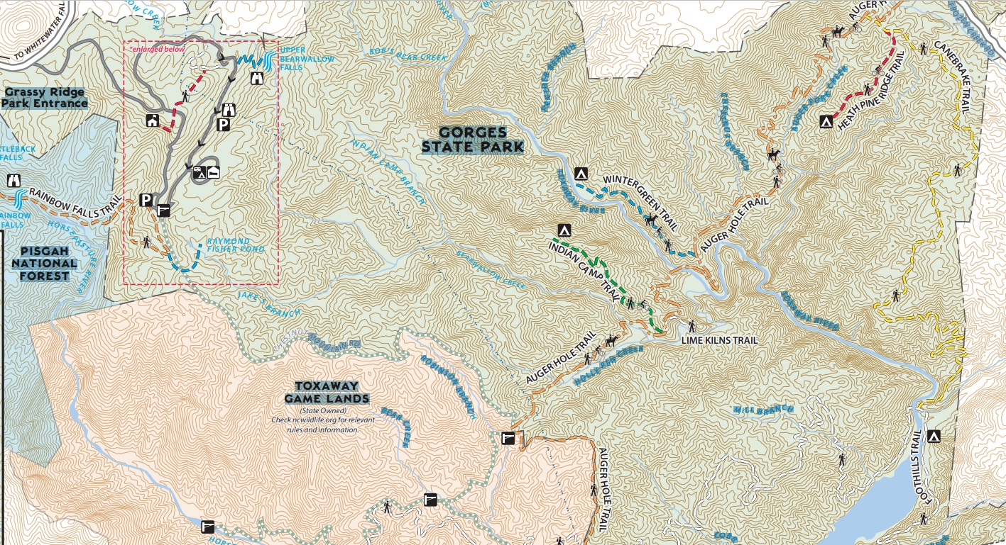
The trailhead for Rainbow Falls is no longer at NC 281. It was relocated to Gorges State Park in 2009 when the park became fully operational and the trailhead is now located just past the visitor’s center in the park. Check there for more details and to get a free trail map.