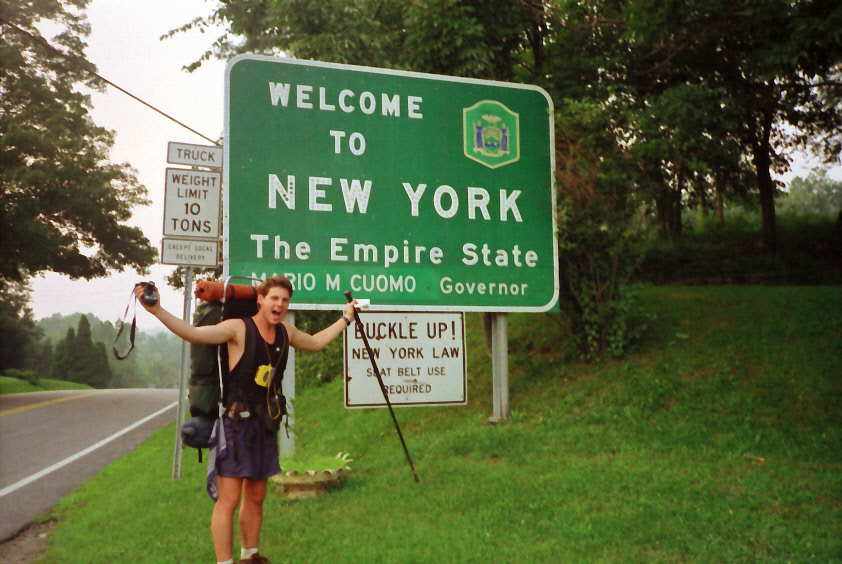
Appalachian Trail #1 (NJ/NY Border to West Mombasha Road)
Appalachian Trail Conservancy
799 West Washington Street
Harpers Ferry, WV 25425
(304) 535-6331

Eighty Eight miles of the Appalachian Trail are in the State of New York, and most hikers find it to be much more wooded and remote than they initially expect. Elevation changes are moderate and the highest point on the Trail in New York is only 1,433 feet. The Trailside Museum and Zoo at Bear Mountain State Park has the lowest point on the entire A.T. at 124 feet. For those of you who might be interested in trying out the Appalachian hiking trail, there are a number of flights to New York one can take if you are from another state or if you are coming from another country not in North America. The trail is relatively easy for seasoned hikers and backpackers and those who are trying out the Appalachian trail for the first time would probably rate the trail difficulty as fairly moderate, perfect for a day or overnight hike.
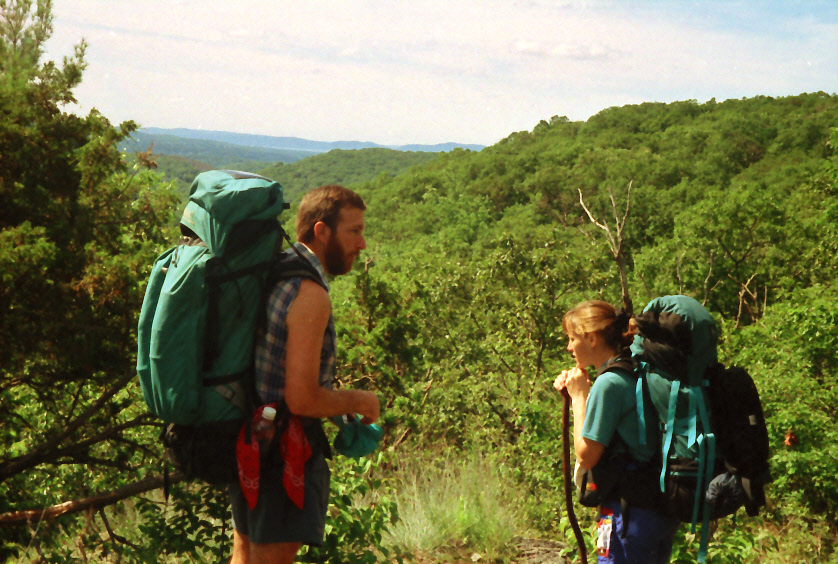
This section from the NJ/NY Border to West Mombasha Road is a short one that covers about twelve miles and follows the ridge of Bellvale Mountain with numerous views from ledges to Greenwood Lake and the Ramapo Hills. Prospect Rock (1,433 feet) is the highest point along the A.T. in New York. The Taylor Mountains are seen to the west from a rock outcropping at this location. From Prospect Rock, the Trail enters a wooded area then crosses NY 17A near the Town of Warwick and Village of Bellvale. The Mombasha High Point (1,280 feet) is just north of here and it has views of New York City, Mombasha Lake and Schunemunk Mountain. Harriman State Park is also visible to the east. It’s about a mile from the Mombasha High Point to West Mombasha Road.
- click to see photos from this backpacking trip on the Appalachian Trail in New York: August 4-5, 1994
- click for a journal entry from this hike in New York: August 4-5, 1994 (password required)
- click for a Daytimer report from my thru-hike in New York (password required)
- click for a map of the A.T. from New York to New Hampshire (password required)
- click for a topo and profile map from NY17A to West Mombasha Road (password required)
- click for a topo and profile map from Wildcat Shelter to West Mombasha Mountain (password required)
- click for a map of the A.T. from Goshen Mountain to West Mombasha Road (password required)
- click to see a video slideshow of my 1994 hike on the A.T. (short film produced 2019 ~ 5 min)
- click to watch a movie with commentary on BirdShooter’s 1994 Appalachian Trail thru-hike (long film produced 1996 ~39 min)
- click to see some of my favorite photos from the Appalachian Trail
- click to view a day-by-day summary of BirdShooter’s 1994 Appalachian Trail thru-hike
- click for specific sections of the Appalachian Trail (with photos from each state)
- click for a map of the entire Appalachian Trail
- click for a summary of the 2000+ mile Appalachian Trail
- click for recommended books, videos and games about the Appalachian Trail