Appalachian Trail #3 (Rangeley to Sugarloaf Mountain)
Appalachian Trail Conservancy
799 West Washington Street
Harpers Ferry, WV 25425
(304) 535-6331
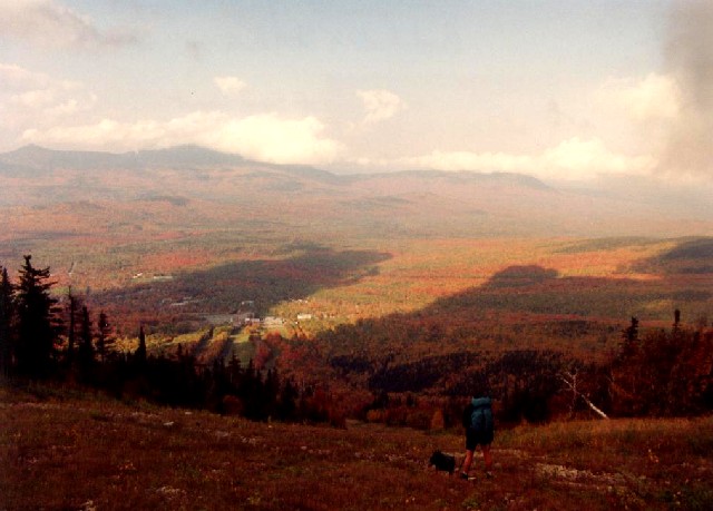
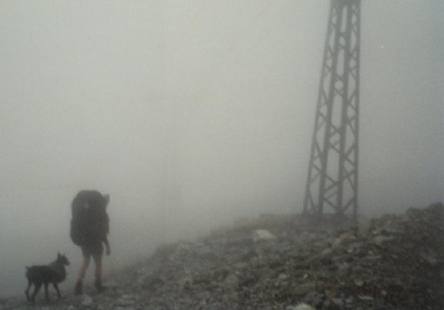
The 282 miles of the Appalachian Trail in Maine is generally considered the most difficult of the fourteen states that the A.T. traverses. While the elevations seldom top 4,000 feet , the terrain is often difficult and there are frequent rock scrambles through very rugged terrain. Even the Appalachian Trail Conservancy (ATC) does not recommend the Maine A.T. for novice hikers. There are limited bridges in the State due to the spring snowmelt and the streams on the trail require frequent fording. Slippery and sometimes hazardous weather can occur at any time, and the Maine A.T. is frequently remote to say the least. In some sections, don’t expect to hike more than a mile an hour and get used to steep ascents and descents. That said – the Maine A.T. has some of the most stunning and remote wilderness on the entire trail. It is often cited as a favorite State for many A.T. thru-hikers.
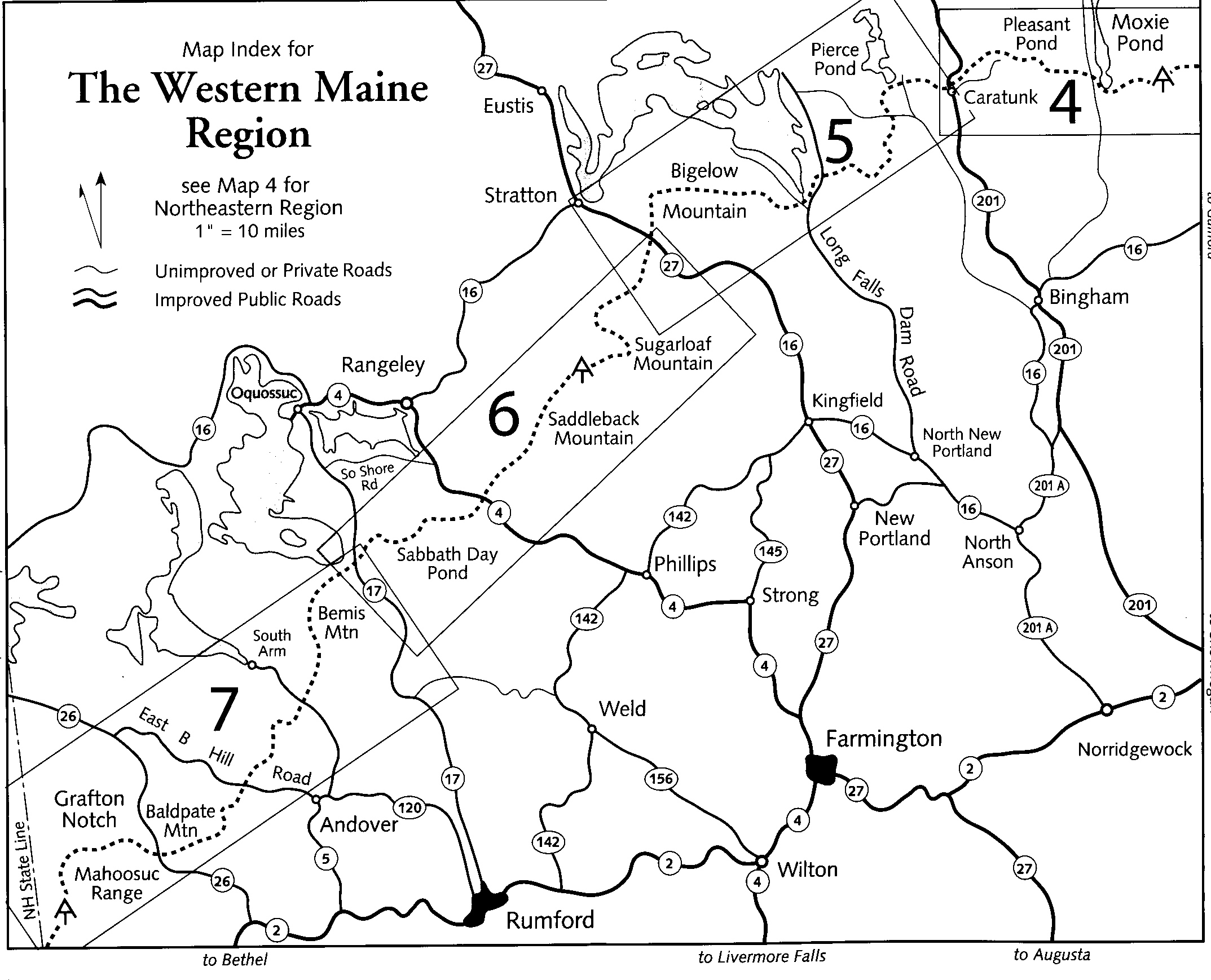
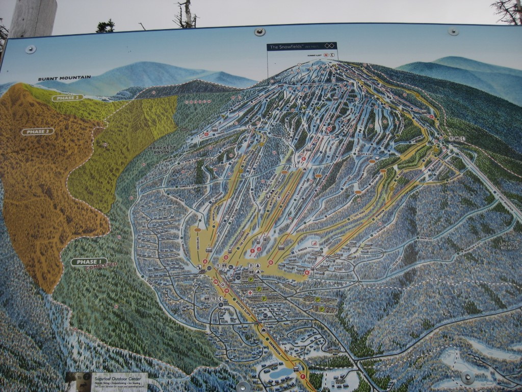
This section of the Maine A.T. starts at Maine Highway 4 just outside of Rangeley and ends at the side trail to Sugarloaf Mountain. The A.T. once crossed the summit of the ski area it but was routed around here in the early 1970’s. Sugarloaf is still one the highlights of this section but it requires a 0.6 mile blue-blazed side hike to the summit. Other summits in this area include Saddleback (4,120′) and Spaulding (4,009′) Mountain where there are ridge traverses that have outstanding views. The town of Stratton, Maine is also nearby for resupply – with a small grocery, gas station, general store, local cafés, and a few inns & lodges (including the White Wolf Inn).
- click for a short video slideshow of my 1994 backpacking trip on the Appalachian Trail
- click for more photos from this section on the Appalachian Trail in Maine: September 19-October 2, 1994
- click for a detailed trail journal from the Appalachian Trail in Maine: September-October, 1994
- click for a Daytimer report from this section of the A.T. in Maine: September and October 1994 (password required)
- click for a map of this section of the Appalachian Trail at Sugarloaf Mountain
- click for an ATC topo & profile map from ME 17 to ME 27 (Stratton) (password required)
- click for an expansion plan of the Sugarloaf Mountain ski resort in 2013
- click for a map of the Appalachian Trail in New England (password required)
- click for more information on the Appalachian Trail
- click for Appalachian Trail hiking and backpacking books
- click to access the guidebook Appalachian Trail: Maine which has details on this destination
- click for other Maine hiking and backpacking books