Wolf Laurel Top (via Byron Herbert Reece Trailhead)
Chattahoochee-Oconee National Forests
1755 Cleveland Highway
Gainesville, GA 30501
770 297-3000

The Chattahoochee National Forest is one of two National Forests in the State of Georgia, and it takes its name from the Chattahoochee River whose headwaters begin in the North Georgia mountains. The River and the area were given the name by the English settlers who heard it from the Indians that once lived here. The Chattahoochee National Forest was created when the Forest Service purchased 31,000 acres in Fannin, Gilmer, Lumpkin and Union Counties from the Gennett family in 1911 for $7.00 per acre. In the beginning, the Chattahoochee was part of the Nantahala and Cherokee National Forests in North Carolina and Tennessee, but eventually the Forest Service made additional land purchases and expanded the Chattahoochee to its current size of nearly 750,000 acres.
This hike to Wolf Laurel Top is an in-and-out, backtrack hike that starts near Neels Gap at the Byron Herbert Reece Trailhead. Start by climbing 0.7 miles to the Appalachian Trail, then turn left and descend for a mile to Neels Gap and the Walasi-Yi store and hostel. (There is no overnight parking available at Neels Gap). From here, pass through the building and begin a steep climb of 817 feet over Levelland Mountain. The ascent is followed by a steep descent then the Trail follows a more gentle grade as it approaches Wolf Laurel Top at 3766 feet. There are spectacular views to the east and south from here and its a great place to take a break or camp if you have packed water. If not, there are campsites and springs on both sides of Wolf Laurel Top at Rock Spring Top and Baggs Creek Gap which are within a mile of here.
- click to see rattlesnakes in them thar hills and the Frank Costanza effect
- click for a video of our Cocktail Hour At Wolf Laurel Top (password required)
- click to view a photo journal of this hike on the Appalachian Trail: May 31, 2013
- click to see trail photos from this hike to Wolf Laurel: May 31, 2013
- click to view a trip report of this hike on the Appalachian Trail: May 31, 2013 (password required)
- click for a Trails Illustrated map for this hike in the Chattahoochee National Forest
- click for an ATC trail map from Jarrard Gap to Hog Pen Gap on the Appalachian Trail (password required)
- click for an ATC trail map from Wood Gap to Wolf Laurel Top (password required)
- click for an ATC profile map from Wood Gap to Wolf Laurel Top (password required)
- click for a Georgia Appalachian Trail overview map (password required)
- click for a Georgia Appalachian Trail profile map (password required)
- click to view a hike to Wolf Laurel Top via the Tesnatee Gap trailhead
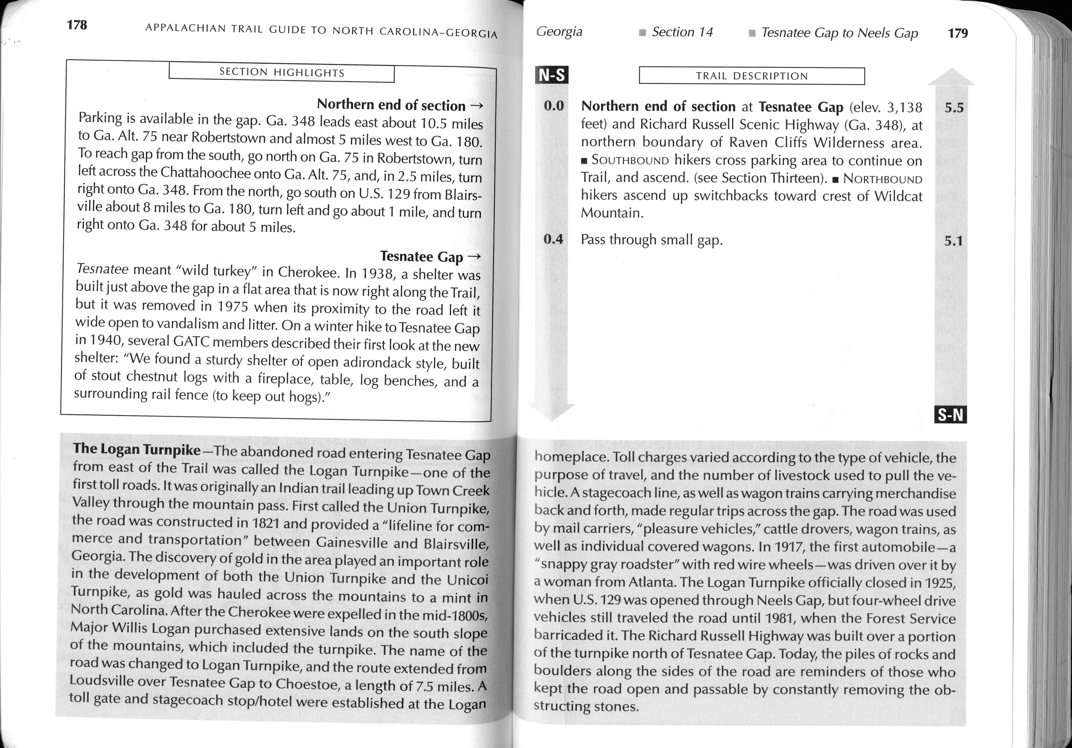
- click for guidebook info on this hike with a section preview and mile 0.0 to 0.4, plus mile 0.4 to 4.4 (password required)
- click for more information on the Appalachian Trail
- click for Appalachian Trail hiking and backpacking books
- click to access the guidebook Appalachian Trail: Georgia-North Carolina which has details on this destination
- click for other Georgia hiking and backpacking books


