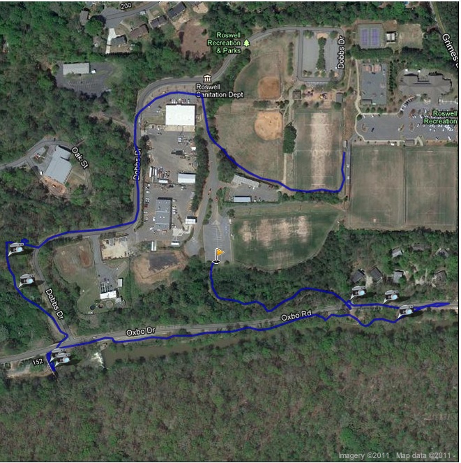
Oxbo Trail (via Waller Park)
City of Roswell
Recreation and Parks
38 Hill Street
Roswell, GA 30075
770-641-3727

The City of Roswell has an extensive network of trails, parks, and outdoor recreational areas, benefiting from its location along the Chattahoochee River and the wooded landscapes that surround the city. The river corridor provides a natural setting for hiking, walking, fishing, and wildlife viewing, while the city’s parks offer trails ranging from short neighborhood walks to longer routes through forests and along streams. Some of the best-known hiking destinations in the Roswell area include the Chattahoochee River National Recreation Area, the Oxbo Trail, the Vickery Creek Trail system, Big Creek Greenway, and the Roswell Riverwalk. Together, these trails provide a mix of paved paths, wooded footpaths, historic sites, wetlands, streams, and riverfront scenery. Many of the trails can also be combined to create longer outings, allowing hikers to explore several different environments without traveling far from central Roswell. The combination of natural scenery, recreational opportunities, and historic landmarks makes Roswell an appealing destination for local hikers and visitors looking to explore the outdoors.
The Oxbo Trail is one of the more accessible trail systems in the Roswell area and runs between Waller Park and Grimes Bridge Park, with an extension that follows Waller Creek for approximately a mile. The route passes through wooded areas and developed parkland and includes dirt, paved, and crushed-stone sections, giving the trail a varied character as it winds through the community. Hikers can access the trail from either park or from a parking area along Grimes Bridge Road, making it possible to customize the length of the outing. A bridge connects the Oxbo Trail with the nearby Vickery Creek Trail system, which is managed by the National Park Service as part of the Chattahoochee River National Recreation Area. This connection allows hikers to extend their walk and explore a larger network of trails, streams, historic ruins, and wooded terrain. Be sure to look for the waterfall along Oxbo Road, which is visible from the bridge and can be especially impressive after periods of rainfall. The waterfall is generally easier to see during the winter months when reduced vegetation provides a clearer view. With its convenient access, relatively easy terrain, creekside scenery, and connection to Vickery Creek, the Oxbo Trail is a good choice for a short local hike or as the starting point for a longer Roswell-area outing.
- click for more photos from this day hike along the Oxbo Trail: October 12, 2010
- click for a trip report from this hike on the Oxbo Trail: October 12, 2010 (password required)
- click for a park and trail map for the City of Roswell
- click for a trail and profile map of a short loop on the Oxbo Trail
- click for a trail and profile map for a longer loop on the Oxbo Trail
- click for another hike on this trail near Grimes Bridge Park in 2011
- click for a summer hike on the Oxbo Trail in July 2017
- click for the guidebook Best Hikes Near Atlanta which has more hikes around the City of Atlanta
- click for the guidebook Hiking Georgia which has more hikes and backpacking trips in the State of Georgia
- click for other Georgia hiking and backpacking books