Slaughter Gap
Chattahoochee-Oconee National Forests
1755 Cleveland Highway
Gainesville, GA 30501
770 297-3000
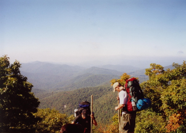
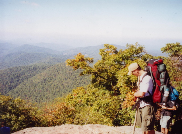
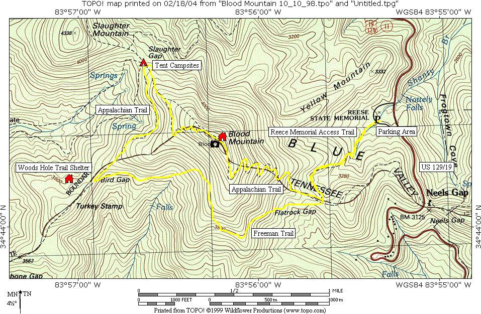
The Blood Mountain Wilderness area received its designation in 1991, and it is a sub-section of the Chattahoochee National Forest. The wilderness area is bordered to the northwest by Georgia Highway 60 and the Blue Ridge mountain range, and to the northeast by Georgia Highway 19/129 and Neels Gap. Major trails in this area include the Appalachian Trail, Freeman Trail, the Dockery Lake/Miller Gap Trail, the Coosa Backcountry Trail, the Duncan Ridge Trail, The Bare Hair Trail, and the Slaughter Creek Trail. The Reece Memorial Trail crosses the Appalachian Trail and joins with the Freeman Trail which it follows along the southern slope of Blood Mountain to Bird Gap. We set up camp in this area, then hiked the next day through Slaughter Gap and over Blood Mountain. It’s a steep climb to the summit at 4,461 feet but the views from a rock outcropping near the shelter are spectacular. Blood Mountain is the highest point on the Appalachian Trail in Georgia, and it is the second highest peak in the State (after Brasstown Bald.)
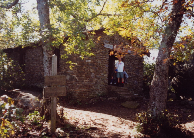
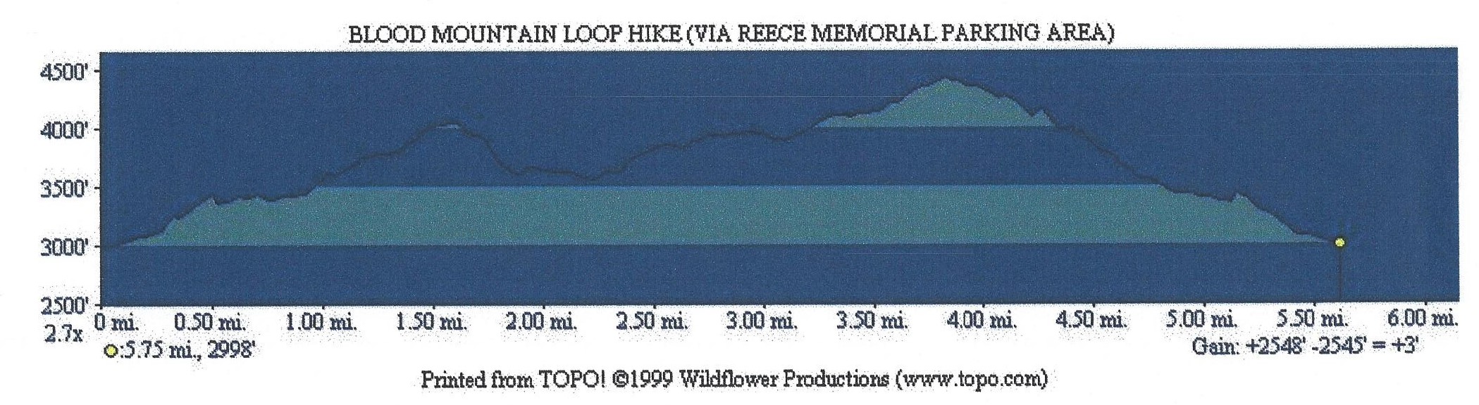
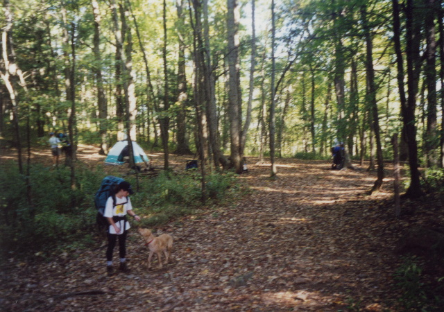
For an overnight backpacking trip, there are a few options. First, there is tent camping near Slaughter Gap, second there are two shelters available which can accommodate 8-12 people. Woods Hole Shelter is located 0.4 miles off the trail and only 0.1 miles from Bird Gap. Blood Mountain Shelter is an enclosed stone structure which is located at the summit Blood Mountain. Woods Hole has water from a nearby spring, but Blood Mountain does not have a water source, so you will have to carry it up from Slaughter Gap or from the trailhead. There is a stream at Slaughter Gap which makes it a heavily used camping area that has room for only a few tents. We started our hike to Slaughter Gap from the Reece Memorial Parking Area off GA 19/129 near Neels Gap. The Reece Memorial Trail crosses the Appalachian Trail and joins with the Freeman Trail which it follows along the southern slope of Blood Mountain to Bird Gap. We set up camp in this area, then hiked the next day through Slaughter Gap and over Blood Mountain. It’s a steep climb to the summit at 4,461 feet but the views from a rock outcropping near the shelter are spectacular. Blood Mountain is the highest point on the Appalachian Trail in Georgia, and it is the second highest peak in the State (after Brasstown Bald.) We finished our hike by descending Blood Mountain and following the Reece Memorial Trail back to the parking area along GA 19/129.
- click for more photos from this hike in the Blood Mountain Wilderness: October 10, 1998
- click for a detailed trip report from this loop hike through Slaughter Gap: October 10, 1998 (password required)
- click for a Daytimer report from this hike near Neel’s Gap: October 10, 1998 (password required)
- click for a Trails Illustrated map of this hike in the Chattahoochee National Forest
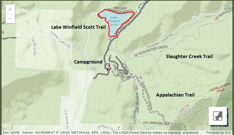
- click for a trail map of the Lake Winfield Scott Recreational Area (password required)
- click for a topo and profile map of this hike to Slaughter Gap (password required)
- click for a a trail map of the Appalachian Trail in Georgia (password required)
- click for a profile map of the Appalachian Trail in Georgia (password required)
- click for an ATC trail map from Woody Gap to Wolf Laurel Top Trail Map (password required)
- click for an ATC profile map from Woody Gap to Wolf Laurel Top (password required)
- click for a hike to the nearby Jarrard Gap that we did in May 2012
- click for a hike we did around Lake Winfield Scott in August 2013
- click for the guidebook Best Hikes With Dogs Georgia And South Carolina
which has details on this area
- click for other Georgia hiking and backpacking books