Appalachian Trail #1 (NY/CT Border to CT/MA Border)
Appalachian Trail Conservancy
799 West Washington Street
Harpers Ferry, WV 25425
(304) 535-6331

There are about fifty miles of the Appalachian Trail in the State of Connecticut and the elevations are fairly moderate and range from 260 to 2,316 feet. The route heading northbound starts near the Ten Mile River and crosses the 120 foot Ned Anderson Memorial Bridge. It then passes near the towns of Kent, Cornwall Bridge, and Salisbury before ascending 2,000 foot Bear Mountain and dropping into Sages Ravine near the CT/MA border. There are some nice river walks in the state of Connecticut and the Housatonic River Valley is particularly scenic. The National Park Service now owns some of the land near the river, and it is one of the longest river walks on the entire A.T. The Great Falls are spectacular along the river, especially in times of high water. They are caused by a dam that was built at the site of a old factory that operated here as early as 1833.
Rand’s View is about three miles north of Great Falls, and it has the best views in the State of Connecticut along the A.T. It is located on a side trail about a mile from the Appalachian Trail. Mount Greylock, fifty miles away, is sometimes visible in the distance from here. The last major climb in this section is to Bear Mountain, which is the highest mountain entirely in Connecticut at 2,316 feet. it has views of the Housatonic Valley and the Berkshires to the north. A monument nearby indicates that Bear Mountain was once thought to be the highest point in the state. From here, the trail descends toward Sages Ravine and crosses into the State of Massachusetts.
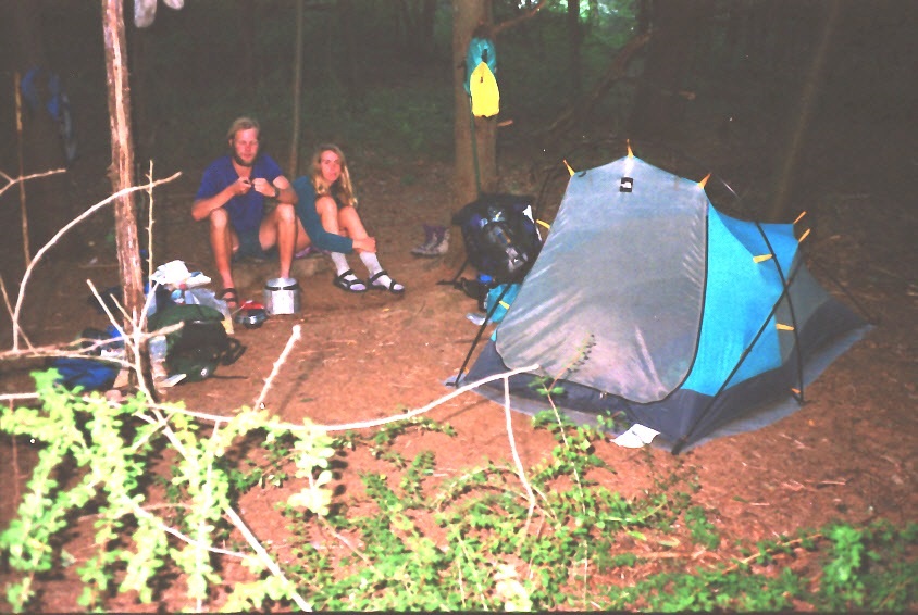
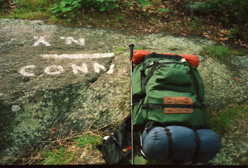
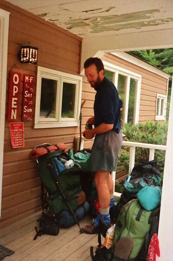
- click for photos from this backpacking trip on the A.T. in Connecticut: August 8, 1994
- click for a journal entry from this hike on the Appalachian Trail: August 8-15, 1994 (password required)
- click for a trail map of the Appalachian Trail in the Northeastern U.S (password protected)
- click for a trail map with mileage of the A.T. in Connecticut (password protected)
- click for a topographical map of the Appalachian Trail in CT: Map 1, Map 2, Map 3, Map 4, Map 5
- click for a trail map of an accidental detour and solo overnight that I had near Kent, CT (password protected)
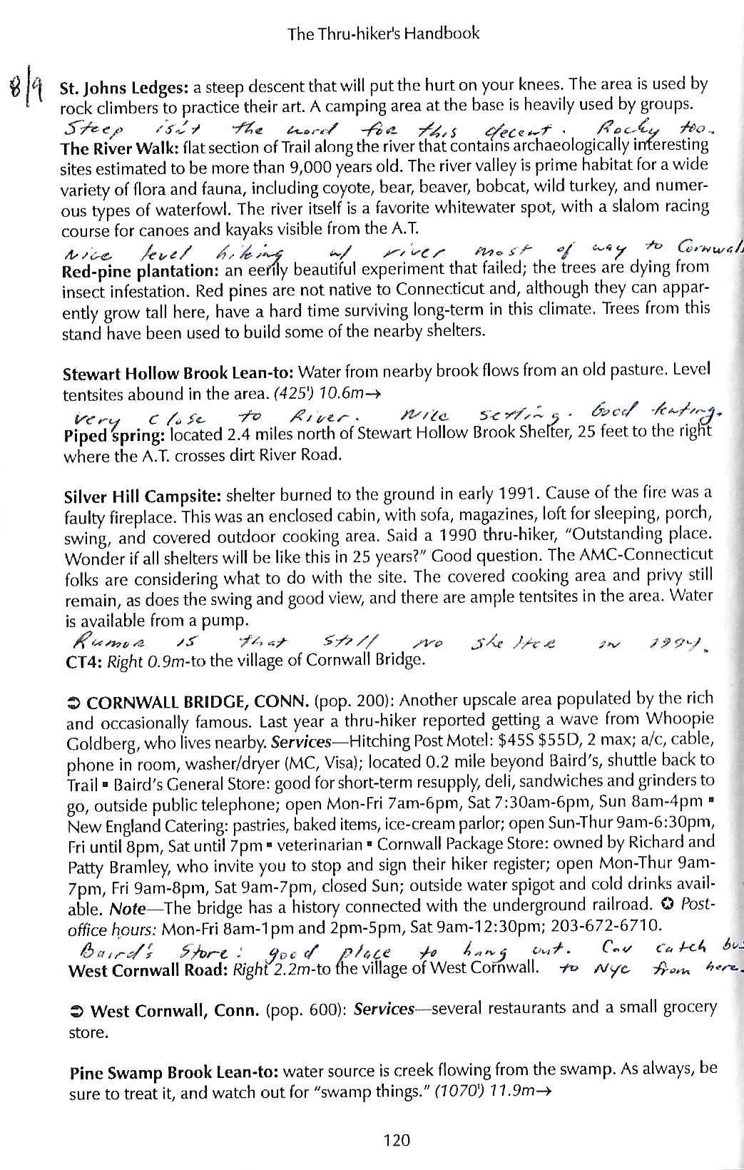
- click for a page from the 1994 Thru-Hiker’s Handbook from St. John Ledges to Pine Swamp Shelter (password required)
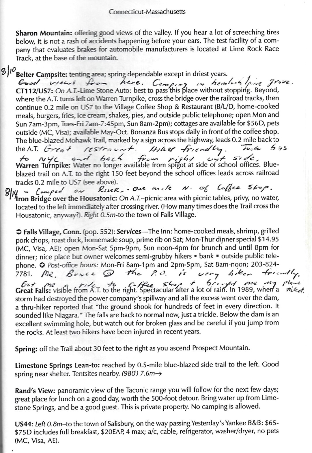
- click for a page from the 1994 Thru-Hiker’s Handbook from Sharon Mountain to U.S. 44 (password required)
- click for a short video slideshow of my 1994 hike on the Appalachian Trail
- click for more information on the Appalachian Trail
- click for Appalachian Trail hiking and backpacking books