Beaver Lake
Hobbs State Park-Conservation Area (HSPCA)
21392 East Highway 12
Rogers, AR 72756
(479) 789-2380

Hobbs State Park–Conservation Area (HSPCA) is the largest state park in Arkansas, encompassing more than 12,000 acres of protected land in Benton County along the southern shoreline of Beaver Lake near Rogers. Established to preserve the natural beauty and ecological diversity of the Ozark Highlands, the park features a remarkable variety of landscapes, including mature oak-hickory forests, clear streams, rugged limestone bluffs, rocky glades, caves, and the scenic coves of Beaver Lake. Because the park is managed as both a state park and conservation area, it provides important habitat for a wide range of wildlife, including white-tailed deer, wild turkey, foxes, armadillos, numerous reptiles and amphibians, and more than 200 species of birds. Beaver Lake itself, with over 480 miles of shoreline, is a popular destination for boating, fishing, kayaking, scuba diving, and swimming. The park’s visitor center features interactive exhibits highlighting the area’s natural and cultural history, while more than 50 miles of hiking, mountain biking, and equestrian trails—including the Pigeon Roost Trail, Hidden Diversity Trail, and Shaddox Hollow Trail—allow visitors to experience the diverse beauty of the Ozarks firsthand.
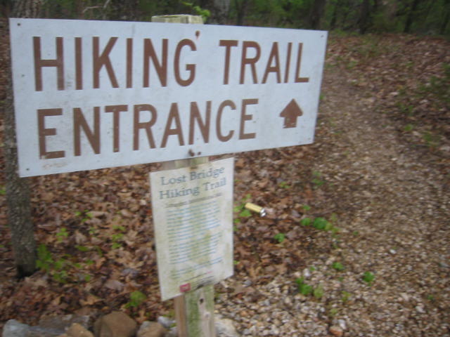
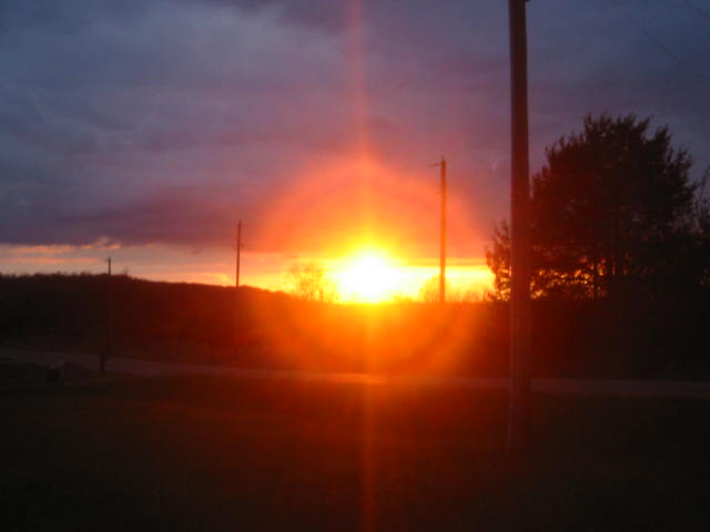
The Lost Bridge Hiking Trail is located within the Lost Bridge South Recreation Area on Beaver Lake, which lies inside Hobbs State Park–Conservation Area. The trailhead is easy to find just before reaching the marina and boat docks, where a small parking area sits on the right side of the road with stairways leading both uphill and downhill to the trail. From the very beginning, the route follows the wooded shoreline of Beaver Lake, winding beneath a canopy of oak, hickory, and cedar trees while offering frequent openings that reveal spectacular views across the clear blue water. Numerous benches and rocky outcrops provide inviting places to pause, watch sailboats and fishing boats drift by, or simply enjoy the peaceful surroundings. As the trail continues, it gently climbs above the shoreline, providing even broader vistas of the lake with the rolling Ozark Mountains forming a picturesque backdrop. During spring and fall, colorful wildflowers and brilliant autumn foliage add even more beauty to the hike, while bald eagles, great blue herons, osprey, and other birds are commonly seen near the water. The trail eventually ascends toward the entrance gate for the Lost Bridge Marina before returning through the forest, creating a relaxing hike that combines lakeside scenery, gentle elevation changes, and some of the finest views found anywhere along Beaver Lake.
- click for a trip report from this hike along Beaver Lake: April 25, 2007 (password required)
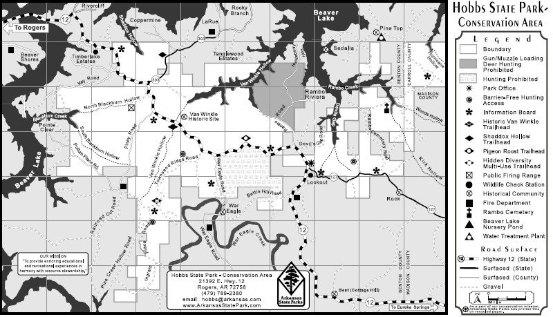
- click for a park map of the Hobbs State Park-Conservation Area
- click for a trail map of this hike to Beaver Lake
- click for more hikes on this day at Beaver Lake and the Spring River
- click for hikes this day at Prairie and Bernice State Park
- click for another hike in Arkansas at Conner Park in Little Rock
- click for the guidebook Hiking Arkansas for more hikes in this area
- click for more hikes in the State of Arkansas


Camping areas on Beaver Lake are managed by the U.S. Army Corps of Engineers. To reserve a campsite, call (877) 444-6777