Oakridge/Kingsnake Trails
Congaree National Park
100 National Park Road
Hopkins, SC 29061-9118
803-776-4396
Congaree National Park is the largest preserve of old-growth floodplain forest in the United States. Located along the Congaree River near Columbia, South Carolina, the park was designated an International Biosphere Reserve in 1983 and it has some of the largest trees that can be seen in the Eastern United States. Along the Congaree River, the trail conditions vary with the weather. After severe rains, the trails flood and occasionally become impassible. The ranger station typically has up-to-date information, so make sure to check with them before you head out on any of the twenty miles of trail in the park. Also, keep in mind that there are two miles of elevated boardwalks that do not permit dogs.
The Oakridge and Kingsnake Trails combined for a roundtrip loop hike. However, the Kingsnake Trail can be done as an in-out, backtrack hike if you are looking for a shorter route which cuts the mileage to 7.4-miles total. Regardless, this hike starts at the parking area for the Kingsnake Trail off SC 1288 where the trail heads south through a mix of heavy forest and marsh and follows orange blazes. The Feral Hog has done well in this rustic habitat, so don’t be surprised to see one tearing at the ground with their tusks as you wander through the wilderness. These untamed animals (also known as wild pigs) have existed in the U.S. since the 1500’s when they were introduced in Florida. While many National Parks have undertaken programs to control their numbers, some are still present in this area. If the pooch catches their scent, hold the leash tight. These Feral Hogs can tear your hound apart with their strong tusks, and the damage they cause to the forest as they root for insects has made them a nuisance to many forest professionals.
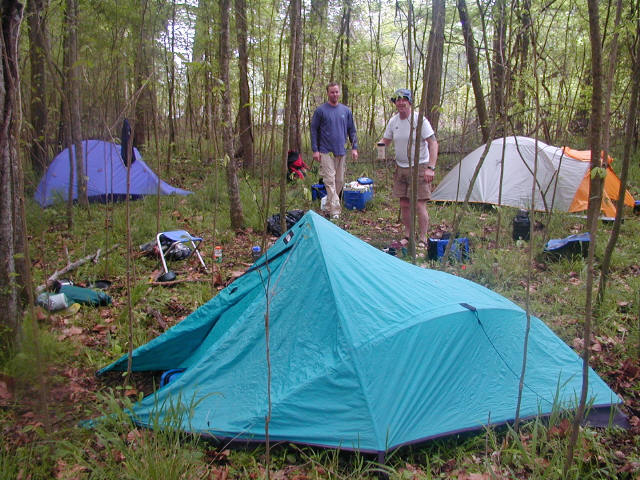
- click for more photos from this trip in the Congaree Swamp: April 13, 2002
- click for a trip report of this adventure along Congaree Creek and River: April 13, 2002 (password required)
- click for a detailed trip report from this trip down the Congaree River: April 13, 2002 (password required)
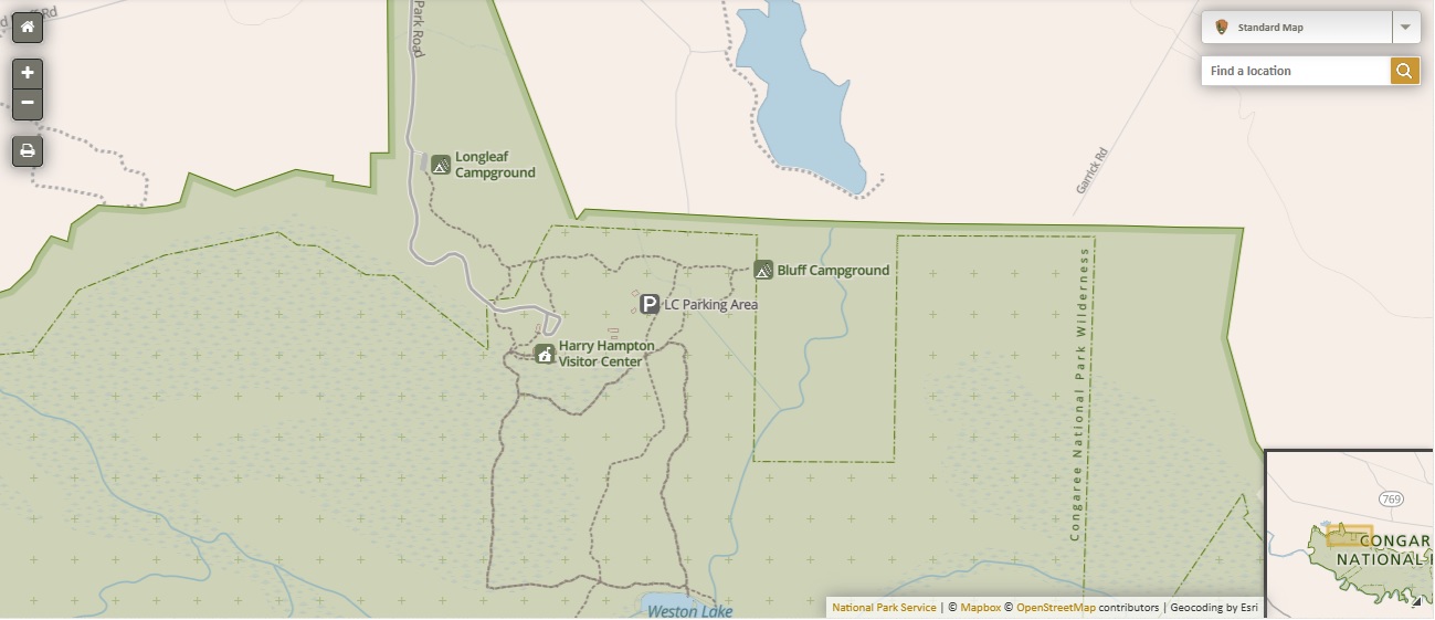
- click for a park map of Congaree Swamp and the Congaree National Park
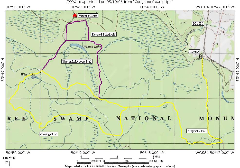
- click for a topographical map of the Kingsnake and Oak Ridge Trails
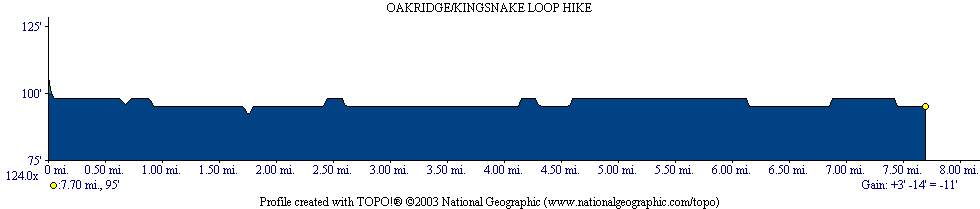
- click for a profile map of the Kingsnake and Oak Ridge Trails
- click for the guidebook Best Hikes With Dogs Georgia And South Carolina which has details on this area
click for a kayaking trip in the Congaree National Park in April 2002 - click for South Carolina hiking and backpacking books
- click for hikes in nearby Columbia on the Stewardship, Learning and Midland Mountain Trails
- click for more hikes in the State of South Carolina