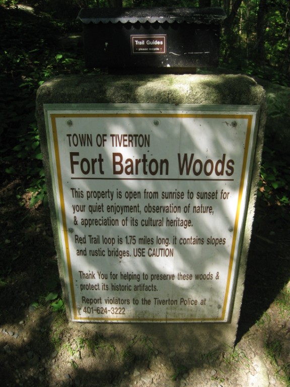
Fort Barton Nature Trail
Tiverton Town Hall
343 Highland Rd
Tiverton, RI 02878
401-625-6710

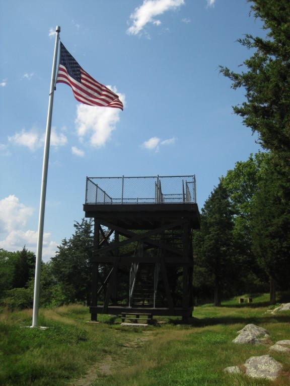
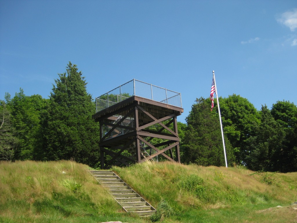
Fort Barton is a historic American Revolution fort in Tiverton, Rhode Island that was used as a launching position for American forces during the Battle of Rhode Island. The site was named after Lt. Col. William Barton who successfully captured the British General Prescott during a midnight raid on the British headquarters at Prescott Farm on Rhode Island (Aquidneck Island).
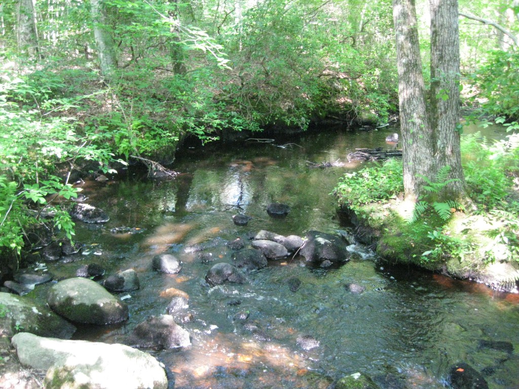
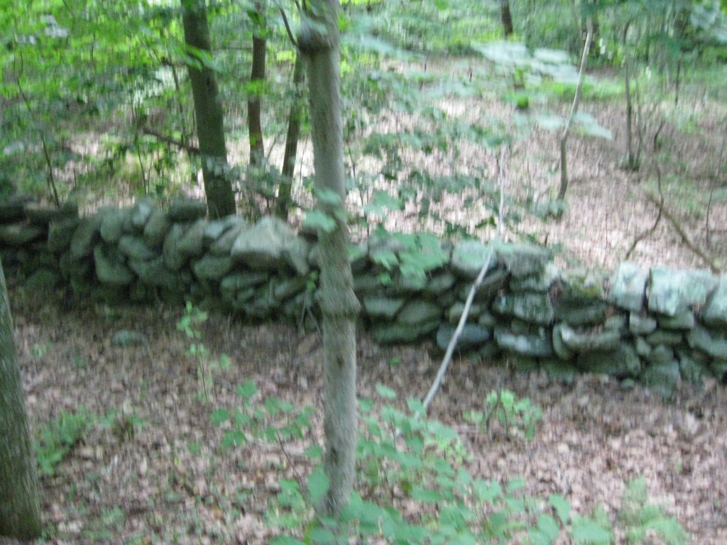
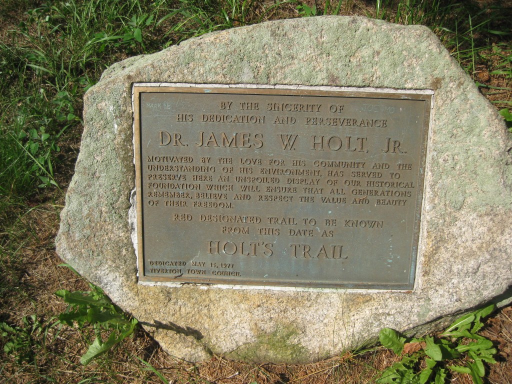
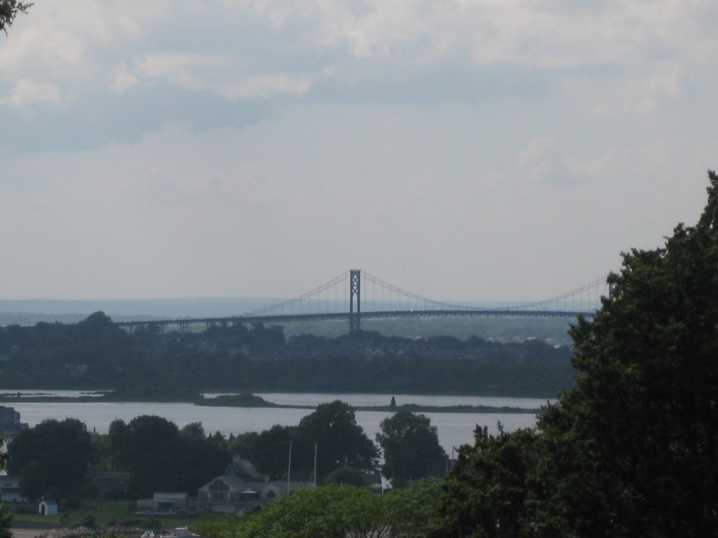
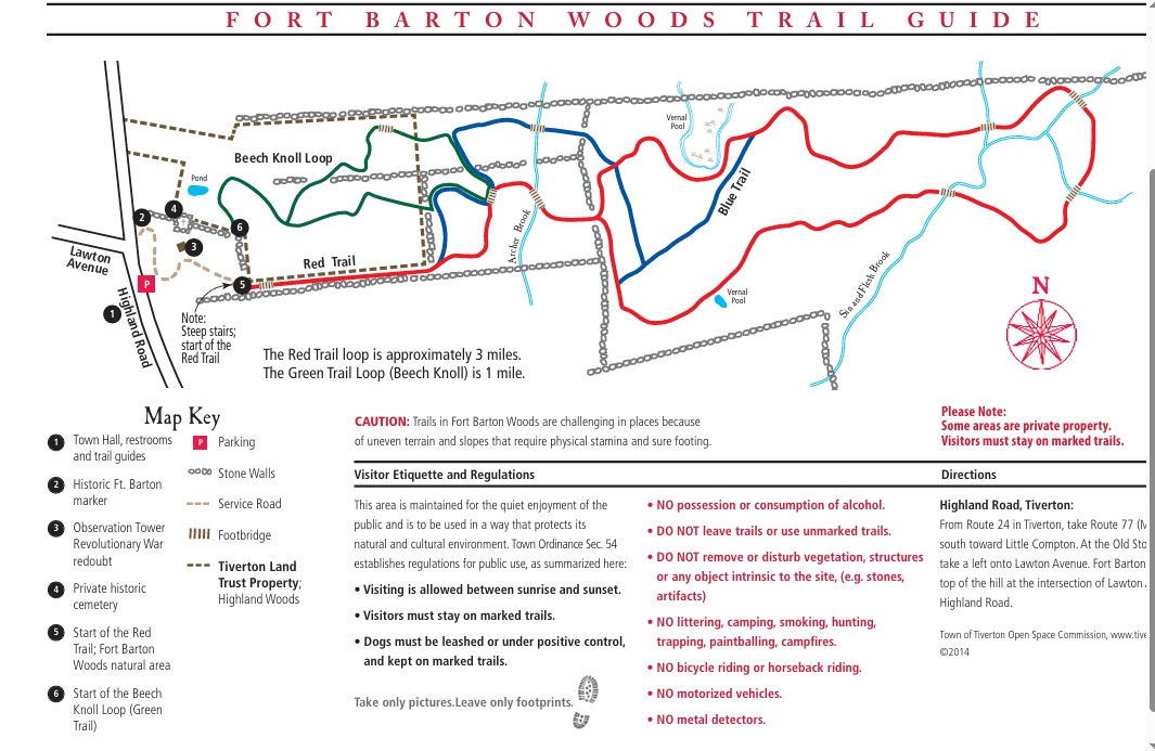
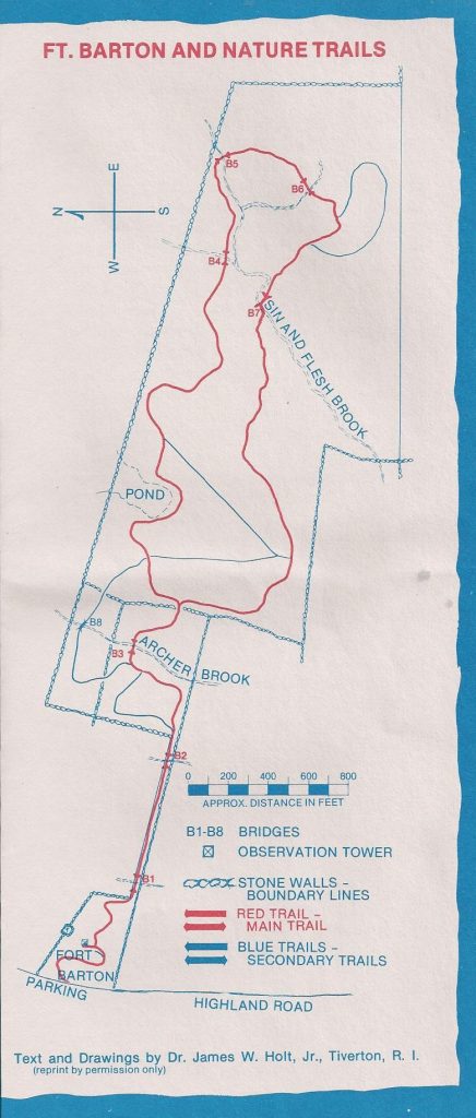
This hike starts at the Tiverton town hall where you can park then cross the street and walk uphill to the tower. From there there is a 1.75 mile loop that heads East through a forested area, passes near a shooting range (which you may hear in the distance), then follows the loop West again to the trailhead. There are actually blazes for both a the red trail (which is the 1.75 mile loop) and some blue trails which allow you to hike a shorter route. The are also a series of small bridges on the route, but it can get muddy in this area. So prepare accordingly. The views from the tower to the Sakonnet River (and bridge) are outstanding.
- click for a video of our travels from Georgia to Maine in 2013 (password required)
- click for more photos from this walk on the Fort Barton Nature Trail: July 16, 2013
- click for more photos from our drive from Georgia to Maine in the summer of 2013 (password required)
- click for a trip report of our Georgia to Maine travels in the summer of 2013 (password required)
- click for a trail map and guide for the Fort Barton trails
- click for a trail map of this hike near the Tiverton Town Hall
- click for a topo and profile map of the Fort Barton Nature Trail (password required)
- click for another hike on this roadtrip at Sugarloaf Mountain
- click for a hike we did the previous week on the Frazer Discover Trail
- click for the guidebook Hiking Rhode Island and Connecticut for more hikes here
- click for more hikes in the State of Rhode Island