Panthertown Creek Sandbar Pool (via Cold Mountain Gap)
Nantahala National Forest
Highlands Ranger District
2010 Flat Mountain Rd,
Highlands, N.C. 28741
(828) 526-3765

Panthertown Valley is located in western North Carolina and has 6,295 acres of protected public land in the Nantahala National Forest. Panthertown lies on the eastern continental divide in North Carolina’s Blue Ridge Mountains and is occasionally referred to as “the Yosemite of the East” for the it’s deep gorges, broad valleys, mountain bogs and granitic rock domes, tranquil creeks and plunging waterfalls.
This hike to Panthertown Creek begins at Cold Mountain Gap and decends along a combination of Forest Roads and hiking trails past Schoolhouse Falls and onto the main corridor trail for Panthertown Valley. Panthertown Creek runs between the two main trailheads at Salt Rock and Cold Mountain Gap and their is a nice sandbar on the route.
- click to see photos from a day hike on the Panthertown Creek Trail: August 8, 2020
- click to read a trip report from our hike to Schoolhouse Falls & the Sandbar Pool: August 8, 2020 (password required)
- click to purchase the Nantahala and Cullasaja Gorges Trails Illustrated map which includes Panthertown
- click for a map of Panthertown Creek Campsites #1-4 in Panthertown Valley (password required)
- click to view a profile map from the Cold Mountain trailhead to Panthertown Creek (password required)
- click to see a map of the entire Panthertown Valley trail system (password required)
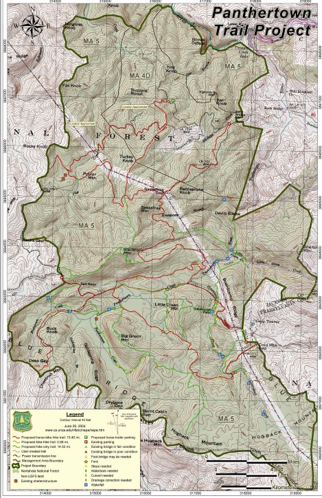
- click to see the Panthertown USFS project map
- click to see other trips to Panthertown Creek in June 2012, November 2014, July 2017, August 2020, February 2023
- click to see photos from another hike to Panthertown Creek starting at the Salt Rock Gap trailhead
- click to access the guidebook North Carolina Hiking Trails which has details on this destination
- click for other North Carolina hiking and backpacking books