Stratton Bald (via Wolf Laurel Trailhead)
Nantahla National Forest
Cheoah Ranger District
Joyce Kilmer Slickrock Creek Wilderness
Route 1, Box 16-A
Robbinsville, NC 28771
(704) 479-6431
Joyce Kilmer-Slickrock Creek Wilderness was designated with the passage of the 1975 Wilderness Act and expanded in size in 1984 with the North Carolina Wilderness Act. The 17,013 acres of forest shares a common boundary along the Unicoi Mountains with the Citico Creek Wilderness in the Cherokee National Forest in Tennessee, but the majority of land is in the Nantahala National Forest in North Carolina.
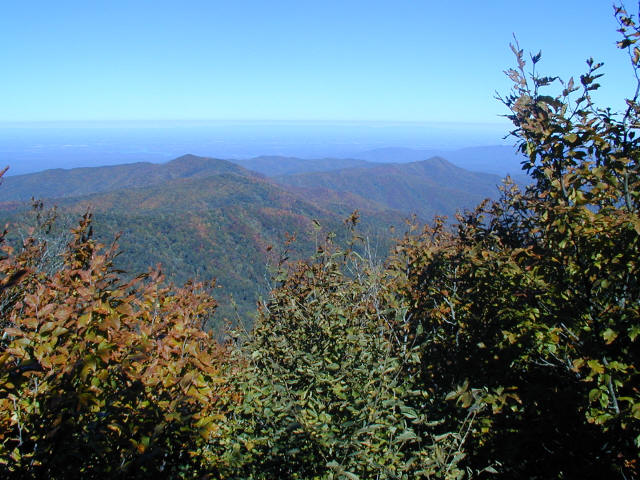
Although the wilderness is best known for the gigantic strands of virgin timber in the Poplar Cove area, the high elevation areas including Stratton Bald (5360 feet) and Hangover offer fantastic views of the surrounding Cherokee and Nantahala National Forests. Both areas exceed 5000 feet and offer dramatic 270-360 degree views. This hike to Stratton Bald is a moderate but short hike that starts at the Wolf Laurel Trailhead and climbs to an open meadow on top of Stratton Bald with excellent views of North Carolina to the south and Tennessee to the west.
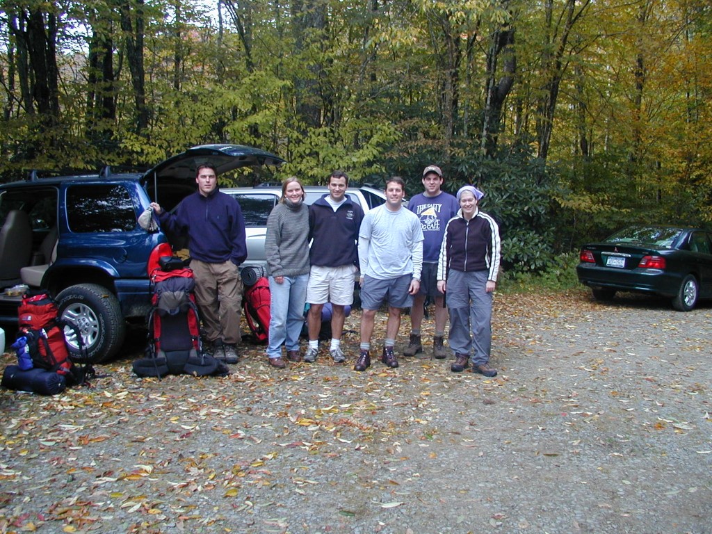
- click to see trail photos from this hike in Joyce Kilmer-Slickrock Creek Wilderness: October 6, 2001
- click to read a photo journal from this backpacking trip to Bob Stratton Bald: October 6, 2001
- click to view a detailed trip report for this hiking trail to Stratton Bald: October 6, 2001 (password required)
- click for a trip report of this hike in the Nantahala National Forest: October 6, 2001 (password required)
- click to purchase the Fontana and Hiwassee Lakes Trails Illustrated Map which has details of this area
- click for a topo and profile map of this backpacking trip to Stratton Bald (password required)
- click for a Trails Illustrated map with multiple access points to this area (password required)
- click for another hike to Bob Stratton Bald in October 2013
- click for a hike in the valley of the Joyce-Kilmer Slickrock Creek Wilderness in August 2004
- click for a hike to the nearby Hangover rock outcropping in November 2002
- click to access the guidebook Hiking Trails of Joyce Kilmer-Slickrock And Citico Creek Wilderness which has details on this destination
- click for other North Carolina hiking and backpacking books