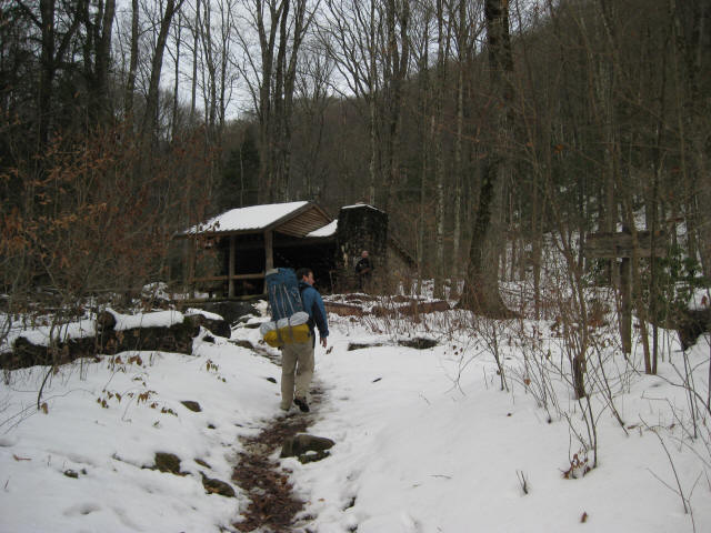
Kephart Shelter
Great Smoky Mountains National Park
107 Park Headquarters Road
Gatlinburg, TN 37738
(865) 436-1200
Great Smoky Mountains National Park encompasses 800 square miles of land and 95 percent of it is forested. The park is world renowned for the diversity of its plant and animal resources and for the beauty of its ancient mountains. Unfortunately, the majority of the people that visit the park never visit the backcountry and see some of the best wilderness in the Southeastern U.S.
This backtrack hike starts at US 441 on the North Carolina side of the part and just north of the Oconaluftee Visitors Center near Cherokee. The trail follows the The Kephart Prong which is a stream that runs down from Kephart Shelter to the Newfound Gap Road (also known as US 441). The shelter sleeps 10-12 and is situated in a valley at the junctions of the Grassy Branch and Sweat Heifer Trails.
- click to see a movie and slideshow recap of our hike to Kephart Shelter in December 2010
- click to see trail photos from this hike in the Great Smoky Mountain National Park: December 18, 2010 (password required)
- click to read a trip report for this backpacking trip in the Smokies: December 18, 2010 (password required)
- click to purchase a Trails Illustrated map of Great Smoky Mountains National Park
- click for a road and facilities map of Great Smoky Mountains National Park
- click for a trail map of Great Smoky Mountain National Park
- click for a topo and profile map of this hike to Kephart Shelter from US 441 (password required)
- click for a map of some other trails hiked in this area in the Great Smoky Mountains National Park
- click for other trips to Kephart Shelter in November 1992 and February 2023
- click for access to the guidebook Trail By Trail: Backpacking In The Smoky Mountains which has details on this destination
- click for other North Carolina hiking and backpacking books


