Rock Gap
Nantahala National Forest
Wayah Ranger District
Franklin, NC 28734
828-524-6441
The Nantahala National Forest is the largest of the four national forests in North Carolina and is the the second wettest region in the country – after the Pacific Northwest. The word “Nantahala” is a Cherokee word meaning “Land of the Noonday Sun.” In some spots, the sun only reaches the floors of the deep gorges in the middle of the day. The National Forest has 531,270 acres with elevation ranging from 5,800 feet at Lone Bald in Jackson County to 1,200 feet in Cherokee County along the Hiwassee River. Rock Gap is a well-known access point and resting spot on the Appalachian Trail (AT) in the Nantahala National Forest near Franklin, North Carolina. Located at mile 105.8 of the AT, it serves as a critical juncture for hikers traversing the Standing Indian Mountain loop or those making a popular 7.2-mile trek north to Winding Stair Gap.
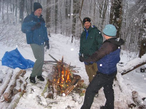
Rock Gap Shelter is a classic Appalachian Trail (AT) refuge located at mile 105.8 in North Carolina, roughly 4 miles north of the Standing Indian Shelter. This stone-and-wood lean-to is situated at an elevation of 3,750 feet. It is highly convenient for those needing a quick exit, as it sits only a short distance from the Rock Gap parking area on Forest Service Road 67. This is a short hike on the Appalachian Trail near Wallace Gap and old US 64. The trailhead is only a short distance from Rock Gap which is located just down the road from Wallace Gap and on the way to the Standing Indian Campground. After a brief hike, double blue blazes mark Rock Gap Shelter which is a small structure that sleeps 6-8 hikers with a recently remodeled patio complete with picnic table and fire pit. A privy and a spring are located within a short distance of the shelter.
- click for a video of Big Johnny!!!, and a falling logs from the sky that nearly took out Brownie
- click for more photos from this hike to Rock Gap Shelter: January 30, 2010
- click for a trip report from this backpacking trip on the Appalachian Trail: January 30, 2010 (password required)
- click to purchase the Nantahala and Cullasaja Gorges Trails Illustrated map for this area
- click for a trail map of the Appalachian Trail in Georgia, North Carolina, and Tennessee (password required)
- click for an ATC profile map from the Timber Ridge Trail to Wallace Gap (password required)
- click for an ATC trail map from the GA/NC Border to Wallace Gap (password required)
- click for a recap of our annual cold weather Klondike Hikes into the wilderness which began in the early 90’s
- click for a fall hike to the shelter at Rock Gap in October 2001
- click for more information on the Appalachian Trail
- click for Appalachian Trail hiking and backpacking books
- click for the guidebook Appalachian Trail: Georgia-North Carolina which has details on this destination
- click for other North Carolina hiking and backpacking books


Rock Gap Shelter was rebuilt in 2023.