West Carry Pond
Appalachian Trail Conservancy
799 West Washington Street
Harpers Ferry, WV 25425
(304) 535-6331

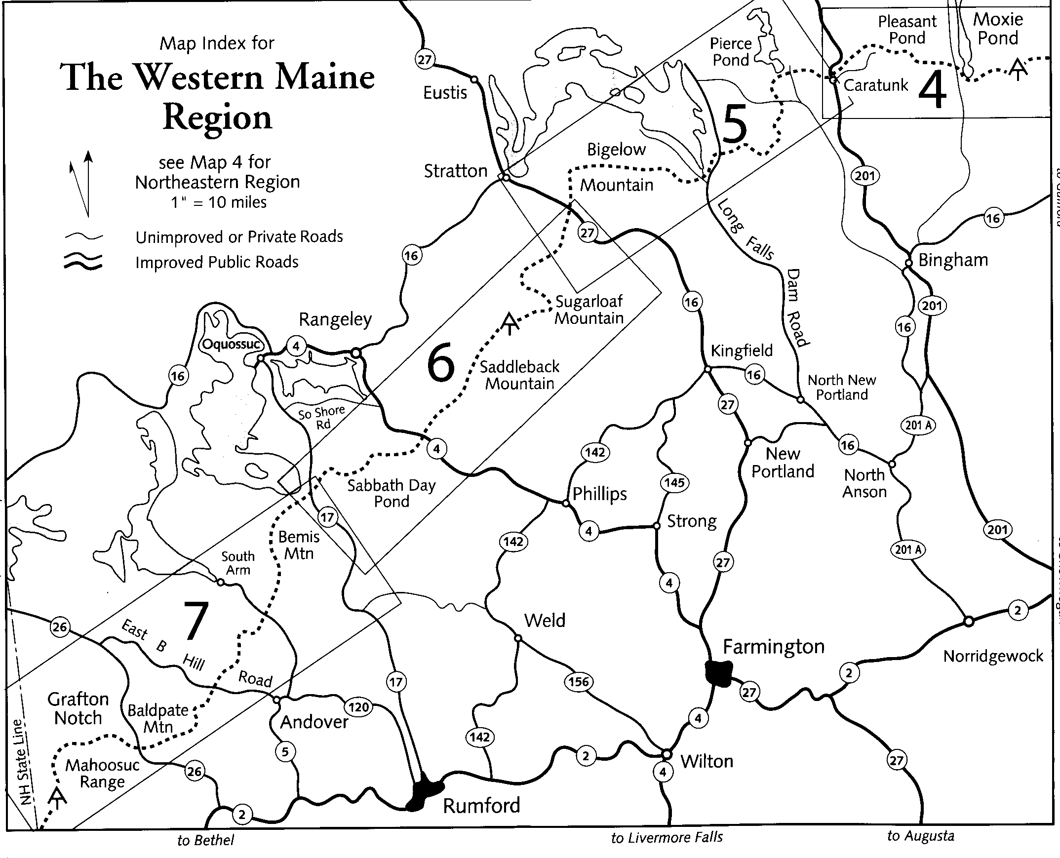
This is one of the easier sections of the Appalachian Trail in Maine and it is a very scenic section of trail. The route starts at Long Falls Dam Road where we had a shuttle driver drop us off due to very limited parking. From the gravel road the A.T. climbs immediately then gradually drops down to West Carry Pond and a lean-to bearing the same name after 3.5 miles. A short distance northbound on the A.T. is Arnold’s Point – named for Colonel Benedict Arnold who led a force of 1,100 Continental Army troops on an expedition from Cambridge in the Province of Massachusetts Bay to the gates of Quebec City. The expedition was part of a two-pronged invasion of the British Province of Quebec, and passed through the wilderness of what is now Maine – crossing the pond at this location.
The Appalachian Trail leaves West Carry Pond after Arnold’s Point and continues on to East Carry Pond where there is a nice beach right on the trail that is perfect for a lunch break. Then 13.5 miles from Long Falls Dam Road the A.T. reached the scenic Pierce Pond and lean-to. Harrison’s Pierce Pond Camps are 0.3 miles away and rent cabins but a reservation is required. The final section of the trail follows the Pierce Pond Stream as it cascades down the mountain to the Kennebec River. The Appalachian Trail Conservancy provides a canoe ferry at the river but has seasonal hours and you should check with their website before you hike this section. Do not ford this river. Hikers have died trying in the past. The parking area to end this section is across the river and across the highway near the town of Caratunk.
- click to watch a video from this hike in New England in September 2019
- click to hear a podcast with Tim Harrison from the nearby Harrison’s Cabins
- click to see photos from this backpacking trip on the Appalachian Trail in Maine: September 26, 2019 (password required)
- click to see more photos of this section from the New Hampshire border to the Kennebec River
- click for a trip report from our hike to East and West Carry Pond: September 26, 2019 (password required)
- click for an ATC topo map from Long Falls Dam Road to the Kennebec River (password required)
- click for an ATC profile map from Long Falls Dam Road to the Kennebec River (password required)
- click for an ATC topo & profile map from ME 27 (Stratton) to the Kennebec River (password required)
- click for an ATC profile map of this backpacking trip from Bog Brook Road to the Kennebec River (password required)
- click for a map of the Appalachian Trail in New England (password required)
- click for more information on the Appalachian Trail
- click for Appalachian Trail hiking and backpacking books
- click to access the guidebook Appalachian Trail: Maine which has details on this destination
- click for other Maine hiking and backpacking books