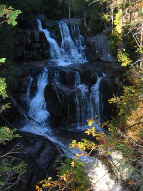
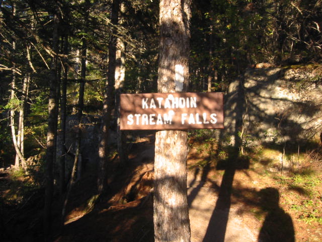
Katahdin Stream Falls
Baxter State Park
64 Balsam Drive
Millinocket, ME 04462
207-723-5140

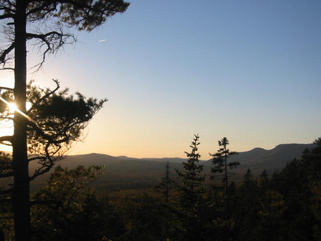
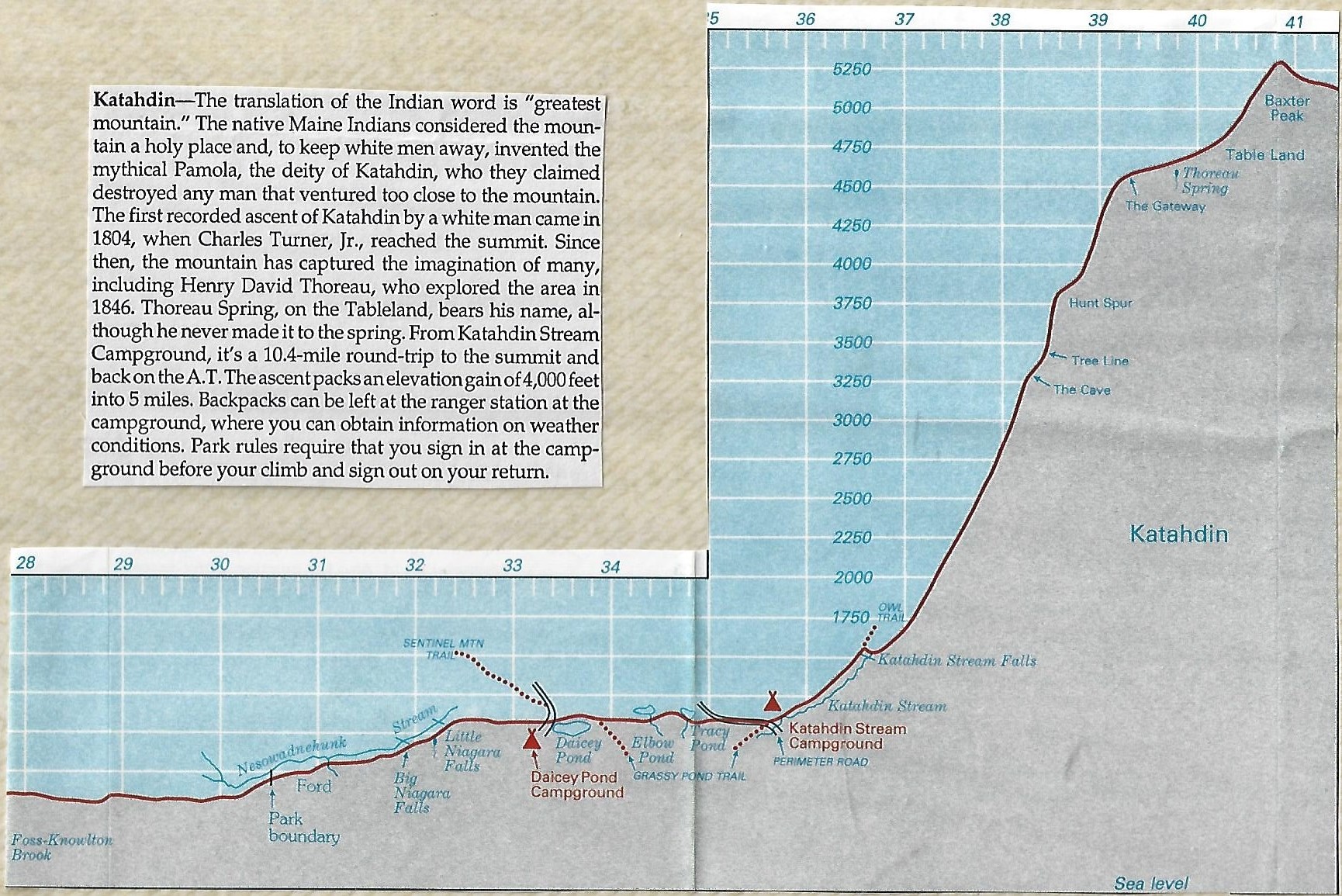
The Appalachian Trail in Maine is generally considered the most difficult of all the fourteen states that the A.T. traverses. The Maine portion covers about 282 miles and offers hikers rugged terrain, stunning wilderness, and remote beauty. In some sections, don’t expect to hike more than a mile an hour and get used to steep ascents and descents. Slippery and sometimes hazardous weather can occur at any time, and the terrain is often remote to say the least. Baxter State Park was a gift to the State of Maine by former Governor Percival P. Baxter who held office from 1921-1924. The wilderness and forest area now encompasses over 200,000 acres, and there are over 200 miles of trails in the park.
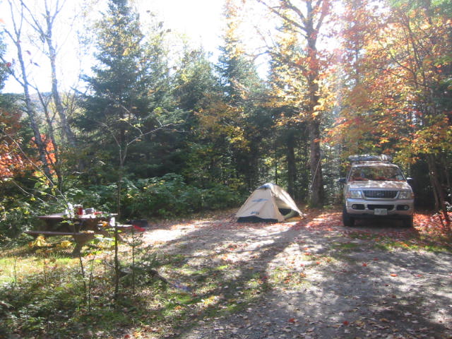
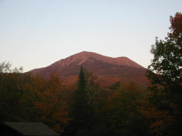
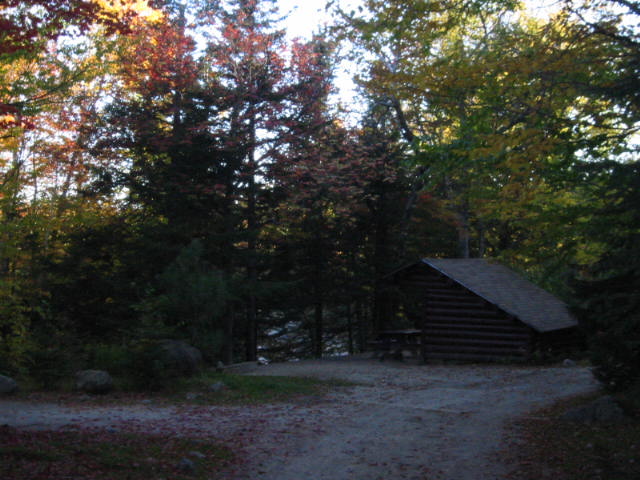
This hike to Katahdin Stream Falls begins at the Katahdin Stream Campground in Baxter State Park and follows the Appalachian Trail just over a mile to an overlook which is located just left of the trail. It is a fairly easy climb to the falls, but the incline and trail difficulty increases dramatically in the next few miles if you choose to continue on to Mt. Katahdin. At 5,268 feet, the summit is 5.2 miles from the trailhead at the campground and 4.0 miles from the falls. Katahdin is best known as the northern terminus of the Appalachian Trail which is marked by a large brown and white sign and magnificent 360 degree views from the summit.
- click to see photos from this hike around to Katahdin Stream Falls: October 1, 2004
- click for a detailed trip report of this hike in Baxter State Park: October 2, 2004 (password required)
- click for a trip report of this hike near Katahdin Stream Campground: October 2, 2004 (password required)
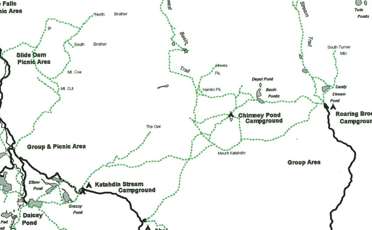
- click for a park map of Baxter State Park near Millinocket, Maine
- click for a topographical map of trails leading to the peak of Mt. Katahdin
- click for a trail map of the hiking trails around Daicey Pond and Mt. Katahdin
- click for a topo and profile map of this A.T. section from Nahamakanta Lake to Mt. Katahdin (password required)
- click for another hike in this area at Katahdin Stream Falls on October 2
- click for a map of the Appalachian Trail in New England (password required)
- click to view a complete photo gallery for my A.T. thru-hike through Maine: September 19-October 2, 1994
- click for a trail journal from the Appalachian Trail in Maine: September-October, 1994
- click for more information on the Appalachian Trail
- click to access the guidebook Appalachian Trail: Maine which has details on this destination