Wildcat Ridge
Chattahoochee-Oconee National Forests
1755 Cleveland Highway
Gainesville, GA 30501
770 297-3000

The Chattahoochee National Forest is one of two National Forests in the State of Georgia, and it takes its name from the Chattahoochee River whose headwaters begin in the North Georgia mountains. The River and the area were given the name by the English settlers who heard it from the Indians that once lived here. The Chattahoochee National Forest was created when the Forest Service purchased 31,000 acres in Fannin, Gilmer, Lumpkin and Union Counties from the Gennett family in 1911 for $7.00 per acre. In the beginning, the Chattahoochee was part of the Nantahala and Cherokee National Forests in North Carolina and Tennessee, but eventually the Forest Service made additional land purchases and expanded the Chattahoochee to its current size of nearly 750,000 acres.
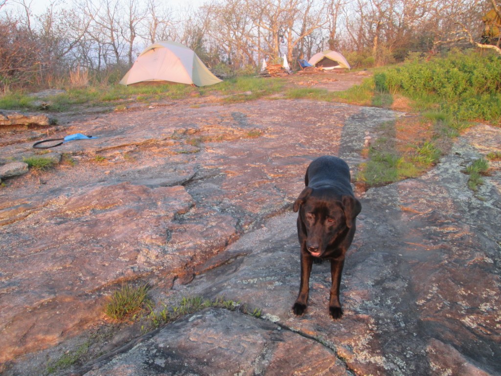
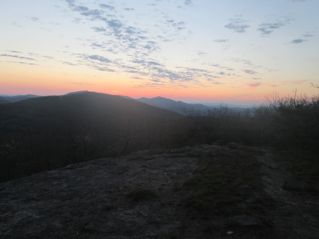
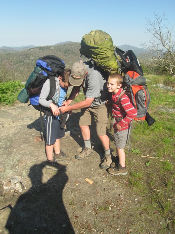
The walk to Whitley Gap Shelter is an in-and-out, backtrack hike that can be done as either a day or overnight hike. The hike starts at Hogpen Gap and follows the Appalachian Trail southbound up 200 feet over 0.2 miles. At the ridgeline, there is a sign for Whitley Gap Shelter which is 1.2 miles off the A.T. on a blue-blazed side trail. Turn left on to the trail and follow the spine of Wildcat Mountain which has some great views to the west toward Cow Rock Mountain and Wolf Laurel Top. The shelter sits in a hollow with a steep decent over the last 0.3 miles. It sleeps 6-8 and has a picnic table, privy, bear cables, and a spring in the area.
- click for a movie from our backpacking trip to this summit in the Chattahoochee National Forest
- click for more photos from this overnight hike to Wildcat Mountain: May 2, 2015 (password required)
- click for a trip report from this hike on the A.T. near Helen, GA: May 2, 2015 (password required)
- click to purchase maps for the Appalachian Trail in Georgia and North Carolina
- click for a topographical and profile map from this backpacking trip to Wildcat Mountain (password required)
- click for a topo and profile map from this hike to Whitley Gap Shelter (password required)
- click for a profile map from Baggs Creek Gap to Unicoi Gap (password required)
- click for a Appalachian Trail map from Wolf Laurel Top to Chattahoochee Gap (password required)
- click for a trail map or profile map of the Appalachian Trail in Georgia (password required)
- click for another hike to Wildcat Mountain in May 2015, October 2020, December 2023 and October 2024
- click for a backpacking trip to the nearby Whitley Gap Shelter where we camped in March 2012
- click for the guidebook Appalachian Trail: Georgia-North Carolina which has details on this destination
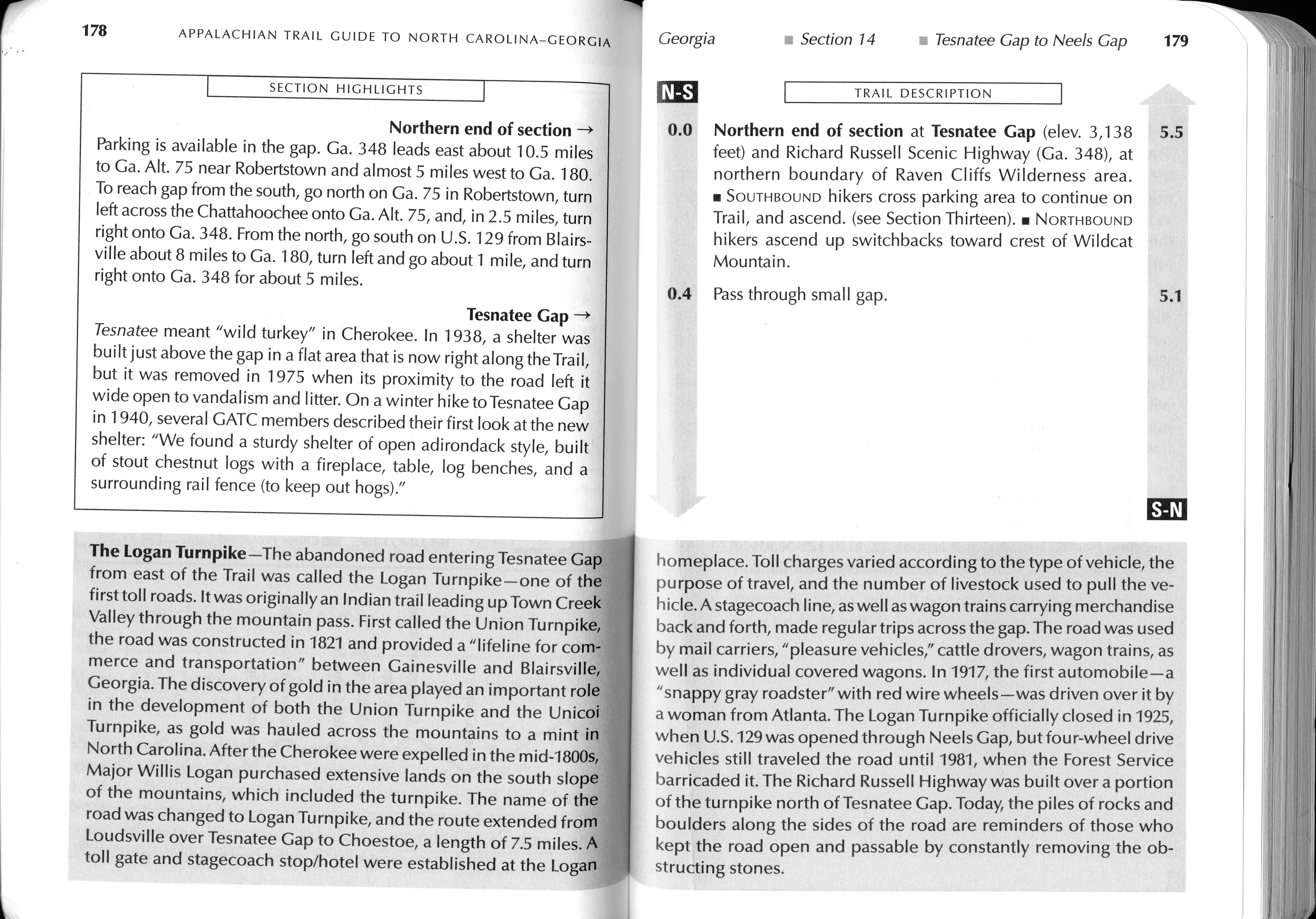
- click to preview this section of the A.T. from Neels Gap to Tesnatee Gap (password required)
- click for more information on Tesnatee Gap and Appalachian Trail miles 0.4 to 4.4 in this section (password required)