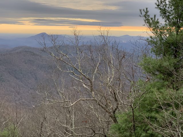
Rocky Mountain (via Indian Grave Gap)
Chattahoochee National Forest
508 Oak Street NW
Gainesville, GA 30501
(404) 536-0541
The Chattahoochee National Forest is one of two National Forests in the State of Georgia, and it takes its name from the Chattahoochee River whose headwaters begin in the North Georgia mountains. The River and the area were given the name by the English settlers who heard it from the Indians that once lived here. The Chattahoochee National Forest was created when the Forest Service purchased 31,000 acres in Fannin, Gilmer, Lumpkin and Union Counties from the Gennett family in 1911 for $7.00 per acre. In the beginning, the Chattahoochee was part of the Nantahala and Cherokee National Forests in North Carolina and Tennessee, but eventually the Forest Service made additional land purchases and expanded the Chattahoochee to its current size of nearly 750,000 acres.
The short 800′ climb to Rocky Mountain is a shuttle hike that starts at the Rocky Mountain Trail on USFS 283 (Indian Grave Gap Road) in the in the Chattahoochee National Forest. There is no official parking here – you are simply pulling off the forest road. From USFS 283 you immediately pass a sign telling you that you are on the Rocky Mountain Trail, then begin a steep 1.0 mile climb to a junction with the Appalachian Trail. Turn left at this trail junction then continue climbing the A.T. southbound for another 0.4 miles up to Rocky Mountain (4017 feet). On Rocky Mountain, there is a small rock outcrop on the A.T. (located 20 yards past a small campsite) with scenic views to Yonah Mountain and to the south. So this is a pleasant day hike if you are looking to spend a few hours on the Trail. From Rocky Mountain, you descend 1.2 miles and 904 feet on the Appalachian Trail to Indian Grave Gap (3113 feet). So the total is 2.6 miles for this shuttle hike. It is 0.8 miles from the Appalachian Trail at Indian Grave Gap to where you parked your first car at the trailhead for the Rocky Mountain Trail – so you can make this a loop hike by hiking the gravel USFS 283 (Indian Grave Gap Road) back to your starting point. Most people hike to the summit via a 1100 feet climb from Unicoi Gap, so this route is a less crowded approach to Rocky Mountain.
- click for a trip report of this backpacking trip to Rocky Mountain: November 29, 2019 (password required)
- click for a Trails Illustrated map of this hike in the Chattahoochee National Forest
- click for a topo and profile map of a loop hike from Unicoi to Indian Grave Gap (password required)
- click for an ATC trail map from Wolf Laurel Top to Chattahoochee Gap (password required)
- click for an ATC profile map from Wolf Laurel Top to Unicoi Gap (password required)
- click for a Georgia Appalachian Trail overview map (password required)
- click for a Georgia Appalachian Trail profile map (password required)
- click to see another approach to Rocky Mountain via Unicoi Gap in December 2018
- click for more information on the Appalachian Trail
- click to access the guidebook Appalachian Trail: Georgia-North Carolina which has details on this destination
- click for Appalachian Trail hiking and backpacking books
- click for other Georgia hiking and backpacking books


