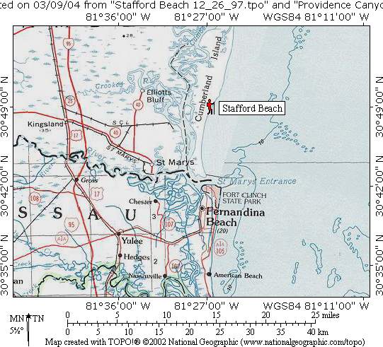
Stafford Beach
Cumberland Island National Seashore
101 Wheeler Street
Saint Marys, 31558
Visitor Information
912-882-4336 x254

The Cumberland Island National Seashore and Wilderness Area encompass approximately 8,840 acres of pristine, undeveloped coastal landscape offers visitors a glimpse of Georgia’s barrier islands as they existed centuries ago. This protected expanse has maritime forests draped in Spanish moss, expansive salt marshes, shifting sand dunes, and unspoiled beaches that stretch for miles along the Atlantic coastline. The southern boundary of the wilderness lies about four and a half miles north of the popular Sea Camp area, marking a transition from more accessible recreation zones into a quieter, more remote backcountry experience. Within this wilderness zone are three designated camping areas, often referred to as “zone camps,” where the absence of marked individual sites enhances the sense of solitude and immersion in nature. Campers can select their own spot within 50 yards of the posted camp markers which allows for a more personalized and low-impact camping experience and aligns with wilderness preservation principles.
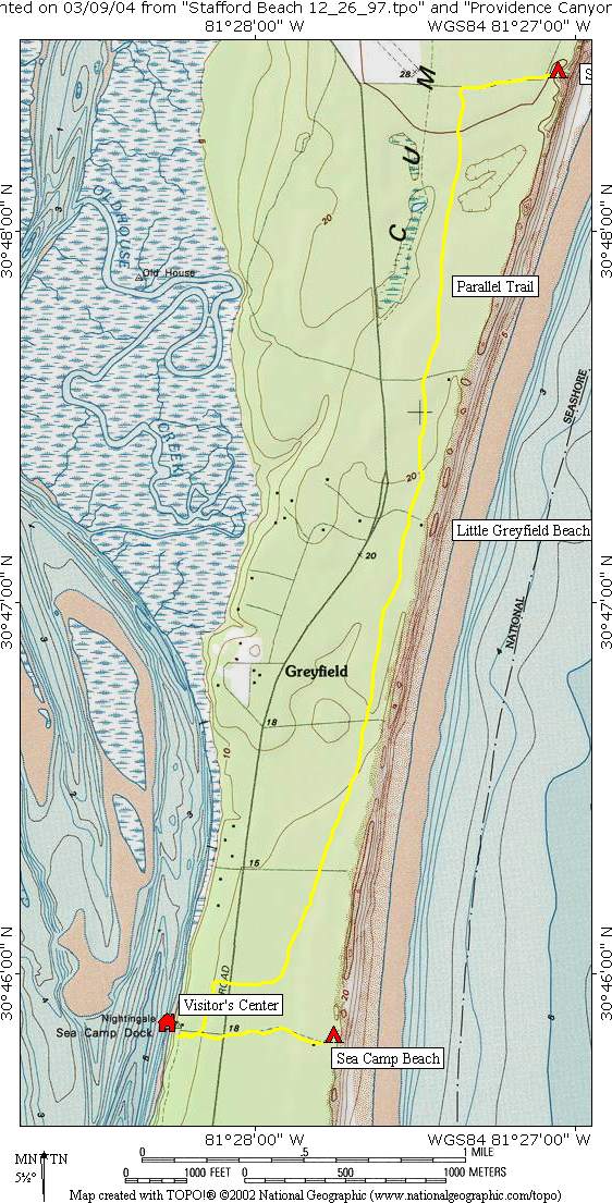
Access to Cumberland Island is intentionally limited, preserving its tranquil atmosphere and ecological integrity. Most visitors arrive via ferry departing from the waterfront in St. Marys, where the mainland visitor center serves as the primary gateway to the island. Upon arrival, those planning to camp in the backcountry must secure reservations at the Sea Camp Visitor Center, located near the ferry landing. The island features five established camping areas, including Sea Camp, which is a convenient walk-in site just a short distance from where the ferry docks. For those that want a deeper backcountry experience, Stafford Beach offers a more secluded alternative. On our trip, we chose to backpack to Stafford Beach, carrying all necessary gear through scenic trails that wind through maritime forests and open coastal stretches. However, visitors who prefer a lighter excursion can stay at Sea Camp and embark on a day hike along the roughly seven-mile route to Stafford Beach and back. Both camping areas provide reliable access to fresh water, an essential amenity in the island’s remote setting. Stafford Beach is equipped with a hand-operated pump that draws from an underground well, while Sea Camp has the convenience of running water at its visitor center, complete with a nearby drinking fountain.
- click for more photos from this hike on Cumberland Island: December 26, 1997
- click for a detailed trip report from this hike at Cumberland Island : December 26, 1997 (password required)
- click for a Daytimer report of this coastal backpacking trip near St. Mary’s Georgia (password required)
- click for a park map of the Cumberland Island National Seashore
- click for a topographic and profile map of this backpacking trip to Stafford Beach
- click for Stafford Beach at Cumberland Island National Seashore
- click for the guidebook Hiking Trails North Georgia for more hikes in this area
- click for more hiking and backpacking books from Georgia


