Gold Branch
Chattahoochee River National Recreation Area
1978 Island Ford Parkway
Sandy Springs, GA 30350
678-538-1273
The City of Roswell has several well-known trails and outdoor recreational areas due to its proximity to the Chattahoochee River and the natural beauty of the surrounding area. Some popular trails in the Roswell area include the Chattahoochee River National Recreation Area, the Oxbo Trail, the Vickery Creek Trail, Big Creek Greenway, and the Roswell Riverwalk. The park spans about 90 acres, providing plenty of space for various outdoor activities. The trails are close to the cities of Marietta and Roswell – so don’t expect much privacy here – but for being so close to the city, these are really nice and scenic hikes.
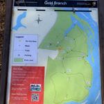
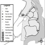
This hike to the Chattahoochee River is from the Gold Branch parking area off Lower Roswell Road near Marietta, GA. The route starts in the northwestern corner of the park and descends down to a small stream in a hardwood forest. From here, you can hike either in a clockwise or counter-clockwise direction to reach the river. Either way you will eventually walk along Bull Sluice Lake – which is a body of water on the northern end of the park. It is almost entirely cut off from the main flow of river with only a narrow passage connecting Bull Sluice Lake with the Chattahoochee. Hiking clockwise takes you to the lake in under 30 minutes. The entire Gold Branch loop is around five miles, but if you are short on time or energy there are a number of smaller loops in the park (see map). This gives you a number of options ranging from 1-5+ miles in the Gold Branch area.
- click for a trip report from this hike at Gold Branch on the Chattahoochee River: February 24, 2012 (password required)
- click for a trail map from this hike along Chattahoochee in Roswell, Georgia
- click for winter hikes along the river at Gold Branch in February 2012, February 2017 and December 2020
- click for fall hikes at Gold Branch on the Chattahoochee River in September 2014
- click for a hike on the nearby Roswell Riverwalk Trail in 2024
- click for another hike in Roswell at Grimes Bridge Park in 2011
- click for a hike on the Oxbo Trail in Waller Park in 2010
- click to access the guidebook Best Hikes Near Atlanta which has more hikes around the City of Atlanta
- click to access the guidebook Hiking Georgia which has more hikes and backpacking trips in the State of Georgia
- click for other Georgia hiking and backpacking books

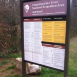




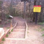

There’s been a few changes at the trailhead since I last hiked here. There is still a fee to hike here ($5), but you now must scan a code at the trailhead with your smartphone and pay electronically – after you set up an account. Also, the national park service had numerous signs restricting parking to the designated lot – which isn’t very big. If you come here on a weekend, you may have to wait for someone to leave before you find parking.