Stover Creek (via Three Forks)
Chattahoochee-Oconee National Forests
1755 Cleveland Highway
Gainesville, GA 30501
770 297-3000
The Chattahoochee National Forest is one of two National Forests in the State of Georgia, and it takes its name from the Chattahoochee River whose headwaters begin in the North Georgia mountains. The River and the area were given the name by the English settlers who heard it from the Indians that once lived here.
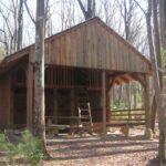
This hike to Stover Creek Shelter starts at Three Forks, a nice flat area accessible by USFS 58 where Stover, Chester, and Long Creek converge. We followed the Appalachian Trail from Three Forks to the Stover Creek Shelter. It was rebuilt and moved in 2012 and is now a multi-level structure situated above the A.T. in a hardwood forest. The shelter is unique in design with four windows in the back and two separate sleeping platforms on the main level. A privy and a seasonal spring are located nearby. In dry months, Stover Creek is a back-up (and reliable) water source to the spring behind the shelter.
- click to watch the forest road blocked by a tree and our success clearing the way
- click to see trail photos from this backpacking trip to Stover Creek Shelter: December 22, 2012
- click for a trip report from this hike near Three Forks: December 22, 2012 (password required)
- click for a Trails Illustrated map of this area between Amicalola Falls & Springer Mountain
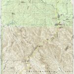
- click to a topographical map of this hike from Three Forks to Amicalola Falls State Park (password required)
- click for an ATC trail map from Amicalola Falls to Three Forks (password required)
- click for an ATC profile map from Amicalola Falls to Springer Mountain (password required)
- click for a Georgia Appalachian Trail overview map (password required)
- click for a Georgia Appalachian Trail profile map (password required)
- click to see more hikes to Springer Mountain and the start of the Appalachian Trail
- click for more information on the Appalachian Trail
- click for Appalachian Trail hiking and backpacking books
- click to access the guidebook Appalachian Trail: Georgia-North Carolina which has details on this destination
- click for other Georgia hiking and backpacking books


