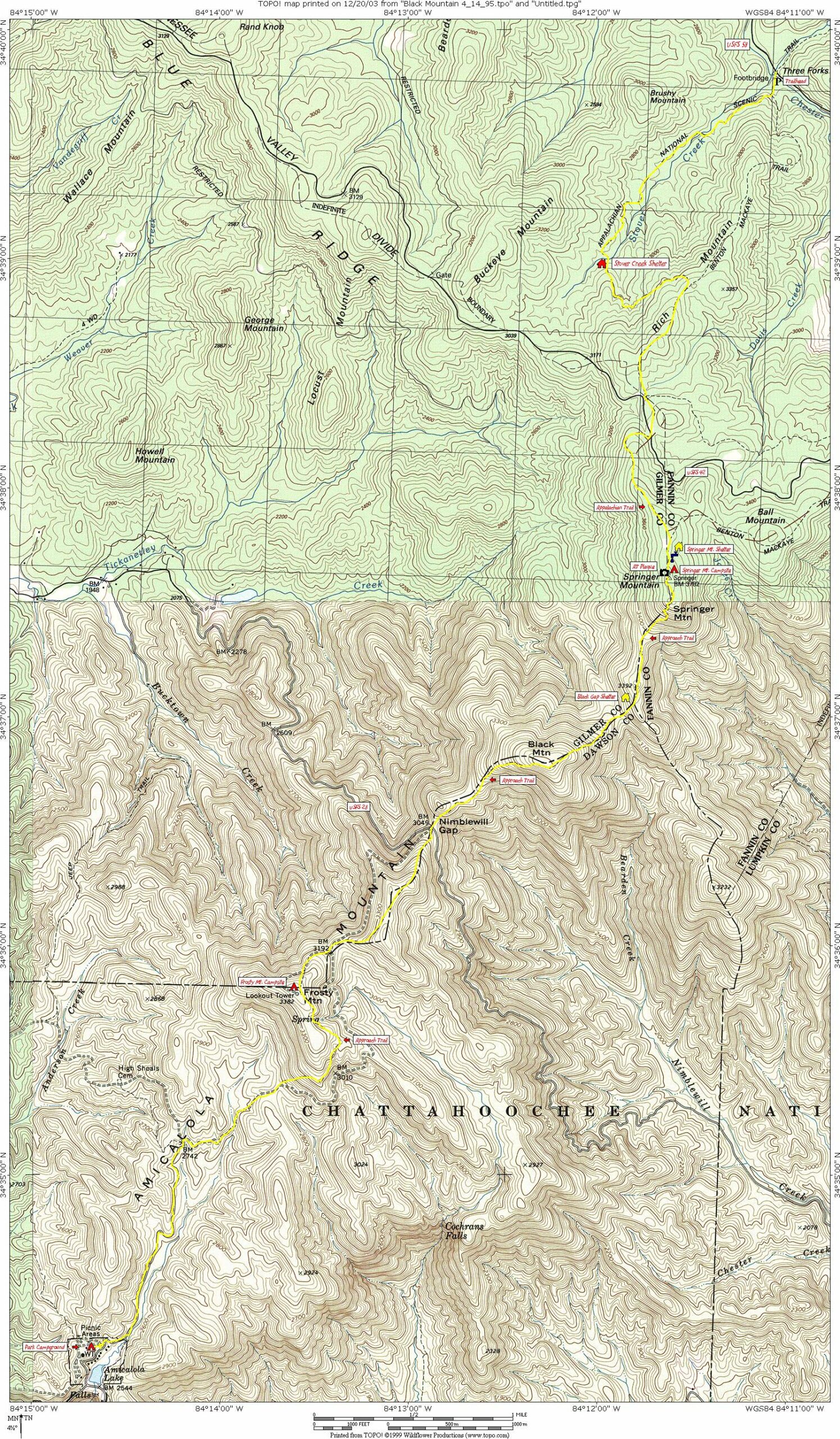
Black Mountain (via Three Forks)
Chattahoochee-Oconee National Forests
1755 Cleveland Highway
Gainesville, GA 30501
Phone: 770 297-3000

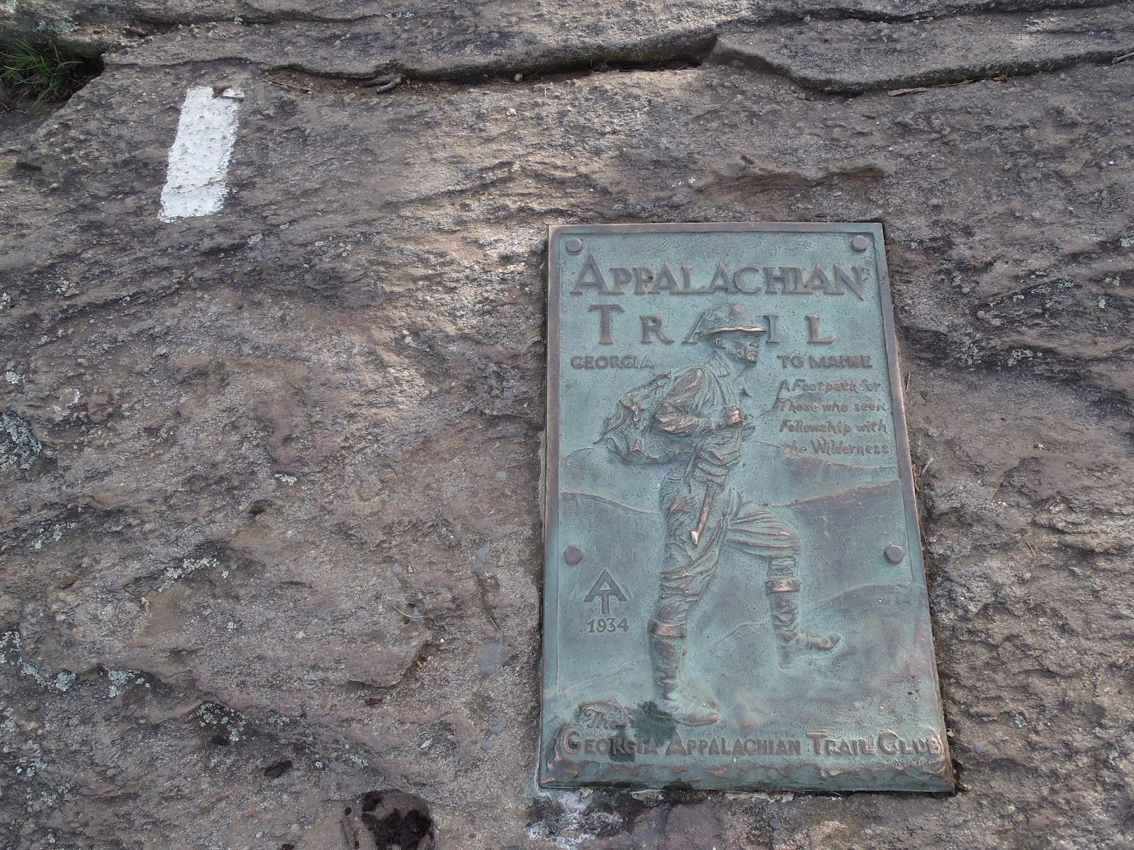
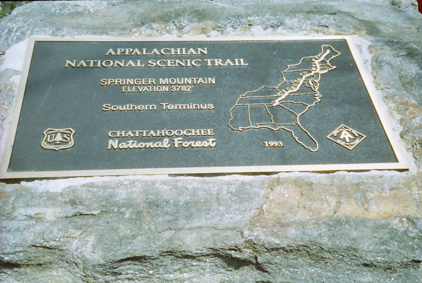
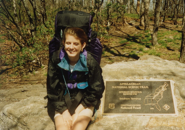
Springer Mountain is located in the Chattahoochee, and it is the southern terminus of the Appalachian Trail. Every spring, 2000-3000 thru-hikers (or individuals that plan to hike the entire A.T. in a single year) leave from the summit of Springer to attempt a 2100+ mile journey to the northern terminus at Mt. Katahdin in Maine. Springer Mountain (3,782 feet) has a bronze plaque (showing a hiker facing north) that is set in stone next to the first white blaze marking the Appalachian Trail. There is also a terminus plaque set in a rock behind the blaze that has a compartment with a trail register of entries from day hikers, backpackers, and thru-hikers that have visited the area. A shelter located about 0.2 miles north of Springer on a blue blazed side trail provides overnight accommodations and has a nearby water source from a mountain spring.
Springer Mountain is crisscrossed by three trails: the Approach Trail (a blue-blazed access trail that heads down the mountain to Amicalola Falls State Park), the Appalachian Tail (which runs northbound to Maine), and the Benton MacKaye Trail (which runs northbound for 100 miles to the Oconee River in Tennessee). The area is popular with both day and overnight hikers, and it gets a fair amount of trail traffic.On our hike in April 1995, we followed the Appalachian Trail southbound across Springer Mountain from Three Forks then descended on the Approach Trail across Black, Frosty, and Rich Mountains to Amicalola Falls State Park. There’s a fair amount of elevation change on this route, but it is much easier if done in this direction. This hike follows the Appalachian Trail southbound across Springer Mountain from Three Forks then descends on the Approach Trail across Black, Frosty, and Rich Mountains to Amicalola Falls State Park. Three Forks, Springer Mountain (the southern terminus of the Appalachian Trail) and Amicalola Falls are the high points of this hike, and there are three shelters on this route and numerous campsite for overnight accommodation.
- click for more photos from this backpacking trip over Black Mountain: April 14, 1995
- click for a detailed trip report from this hike starting at Three Forks: April 14, 1995 (password required)
- click for a Daytimer report for this hike on the Approach Trail: April 14, 1995 (password required)
- click for a Trails Illustrated map of this area between Amicalola Falls & Springer Mountain
- click to a topographical map of this hike from Three Forks to Amicalola Falls State Park (password required)
- click for an ATC trail map from Amicalola Falls to Three Forks (password required)
- click for an ATC profile map from Amicalola Falls to Springer Mountain (password required)
- click for a Georgia Appalachian Trail overview map (password required)
- click for a Georgia Appalachian Trail profile map (password required)
- click to see more hikes to Springer Mountain and the start of the Appalachian Trail
- click for Appalachian Trail hiking and backpacking books
- click for the guidebook Appalachian Trail: Georgia-North Carolina which has details on this destination