Frosty Mountain
Chattahoochee-Oconee National Forests
1755 Cleveland Highway
Gainesville, GA 30501
770 297-3000
The Chattahoochee National Forest is one of two National Forests in the State of Georgia, and it takes its name from the Chattahoochee River whose headwaters begin in the North Georgia mountains. The River and the area were given the name by the English settlers who heard it from the Indians that once lived here. The Chattahoochee National Forest was created when the Forest Service purchased 31,000 acres in Fannin, Gilmer, Lumpkin and Union Counties from the Gennett family in 1911 for $7.00 per acre. In the beginning, the Chattahoochee was part of the Nantahala and Cherokee National Forests in North Carolina and Tennessee, but eventually the Forest Service made additional land purchases and expanded the Chattahoochee to its current size of nearly 750,000 acres.
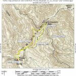
Frosty Mountain is located in the Chattahoochee National Forest along the Approach Trail to Springer Mountain (the southern terminus of the Appalachian Trail.) The summit was once the site of a U.S. Forest Service lookout tower, but it has been removed and all that remains is a flat area suitable for overnight camping. A seasonal spring is located a short distance to the southeast although it may be difficult to find especially in the summer months. This hike makes a loop from Nimblewill Gap at USFS 28 and follows the Approach Trail to Frosty Mountain. It then returns to the parking area via USFS 46 which is a rough route that is only suitable for four wheel vehicles. There are a few moderate ascents and descents on the Approach Trail, but the USFS 46 route is graded and fairly easy to hike. A side trail to the Len Foote Hike Inn is accessible from the Approach Trail in this section and makes a nice side hike if you have the time.
- click for photos from this hike to Frosty Mountain: October 16, 2004
- click for a detailed trip report from this backpacking trip: October 16, 2004 (password required)
- click for a Trails Illustrated map of this area between Amicalola Falls & Springer Mountain
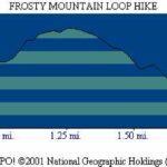
- click for a topographical map or profile map of this loop hike to Frosty Mountain (password required)
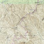
- click for a topographical map of the Approach Trail to Springer Mountain (password required)
- click for a profile map of the Approach Trail from Amicalola Falls to USFS 42 (password required)
- click for an ATC trail map from Amicalola Falls to Three Forks (password required)
- click for an ATC profile map from Amicalola Falls to Springer Mountain (password required)
- click for a Georgia Appalachian Trail overview map (password required)
- click for a Georgia Appalachian Trail profile map (password required)
- click for another hike to Frosty Mountain in November 2020 and December 2021
- click for more information on the Appalachian Trail
- click for Appalachian Trail hiking and backpacking books
- click to access the guidebook Appalachian Trail: Georgia-North Carolina which has details on this destination
- click for other Georgia hiking and backpacking books


