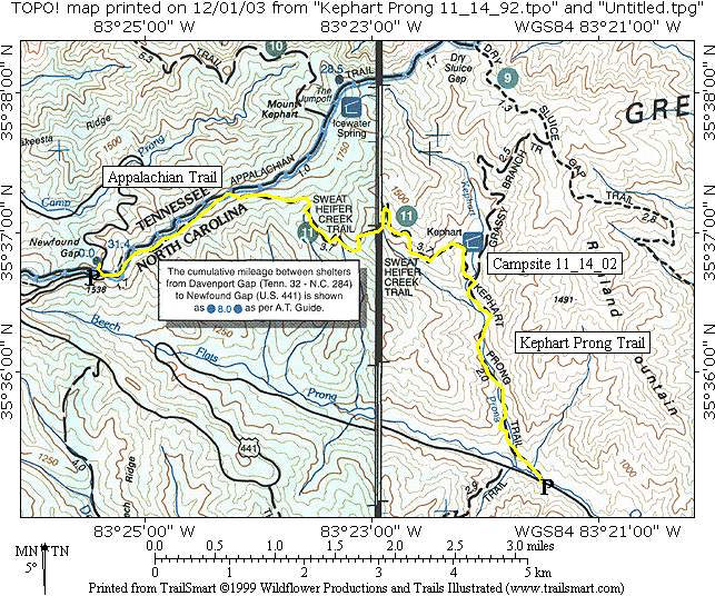
Kephart Shelter (via Newfound Gap)
Great Smoky Mountains National Park
107 Park Headquarters Road
Gatlinburg, TN 37738
(865) 436-1200

The Great Smoky Mountains National Park stretches across 800 square miles, with nearly 95 percent of its land covered in forest. These ancient mountains, which are among the oldest on Earth, are built from rocks more than 200 million years old with their jagged peaks worn down into the soft, rounded ridges that are present today. These ridgelines are traversed by the Appalachian Trail which climbs to its highest point at Clingmans Dome (6,643 feet) and straddles the border of North Carolina and Tennessee in the park. From the ridges you will often see a distinctive blue haze that lingers over the valleys. It is a natural mist that is created when plants release water vapor and organic compounds into the air which gives the area its trademark “Smoky” Mountains name. Unfortunately, the majority of the people that visit the park never visit the backcountry and see some of the best wilderness in the Southeastern U.S.
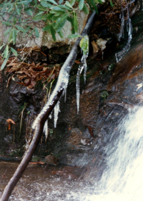
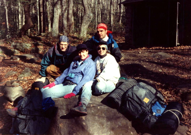
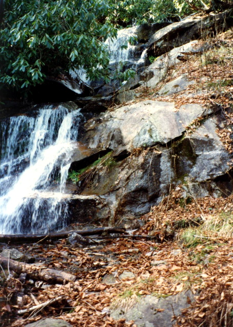
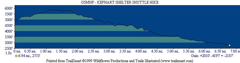
The Kephart Shelter is a rustic backcountry camping shelter located in the Great Smoky Mountains National Park, accessible primarily via the scenic and historic Kephart Prong Trail. It serves as a junction for several trails and is a popular destination for both day hikes and overnight backpacking trips. The shelter is situated in a forested valley in the North Carolina side of the park, near the Kephart Prong (stream). It is one of the lowest elevation shelters in the park not located on the Appalachian Trail. This hike follows the Appalachian Trail from Newfound Gap down the Sweat Heifer Trail to Kephart Shelter. The Kephart Prong is a stream and the water source for the shelter, and the trail follows it to US 441 to complete this shuttle hike.
- click for more photos from this hike in the Great Smoky Mountain National Park: November 14, 1992
- click for a Daytimer report from this backpacking trip to Kephart Shelter: November 14, 1992 (password required)
- click to purchase a Trails Illustrated map of Great Smoky Mountains National Park
- click for a road and facilities map of Great Smoky Mountains National Park
- click for a trail map of Great Smoky Mountain National Park
- click for a topo and profile map of this hike to Kephart Shelter from Newfound Gap (password required)
- click for a map of some other trails hiked in this area in the Great Smoky Mountains National Park
- click for a trail map of the Appalachian Trail in Georgia, North Carolina, and Tennessee (password required)
- click for other trips to Kephart Shelter in December 2010 and February 2023
- click for the guidebook Trail By Trail: Backpacking In The Smoky Mountains for details on this destination
- click for other North Carolina hiking and backpacking books