Cold Mountain
Pisgah National Forest
Shining Rock Wilderness
1600 Pisgah Highway
Pisgah Forest, NC 28768
(828) 877-3265

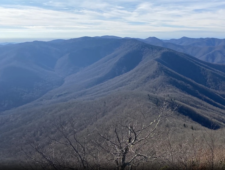
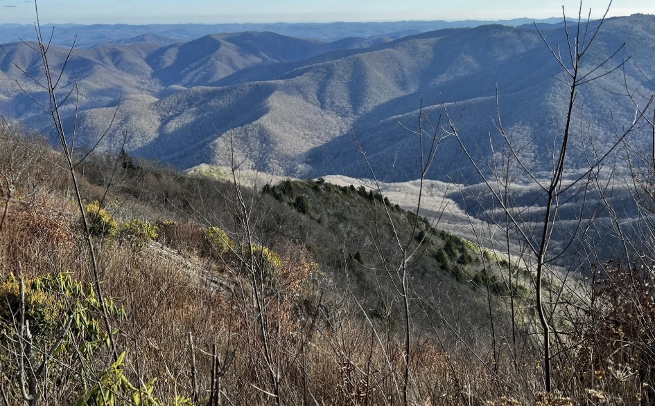
Cold Mountain at 6,030 feet is located in The Shining Rock Wilderness and is one of five peaks in this section of the Pisgah National Forest that rises over 6,000 feet. The mountain’s history is deep in Appalachian roots, Civil War–era lore, and modern literary fame. Long before European settlement, the high ridges and surrounding valleys of Cold Mountain were part of Indigenous hunting grounds – later giving way to small, isolated farming communities in Haywood County during the late 18th and 19th centuries. During the Civil War, the remote terrain became a refuge for deserters and Union sympathizers in a region deeply divided by the conflict, a theme that later shaped the mountain’s cultural identity. In the early 20th century, logging reached nearby areas but largely spared Cold Mountain’s highest slopes, which helped preserve its rugged character.
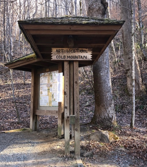
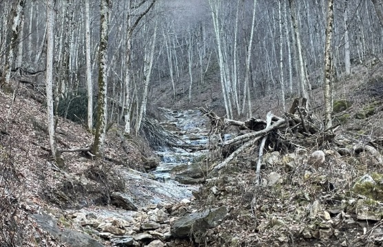
If you have seen the movie Cold Mountain or read the 1997 best selling novel by Charles Frazier then you may be one of the many hikers that have flocked to this area. Prior to the book and movie releases, only hunters and hard-core hikers spent much time on the mountain. The 10.4-mile round-trip hike to Cold Mountain is a steep and strenuous route with sections of unmarked trail and and an elevation gain of 2,800 feet from the Art Loeb trailhead at the Daniel Boone Scout Camp (SR 1129) to the summit. Sorrell Creek, a cold, clear mountain stream, is about two miles into the hike and is a nice place to take a break. Keep in mind that this section of the Blue Ridge Parkway is closed for much of the winter depending on the weather – usually November through March. During these months, you can call 828-298-0398 for weather and road closure information. Even when the Parkway is closed, the Cold Mountain overlook is accessible from U.S. 276 exchange.
- click for the Pisgah Ranger District Trails Illustrated map which details on this area
- click for a topo and profile map of this hike on the Art Loeb Trail (password required)
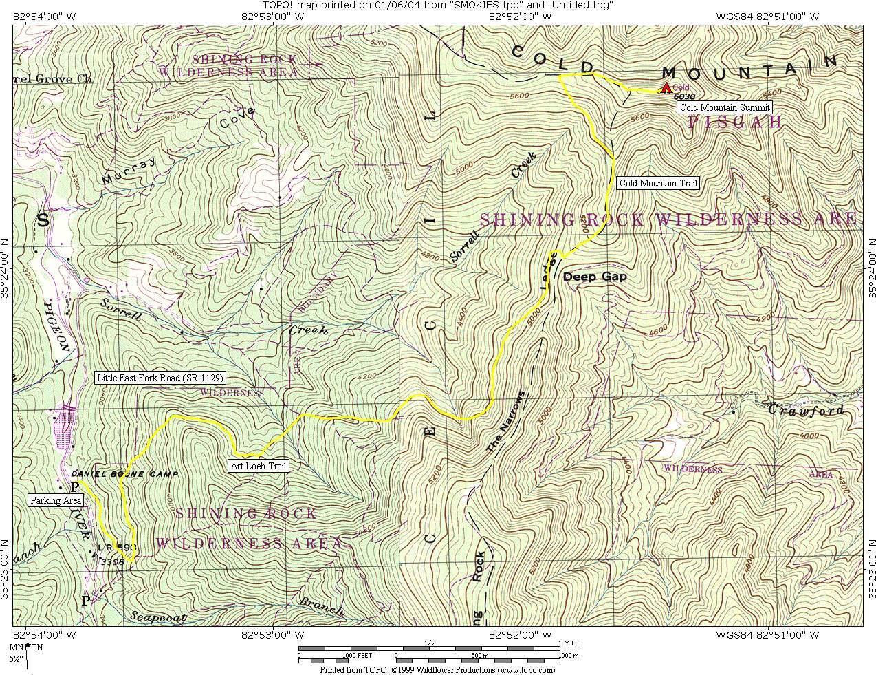
- click for a topographical map of this hike to Cold Mountain
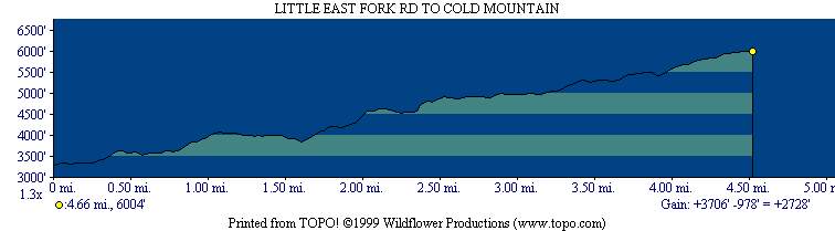
- click for a profile map from this backpacking trip to Cold Mountain
- click for a trail map of the intersecting trails at Shining Rock Gap (password required)
- click for a photo of the intersecting trails at Shining Rock Gap (password required)
- click for a news articles about Cold Mountain: December 25, 2003 (password required)
- click for more backpacking trips in the Shining Rock Wilderness in October 1999 and October 2000
- click for a recap of our annual cold weather Klondike Hikes into the wilderness which began in the early 90’s
- click for the guidebook North Carolina Hiking Trails which has details on this destination
- click for more hikes in the State of North Carolina