Hawk Mountain (via Three Forks)
Chattahoochee-Oconee National Forests
1755 Cleveland Highway
Gainesville, GA 30501
770 297-3000
The Chattahoochee National Forest is one of two National Forests in the State of Georgia, and it takes its name from the Chattahoochee River whose headwaters begin in the North Georgia mountains. The River and the area were given the name by the English settlers who heard it from the Indians that once lived here. The Chattahoochee National Forest was created when the Forest Service purchased 31,000 acres in Fannin, Gilmer, Lumpkin and Union Counties from the Gennett family in 1911 for $7.00 per acre. In the beginning, the Chattahoochee was part of the Nantahala and Cherokee National Forests in North Carolina and Tennessee, but eventually the Forest Service made additional land purchases and expanded the Chattahoochee to its current size of nearly 750,000 acres.
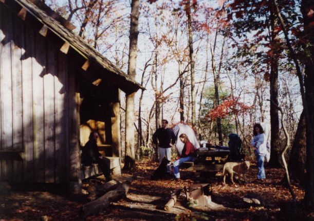
Hawk Mountain is a significant stopping points for A.T. thru-hikers since it is located just 8 miles north of the Appalachian Trail’s southern terminus. The mountain has a storied history tied to the U.S. Army Rangers, who have long used the rugged terrain for training exercises out of nearby Camp Frank D. Merrill – sometimes leading hikers to hear distant gunfire from simulated combat missions. A notable mystery on the summit is the large “G 23” marking, believed to have served as a historical aviation navigation aid or an old landing zone. While the original Hawk Mountain Shelter was built around 1960 and later relocated away from military staging areas to protect the trail experience, the site remains a favorite for backpackers who visit the nearby Hickory Flatts Cemetery and the scenic Long Creek Falls. This hike to Hawk Mountain starts at Three Forks, a nice flat area accessible by USFS 58 where Stover, Chester, and Long Creek converge. We followed the Appalachian Trail from Three Forks past Long Creek Falls (a scenic waterfall with a thirty foot drop) and on to Hawk Mountain (the site of an Appalachian Trail shelter).
- click for more photos from this hike to Hawk Mountain: November 7, 1998
- click for a Daytimer report from this hike starting at Three Forks: November 7, 1998 (password required)
- click for a Trails Illustrated map of this area between Amicalola Falls & Springer Mountain
- click for a Georgia Appalachian Trail overview map (password required)
- click for a Georgia Appalachian Trail profile map (password required)
- click for an ATC trail map from Three Forks to Woody Gap (password required)
- click for an ATC profile map from Springer Mountain to Sassafrass Mountain (password required)
- click for more information on the Appalachian Trail
- click for Appalachian Trail hiking and backpacking books
- click for the guidebook Appalachian Trail: Georgia-North Carolina which has details on this destination
- click for other Georgia hiking and backpacking books


