Yellowstone Falls
Pisgah National Forest
Shining Rock Wilderness
1600 Pisgah Highway
Pisgah Forest, NC 28768
(828) 877-3265

The Shining Rock Wilderness is a series of high elevation ridges with spectacular views in the Pisgah National Forest. Five peaks in the area are over 6000 feet including Cold Mountain (6,030 feet) and Black Balsam Knob (6,214 feet). However, the wilderness is named for Shining Rock (5,940 feet) which is a summit of white quartz located in the middle of the forest. The area is known for its open balds, rugged terrain, and extensive trail network, including sections of the Art Loeb Trail and the Mountains-to-Sea Trail. Hikers can expect sweeping 360-degree views, especially from grassy summits like Black Balsam Knob, along with diverse ecosystems ranging from spruce-fir forests to exposed alpine-like ridges. The wilderness is also popular for backpacking, offering remote campsites and a sense of solitude despite its proximity to the Blue Ridge Parkway.
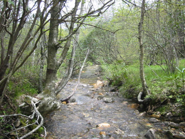
This hike to Yellowstone Falls is lower in elevation and more easily accessed than the large peaks of the wilderness. Yellowstone Falls is named after the yellow mosses, lichens, and minerals that coat the rocks around the falls. The falls are near the Graveyard Fields, an area destroyed by fire in November 1925. The blaze cleared the forest of vegetation and left only spruce tree stumps. This reminded many hikers of gravestones in a cemetery and the name stuck. The hike to the upper falls starts at the Blue Ridge Parkway mile marker 418.8 and follows a paved path down to the Yellowstone Prong of the East Fork of the Pigeon River. Here the Yellowstone Falls Trail (which is also known as the Graveyard Fields Trail) turns left and follows the river to Upper Yellowstone Falls.
- click for a detailed trip report of this hike in the Shining Rock Wilderness: August 12, 1995 (password required)
- click for a Daytimer report of this hike to Yellowstone Falls (password required)
- click for the Pisgah Ranger District Trails Illustrated map which details on this area
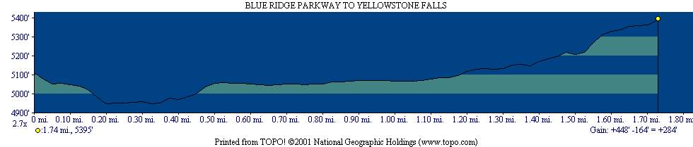
- click for a topographical and profile map of this hike in the Pisgah National Forest
- click for a map of intersecting trails at Shining Rock (password required)
- click for a photo of intersecting trails at Shining Rock (password required)
- click for more photos from other hikes to Yellowstone Falls on May 16, 2004 and May 22, 2004
- click for more backpacking trips in the Shining Rock Wilderness in October 1996 and October 1999
- click for the guidebook North Carolina Hiking Trails which has details on this destination