Tusquitee Bald
Nantahala National Forest
Wayah Ranger District
Franklin, NC 28734
828-524-6441
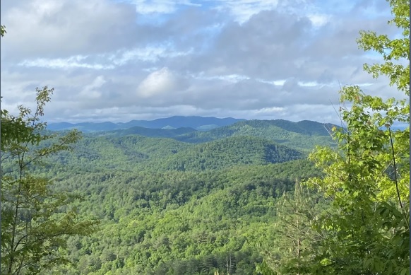
The Nantahala National Forest is the largest of the four national forests in North Carolina and is the the second wettest region in the country – after the Pacific Northwest. The word “Nantahala” is a Cherokee word meaning “Land of the Noonday Sun.” In some spots, the sun only reaches the floors of the deep gorges in the middle of the day. The National Forest has 531,270 acres with elevation ranging from 5,800 feet at Lone Bald in Jackson County to 1,200 feet in Cherokee County along the Hiwassee River.
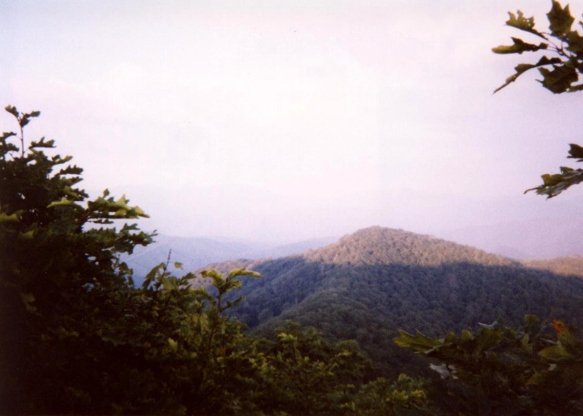
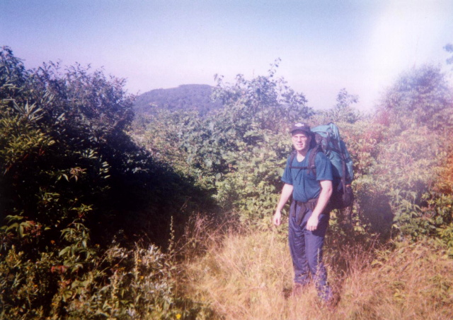
Tusquitee Bald at 5,240 feet has an elevation gain of 2,160 feet from the Bob Allison Camp at Tuni Gap Road. There are outstanding views from the summit to Wine Spring Bald (on the Appalachian Trail to the east), Chatuge Lake to the south, and Nantahala Lake to the northeast. The Chunky Gal Trail climbs to the Dead Line Ridge which was not well marked or maintained during our visit. If you are looking for solitude, however, this is your hike. We didn’t see a soul on this trip and that is rare these days, especially on a weekend.
- click for more photos from this backpacking trip to Tusquitee Bald: August 2, 1997
- click for a Daytimer report for this hike in the Nantahala National Forest: August 2, 1997 (password required)
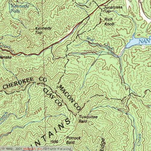
- click for a topographical map with details on this hike to Tusquitee Bald
- click for a profile map of this hike on the Chunky Gal Trail (password required)
- click for a black and white guidebook map of the Chunky Gal Trail (password required)
- click for a photo of some major peaks in the National Forest including Tusquitee Bald (password required)
- click for a photo of Tusquitee Bald and the Tusquitee Range from across the valley (password required)
- click for a guidebook with details on this hike to Tusquitee Bald (password required)
- click for the guidebook North Carolina Hiking Trails which has details on this destination
- click for other North Carolina hiking and backpacking books
- click for more hikes in the State of North Carolina