Shepard State Park
Shepard State Park
1034 Graveline Road
Gautier, MS 39553
(228) 497-2244
Shepard State Park is a scenic park located in Gautier, Mississippi. It offers a variety of outdoor activities, including hiking, biking, fishing, and camping. The park is known for its peaceful atmosphere, with plenty of wildlife, wooded areas, and access to the Singing River. There are several trails for both hikers and cyclists to explore. The trails wind through a mix of pine forests, wetlands, and open fields, providing an outdoor experience with plenty of wildlife sightings. The park also has RV and tent camping sites with amenities like water and electricity.
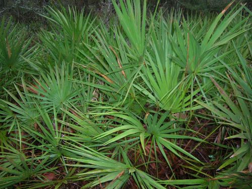
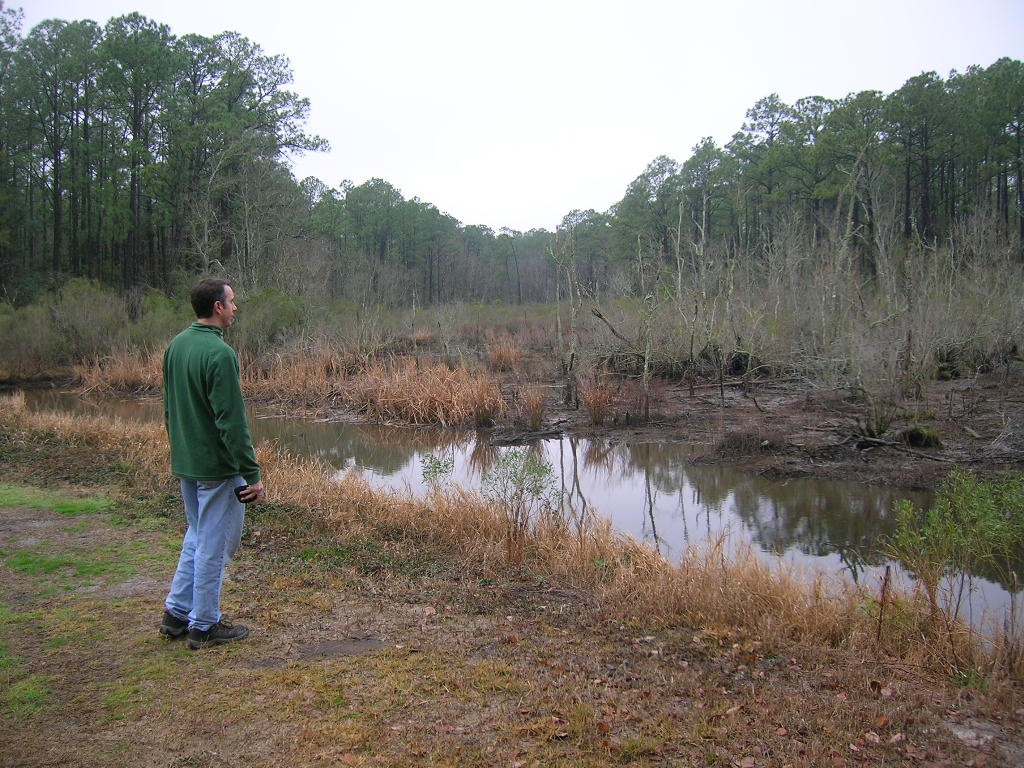
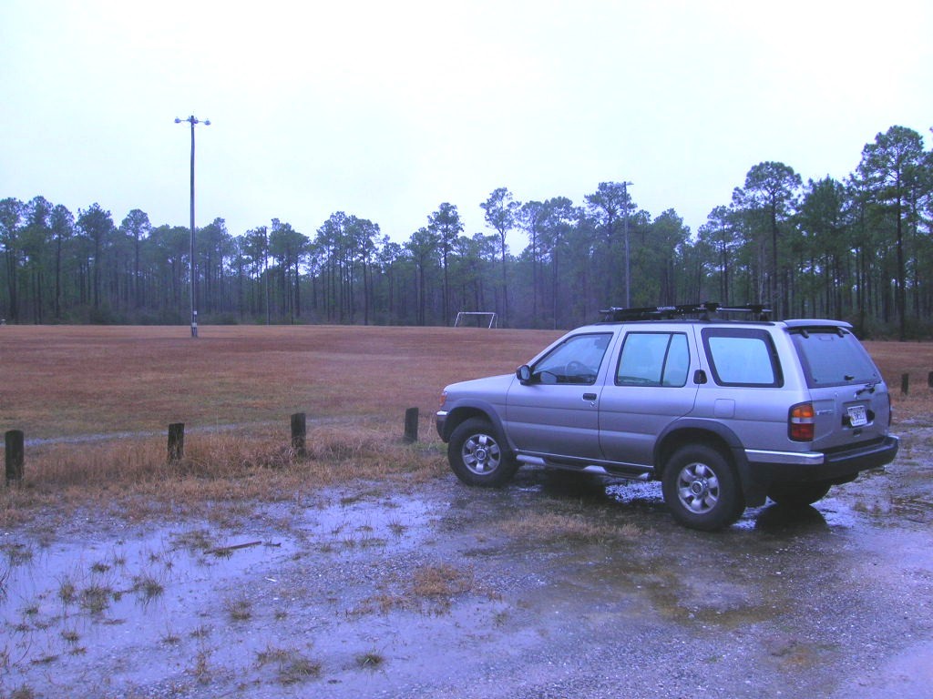
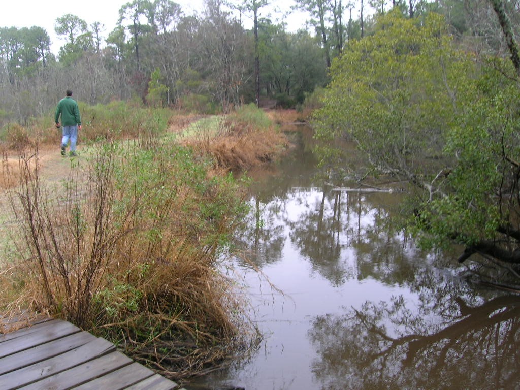
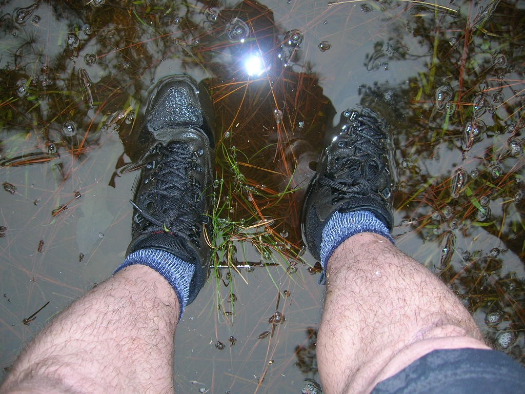
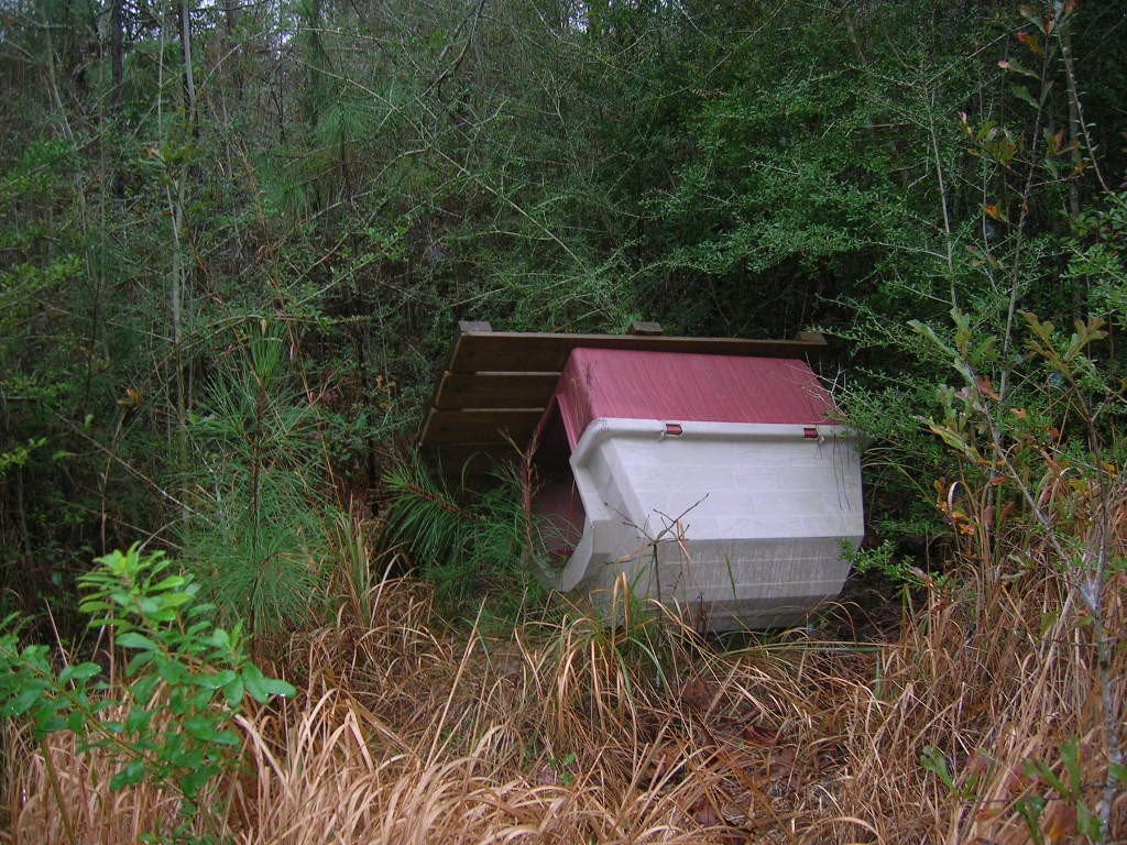
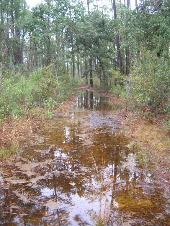
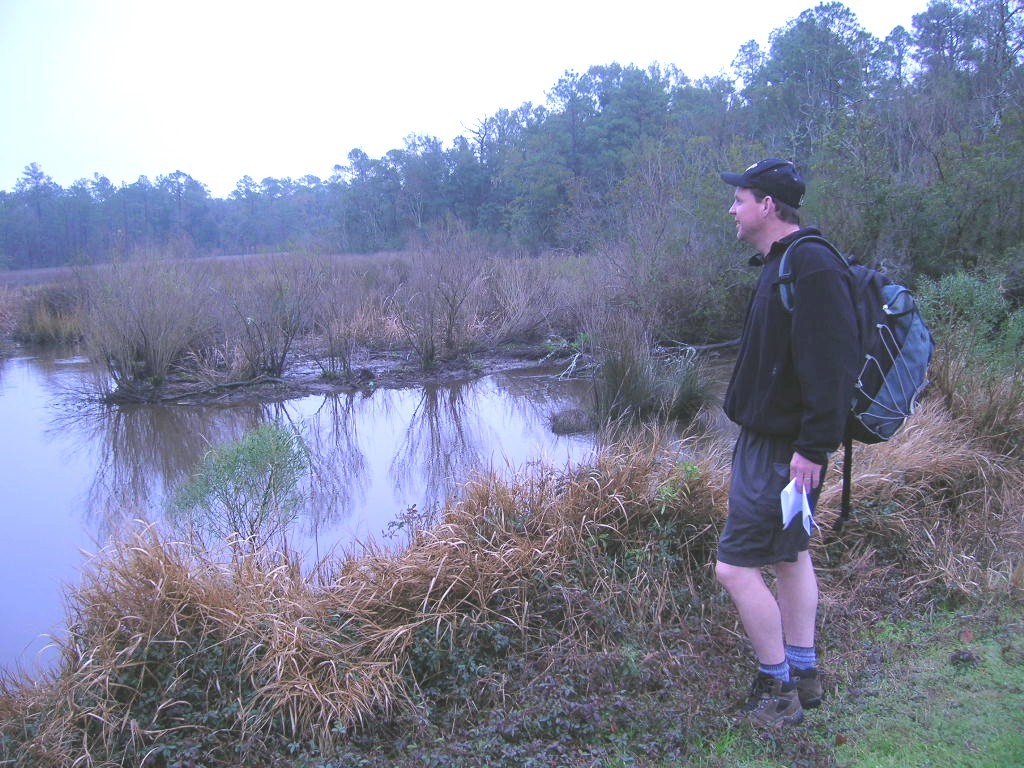
This hike at Shepard State Park starts near the ball fields (which look more like abandon soccer fields than anything). We followed the gravel road down and to the left until we found signs for the Palmetto Trail which traverses a series of small wood footbridges over a bayou then enters a coastal forest. The trail loops through this wilderness then turns back to the starting point after a few miles. Visible on the trail are some tidal creeks, open marshland, and numerous items that were washed in the forest during Hurricane Katrina. We found everything from photo albums, tackle boxes, to a large dog house. Check with the ranger station before you head out, as the trail was extremely swampy (up to shin deep in some areas) during our hike.
- click for a trip report from this walk through Shepard State Park: January 26, 2008 (password required)
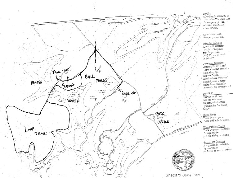
- click for a park map of Shepard State Park
- click to view a trail map from this hike on the Palmetto Nature Trail
- click for a topo and profile map of this hike at Shepard State Park (password required)
- click for the guidebook Hiking Mississippi for more hikes in the area
- click for more hikes in the State of Mississippi

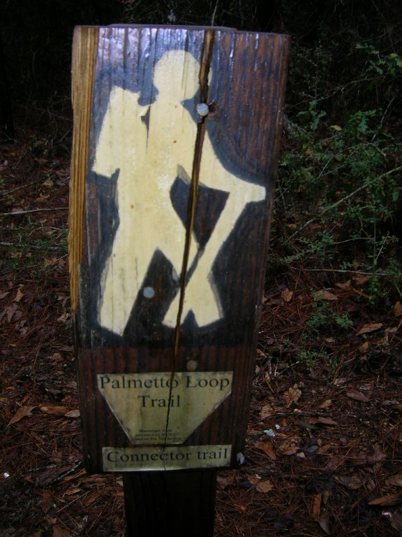


This loop trail seems to be called the Oscar Trail and not the Palmetto Nature Trail as of 2025