Foothills Trail (Upper Whitewater Falls to Sloan Bridge)
Foothills Trail Conference
P.O. Box 3041
Greenville, SC 29602
864.467.9537
The Foothills Trail is a scenic, long-distance hiking trail that spans approximately 77 miles across the foothills of the Blue Ridge Mountains in the Carolinas. It stretches between Oconee State Park in South Carolina and Table Rock State Park, also in South Carolina, though parts of the trail extend into North Carolina. The trail is well-marked and maintained by the Foothills Trail Conservancy, which provides resources such as maps and guides. The Foothills Trail varies from moderate to challenging, with steep climbs and descents in some areas, especially near Table Rock and Sassafras Mountain, which is South Carolina’s highest point. No permit is required for hiking the trail, but some campsites may require reservations or fees.
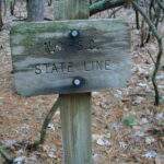
The main stem of this nearly 100 mile long hiking trail extends from Table Rock State Park in Pickens County, to Oconee State Park in Oconee County. The trail crosses some of the most rugged and beautiful terrain in the Southeast and provides access to Sassafrass Mountain, the highest peak in South Carolina, and to major mountain streams and breathtaking views. The section of trail from Upper Whitewater Falls to Sloan Bridge is a wooded area that ascends Grassy Knob and follows the Chattooga Ridge across the SC/NC line and descends to Sloan Bridge at SC 107.
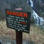
- click to see more photos from this hike on the Foothills Trail: February 15, 2003
- click for a detailed trip report of this walk near Sloan Bridge: February 15, 2003 (password required)
- click for a trip report from this hike near Sapphire, NC: February 15, 2003 (password required)
- click for an overview map of the Foothills Trail (password required)
- click to buy the official Foothills Trail map from the Foothills Trail Conference
- click for a topographical & profile map of the entire Foothills Trail (password required)
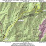
- click for a topographical and profile map of this section from Upper Whitewater Falls to Sloan Bridge (password required)
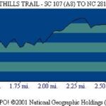
- click for a topo and profile map from Upper Whitewater Falls to SC 107 (password required)
- click to buy a guidebook on the Foothill Trail
- click for more information on the Foothills Trail
- click for Foothills Trail hiking and backpacking books
- click for South Carolina hiking and backpacking books
- click for other hikes on the Foothills Trail in South Carolina
