Linville River (via Bynum Bluff)
Pisgah National Forest
Grandfather Ranger District
109 East Lawing Drive
Nebo, NC 28761
(828) 652-2144
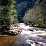
The Linville Gorge Wilderness in the mountains of western North Carolina is part of the Pisgah National Forest and it covers 10,975 acres of dense hardwood and pine forest. The gorge is formed by Jonas Ridge on the east and Linville Mountain on the west and it is bisected by The Linville River at 1,300 feet. The terrain is extremely steep and rugged, and it rises to 4,120 feet at Gingercake Mountain, the highest point in Linville Gorge. These features are ideal for hiking, backpacking and rock climbing and the area has roughly 39 miles of wilderness trails to explore. The area is named after explorer William Linville who with his sons was scalped by Indians in 1766 in the gorge. Today, the primary challenge is route finding as some trails are quite steep and meander through dense forest. Novice hikers often get easily disorientated, so make sure to take a map, compass, and/or GPS on your trip.
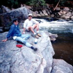
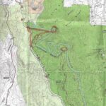
This hike starts at the Bynum Bluff trailhead and follows a trail bearing the same name 1.1 miles down to the Linville River. The Bynum Bluff trail drops 746 feet to the river where there are backcountry campsites in the gorge. On this backpacking trip, we camped at the river before exiting the gorge via the Pine Gap trail and looping back to our car via the forest road (1238), The Linville River flows through the center of the gorge for about 12 miles, cascading over rocks and creating pools. It is often used by anglers and has some secluded spots for swimming – although the currents can be strong. Linville Gorge is a designated wilderness area, so visitors are encouraged to follow Leave No Trace principles. There are no developed facilities, and cell service is spotty.
- click to see photos from this hike in the Linville Gorge Wilderness: May 7, 1993
- click for a Daytimer report of this backpacking trip in the Pisgah National Forest: May 7, 1993 (password required)
- click to purchase a Trails Illustrated map of Linville Gorge in the Pisgah National Forest
- click for a topo and profile map of this loop hike to the Linville River (password required)
- click for a topo and profile map of the Bynum Bluff trail to the Linville River (password required)
- click for a trail map of this hike in the Linville Gorge Wilderness
- click for a hike on the Pinch-In trail in the Linville Gorge Wilderness in April 1993
- click for a hike on the Conley Cove trail in the Linville Gorge Wilderness in November 1994
- click to access the guidebook North Carolina Hiking Trails which has details on this destination
- click for other North Carolina hiking and backpacking books


