Looking Glass Rock (Upper Summit)
North Carolina National Forests
Supervisor’s Office
160 Zillicoa St. Suite A
Asheville, NC 28801
828-257-4200
The Pisgah National Forest was established in 1916 and was one of the first national forests in the eastern United States. The land originally included 86,700 acres that were part of the Biltmore Estate, but were sold to the federal government in 1914 by Edith Vanderbilt. Today the Pisgah National Forest covers 512,758 acres of mountainous terrain in the southern Appalachian Mountains of North Carolina – including parts of the Blue Ridge and Great Balsam Mountains. Elevations reach over 6,000 feet and include some of the highest mountains in the eastern United States.
Looking Glass Rock is a massive piece of exposed granite that rises from the valley floor at 2310 feet to the summit at 3969 feet in the Pisgah National Forest. The name reflects the appearance of the mountain when water freezes on the exposed granite and reflects the sun like a mirror. This hike to Looking Glass Rock is located near Brevard, North Carolina and is a favorite destination of many hikers and backpackers. It is often crowded on weekends, so get there early for a parking spot or plan to hike during the week.
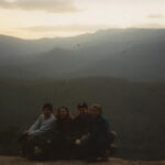
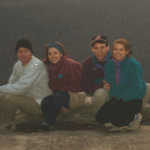
- click to see trail photos from this hike to Looking Glass Rock: April 1, 1995
- click to view a Daytimer report from hike in the Pisgah National Forest: April 1, 1995 (password required)
- click to purchase the Pisgah Ranger District Trails Illustrated map which details on this area
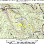
- click for a topographical and profile map from this hike to Looking Glass Rock (password required)
- click for a topo and profile combo map of this hike to Looking Glass Rock (password required)
- click for hikes to the lower site at Looking Glass Rock in March 1995 and April 2000
- click for hikes to the upper site at Looking Glass Rock in April 1995 and September 1999
- click to read an article from another backpacking trip to Looking Glass Rock: April 21, 2000
- click to access the guidebook North Carolina Hiking Trails which has details on this destination
- click for other North Carolina hiking and backpacking books


