Fifth Debsconeag Lake
The Nature Conservancy
Worldwide Office
4245 North Fairfax Drive, Suite 100
Arlington, Virginia 22203-1606
Phone: 703-841-5300
The Debsconeag Lakes Wilderness Area (DLWA) is located just south of Baxter State Park and to the east of Nahamakanta Lake, and includes some sections of the Appalachian Trail. The Native American name means “carrying place” for the portage sites they used to carry their birch bark canoes around rapids and waterfalls. The Nature Conservancy acquired this 46,271-acre preserve in 2002 and secured a forest conservation easement on 195,000 acres adjacent to the Debsconeags and Baxter State Park.
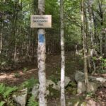
The DLWA contains the highest concentration of pristine remote ponds in New England and has thousands of acres of mature forests. On this hike, we followed the Nahamakanta Stream Road past Nahamakanta Lake for one mile to a trailhead for the Debsconeag Backcountry Trail and followed it 1.1 miles to the northwestern edge of the Fifth Debsconeag Lake. This lake is one of a series of Debsconeag lakes and ponds that you can hike to in the wilderness, and there are loops ranging from ~ 9 to 14 miles with the larger loop taking you on the northeastern shore of Nahmakanta Lake.
- click for a video of this hiking and backpacking trip in Maine in September 2022
- click to see photos from our hike on the Debsconeag Backpacking Trail: September 24, 2022 (password required)
- click for a trip report from this hike in the 100 Mile Wilderness: September 24, 2022 (password required)
- click for an area map of the Debsconeag Lakes Wilderness (password required)
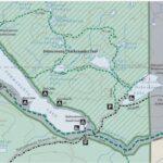
- click for a trail map of the Nahamakanta & Debsconeag Lakes
- click for a mileage map of the Debsconeag Lakes Wilderness Area
- click for a topo and profile map of the A.T. from the West Branch of the Pleasant River (password required)
- click for a topo and profile map of the A.T. from Nahmakanta Lake to Mt. Katahdin (password required)
- click for a map of the Appalachian Trail in New England (password required)
- click to access the guidebook Appalachian Trail: Maine which has details on this area
- click for other Maine hiking and backpacking books


