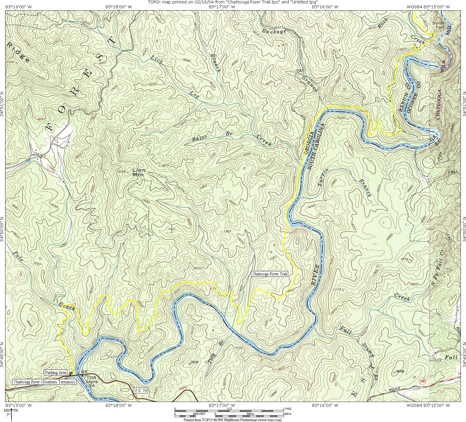
Chattooga River Trail (US 76 to Sandy Ford)
Chattahoochee National Forest
Chattooga River District
9975 Highway 441S
Lakemont, GA 30552
706 754-6221

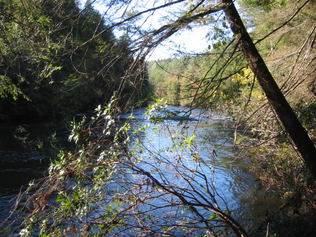
The Chattooga River begins in the mountains of North Carolina as small rivulets, nourished by springs and abundant rainfall, high on the slopes of the Appalachian Mountains. The water drops a half mile in elevation over fifty miles as it winds its way to Lake Tugaloo where the river ends between South Carolina and Georgia. The Chattooga is one of the few remaining free-flowing streams in the Southeast, and the setting is primitive with dense forests and undeveloped shorelines on most of its route.
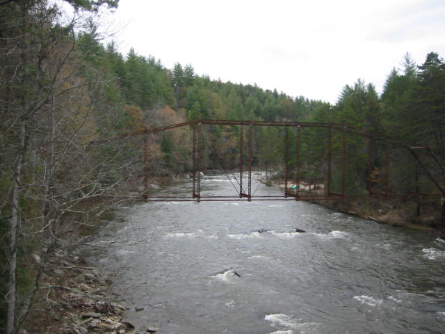
The Chattooga River Trail is a forty mile route that borders the states of North Carolina, South Carolina, and Georgia and follows the banks of the Chattooga National Wild And Scenic River from Burrell’s Ford to US 76. Congress designated the river on May 10, 1974 and it is often used by kayakers, hikers, backpackers, and fisherman as it winds from the North Carolina mountains to Lake Tugaloo. The Chattooga River Trail shares its pathway with both the Foothills and Bartram Trails in the Russell Bridge area, but it stays close to the river for its entire distance unlike the other major southeastern trails.
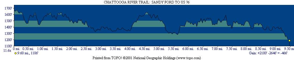
Section One of the Chattooga River Trail runs from US 76 to Sandy Ford Road near Clayton, GA. The hike stays close to the Chattooga National Wild And Scenic River for its entire route and the Class 3-5 rapids (once featured in the 1972 movie Deliverance) are often heard in the distance. Only a few miles of this section hug the banks of the Chattooga, and the majority of the hike is spent high on the ridge making moderate ascents and descents through a hardwood forest. Nonetheless, there are occasional views of the river particularly in the winter months and some nice campsites are only a few miles from each trailhead. At 1,190 feet, US 76 is the lowest elevation on the entire Chattooga River Trail and it is also the southern terminus of the route.
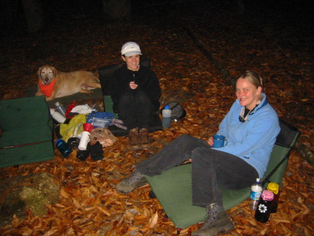
- click to see trail photos from this hike along the Chattooga River Trail: November 13, 2004
- click to view a detailed trip report of this hike starting at Sandy Ford: November 13, 2004 (password required)
- click for a trip report of this backpacking trip starting at U.S. 76 (password required)
- click for a topographical map of this section of the Chattooga River Trail
- click for a detailed map and profile map for this section between U.S. 76 and Sandy Ford
- click to view a trail map of the Chattooga River from Sandy Ford to US 76 (password required)
- click for The Chattooga National Wild And Scenic River guidebook which has details on this destination
- click for more information on the Chattooga River Trail
- click for Chattooga River Trail hiking and backpacking books
- click for other Georgia hiking and backpacking books
- click for other hikes on the Chattooga River Trail in Georgia