Currahee Mountain
Chattahoochee-Oconee National Forest
Chattooga River District
9975 Highway 441 S
Lakemont, GA 30552
706-754-6221
Currahee Mountain is a well-known landmark in northeast Georgia that is located just outside the town of Toccoa. At 1,735 feet, the mountain stands alone from the Blue Ridge Mountains, which makes it especially striking. “Currahee” comes from the Cherokee word gurahiyi, often translated as “stands alone” — a fitting description for this solitary peak. The mountain is most famous for its role in World War II when nearby Camp Toccoa was a training base for paratroopers. This included the famous “Easy Company” of the 506th Parachute Infantry Regiment which was later featured in the film Band of Brothers. Trainees would run up and down Currahee as part of their conditioning — a grueling 3-mile climb that became legendary. The phrase “Three miles up, three miles down” became a symbol of their toughness. There is a museum open to the general public at the base of the mountain that tells the story of the WWII paratrooper training in the area.
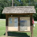
This hike to Currahee Mountain follows a gravel 4×4 road for ~2.8 miles to the summit which has multiple cell phone towers but outstanding views from the top. There is a trailhead and parking for 5-7 vehicles at the start of the 4×4 road and a gate just after it. The gate is typically open – so don’t be surprised to see people driving to the summit, but because of the history of the paratroopers you will often find hikers and occasionally military personnel training on the road. Veterans and families still make pilgrimages to Currahee, and each year the Currahee Challenge Run follows the paratroopers old training route.
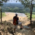
- click to watch a 360 video from a rock outcropping at Currahee Mountain
- click for a panoramic photo from the rock outcrop near the tower
- click for a trip report from this hike near Toccoa, Georgia: September 5, 2020 (password required)
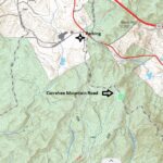
- click for a trail map from this hike on Currahee Mountain Road
- click for a topo and profile map from this hike to Currahee Mountain (password required)
- click for the guidebook Hiking Georgia which has more hikes and backpacking trips in the State of Georgia
- click for other Georgia hiking and backpacking books
- click for links to other outdoor books and magazines
- click for more hikes in the State of Georgia


