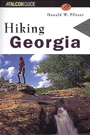
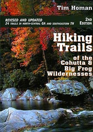
GEORGIA – TRAIL BOOKS

Hiking Georgia

Georgia beckons hikers with nearly 1,000 miles of trails that tunnel through flowering rhododendron thickets, follow streams of the northern mountains, crisscross historic paths in rolling foothills, and wind among towering pines of the coastal plain. Hiking Georgia, Second Edition, the only guide to the entire state, covers well-known areas but also introduces hikers to some relatively undiscovered places. Author Donald W. along a quiet nature trail, a trek along 80 miles of the Appalachian Trail, or a medium distance that suits you. Recently revised and expanded, this guide contains accurate information, detailed maps, and photos that depict the landscape of the Peach State’s backcountry: the come-hither curve of an insectivorous swamp plant, rivers and waterfalls, and historic battlefields. It also includes tips on hiking with children and backcountry safety and ethics.

Birdshooter’s Take: This book is organized by geography with an index map showing you the exact location of each hike. That’s a major plus if you are looking for a day or overnight trip in a particular region of the state. Hiking Georgia also has a trail map which shows major roads, trailheads, and the route of the hiking trail. There are some pictures in this trail book and the material is decent with data on trail difficulty, length, elevations, and special features and attractions. There are 74 hikes in this book and it is geared to both day and overnight hikers. My Recommendation: If you do a lot of hiking all over the State of Georgia this is a good buy since it is one of the few books that covers the entire state.

The Hiking Trails of the Cohutta and Big Frog Wildernesses

Join Tim Homan as he explores the trails of northwestern Georgia and southeastern Tennessee, describing the surroundings and providing important information for novice and experienced hikers. Tim Homan returns as our guide through northwestern Georgia and southeastern Tennessee in his third hiking book covering the southern Appalachians. Homan expertly maps out each area and describes each trail in great detail, explaining the surrounding habitat, providing comments on the area’s vegetation, and noting specific sights to see. His personable narrative style makes the book at once a helpful resource and a pleasure to read. Trailhead and regional maps and detailed directions make the book even more user-friendly.

Birdshooter’s Take: Author Tim Homan has a number of guidebooks for hikes in the Southeast and I have found his writings to be among the best. There is detailed history on the Cohutta and Big Frog Wilderness in this book with thorough directions to the trailheads, nature notes, and a difficulty rating for both day hikers and backpackers. My Recommendation: This guide is currently the best and only book available if you plan to hike in the Cohutta and Big Frog Wilderness.

Hiking Trails Of North Georgia

The Hiking Trails of North Georgia is an indispensable resource, whether you’re planning a leisurely afternoon walk or a strenuous backpacking trip. The convenient new format of this updated third edition will enable you to explore North Georgia’s beautiful natural area with intelligence and ease.

Birdshooter’s Take: This is another of Tim Homan’s guidebooks and one of the first ones that I used for Georgia hiking trails. It has 124 hikes in the State with 11 maps and precise directions to the trailheads. The book is designed for both hikers and backpackers but focuses only on the trails in North Georgia. It also includes sections of the Appalachian Trail, Benton MacKaye Trial, Duncan Ridge Trail, and Bartram Trail in Georgia. My Recommendation: If you hike a lot in North Georgia, this is the best book out there.

Exploring the Appalachian Trail: Georgia, North Carolina, Tennessee (Exploring the Appalachian Trail)

10 b/w photos 65 maps Complete descriptions of 170 great day hikes on the AT Easy-to-read topographic maps and elevation profiles for each hike Plants, wildlife, and historical points to see along the way From the spruce forests of Tennessee and the leafy gorges of Virginia to the rolling Pennsylvania hills and the rocky heights of New England, the Appalachian Trail offers 2,200 miles of hiking opportunities. The five books in this series present accurate, detailed information for 170 day hikes (and a few overnighters), all recommended by AT experts. Where to start and finish, water sources and shelters, early exit options, and what to expect on the trail itself are described. Specially commissioned easy-to-read-and-use topographic maps and elevation profiles accompany each recommended hike; mileage data, the best direction to travel, route difficulty, and sources for additional maps and information are also included. Each book points out natural and historical featuresplants, trees, animals, landforms, bridges, vistasthat make the recommended hikes special. 32 hikes in Georgia, North Carolina and Tennessee.

Birdshooter’s Take: This is a great book particularly if you do a lot of one and two day hikes along the Appalachian Trail in Georgia, North Carolina or Tennessee. Most guidebooks don’t have profile maps, but this one has both a profile and a trail map in the book. There is also other useful information that you don’t always find in a guidebook including recommended campsites, loop options (if you want to use some blue-blazed side trails to loop back to your starting point), and a summary of the itinerary in a mileage format. My Recommendation: Get this book over the A.T. guide shown below if you do a lot of day or overnight hikes. There’s more detail and it has trail and profile maps.

Appalachian Trail Guide to North Carolina – Georgia

Official guidebook and maps to the Appalachian Trail in north Georgia (the southern terminus) into North Carolina and through the Great Smoky Mountains National Park, more than 235 miles. Includes two detached map sheets for south of the park and National Geographic-Trails Illustrated’s map of the park.

Birdshooter’s Take: The ATC has been cranking out guidebooks for years and has a lot of experience in detailing trail history, geography, and relocations. This book includes all sections of the A.T. from it’s start at Springer Mountain in Georgia through the Great Smoky Mountain National Park along the North Carolina and Tennessee border. A trail itinerary for both northbound and southbound hikers along the A.T. makes it easy to follow regardless of your route. There’s also detailed information on side trails, campsites, shelters, and water sources along the route. My Recommendation: Buy this book if you plan to hike a large section of the A.T. in either Georgia or North Carolina. This is the best information available and the book is small enough to put in your pack. It’s better than the book shown above for a long distance hiker due to its size and tendency to focus on the A.T. from a long distance hiker’s perspective.

Best Hikes With Dogs Georgia And South Carolina

One cold November night in the Blood Mountain Wilderness in north Georgia, Steve Goodrich and his wife, Ashley, had to wrap themselves around their yellow lab, Rebel, under one sleeping bag. It was the last time they would fail to anticipate their dog’s special needs on the trail. Since then, Rebel and the Goodriches have hiked thousands of miles together in Georgia and South Carolina to select the best dog-friendly, dog-fun, and dog-safe trails in the region. Most hikes are on lightly traveled trails with few horses, bicycles, or motorized vehicles. Hikes avoid steep, rocky terrain and many offer lakes or streams as rewards. Potential dog hazards such as alligators or snakes are noted in the hike descriptions. Advice on hiking with dogs includes what to pack for your pooch–the Ten Canine Essentials and a doggy first-aid kit. A “Hike Summary” chart in the front of the book indicates trail length, water features, loop hikes, whether “best for fit dogs,” and more.

Georgia Atlas & Gazetteer

These over-size maps offer full state coverage of things important to outdoor users, such as back roads, dirt roads and trails, hidden lakes and streams, boat ramps, public lands, trailheads, campsites, and unique natural features. Most atlases have elevation contours. DeLorme Publishing Company.

Speak Your Mind

*