Browne Circle Double Loop
Lake Lanier Islands Development Authority
3280 McEver Road
Suite 106
Buford, GA 30518
(770) 932-6608
Lake Lanier (officially known as Lake Sidney Lanier) is a large reservoir in northern Georgia, United States. It is one of the most popular lakes in the southeastern U.S., known for its recreational activities, scenic beauty, and historical significance. The lake is located about 40 miles northeast of Atlanta, spanning across Hall, Forsyth, Dawson, Gwinnett, and Lumpkin counties. It was created in 1956 by the U.S. Army Corps of Engineers by damming the Chattahoochee River with the Buford Dam for flood control, water supply, hydroelectric power generation, and recreation.
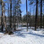
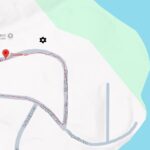
Lake Lanier covers approximately 38,000 acres with over 692 miles of shoreline. The average depth is about 50 feet, with maximum depths around 160 feet near Buford Dam. The lake has numerous islands, many of which are the remnants of hilltops from communities submerged during its creation. This short hike in the Deerwood subdivision follows the Browne Circle Loop near the southwestern portion of the lake. It is an easy walk on a paved road that circles twice around a residential neighborhood on Lake Lanier.
- click for a trip report from this hike on the Browne Circle Loop: December 8, 2017 (password protected)
- click for a trail map of this walk at Lake Lanier in Cumming, Georgia (password protected)
- click for another hiking and camping trip at Browne Circle in November 2016
- click for a hike at Lake Lanier Island on the Legacy Lite Trail in June 2012
- click to see a hike on the nearby Park Brooke Trail in Alpharetta in July 2010
- click to access the guidebook Best Hikes Near Atlanta which has more hikes around the City of Atlanta
- click to access the guidebook Hiking Georgia which has more hikes and backpacking trips in the State of Georgia
- click for other Georgia hiking and backpacking books


