Middle Saluda River
Jones Gap State Park
State Park Service
303 Jones Gap Road
Marietta, SC 29661
(864) 836-3647
The 3,346-acre Jones Gap State Park is located in the 10,000-acre Mountain Bridge Wilderness Area, and the park encompasses the Middle Saluda River, designated as South Carolina’s first scenic river. More than 400 species of flora including rare and endangered plants and state record trees are found in the park, and the Environmental Education Center offers nature exhibits and a lab area to explore. Portions of the old Cleveland Fish Hatchery have been restored and are stocked with trout (for observation only). The park has over fifty miles of hiking trails and is also an access point to the Foothills Hiking Trail via the Jones Gap Trail. There are great campsites along the Middle Saluda River and you can follow numerous trails through both Jones Gap and Caesars Head State Parks for a great day or overnight hike.
Solomon Jones built the Jones Gap Trail as a toll road in the 1800’s, and it was used for this purpose until about 1910. What is now US Highway 276 became the route used by motorists. This shuttle hike begins at the Raven Cliff Falls Parking Lot (where the toll road crossed the ridge) and travels eastbound, culminating at the Jones Gap State Park trailhead. The hike leaves the lot, following the Tom Miller Trail and after 0.8 miles intersects with the Jones Gap Trail. Here the route turns right and follows the Jones Gap Trail another 4.5 miles to the Jones Gap State Park Parking Lot, following the Middle Saluda River almost the entire route. The hike crosses the river several times which makes the route a favorite for dogs that enjoy the water. Along the hike, there are also several small but scenic waterfalls tucked along the Middle Saluda River. One in particular drops about 15 feet after about 3.5 miles, and there is a nice wading pool at its base.
- click to see trail photos from this hike along the Middle Saluda River: August 26, 2000
- click to view a detailed trip report for this hike at Jones Gap State Park: August 26, 2000 (password required)
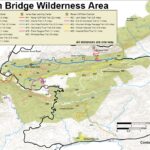
- click for a park and trail map for the Mountain Bridge Wilderness Area
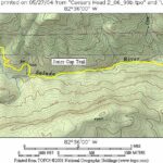
- click for a topographical and profile map of this day hike in the Mountain Bridge Wilderness
- click for more information on the Foothills Trail
- click for other hikes on the Foothills Trail in South Carolina
- click for Foothills Trail hiking and backpacking books
- click to access the guidebook Best Hikes With Dogs Georgia And South Carolina which has details on this destination
- click for South Carolina hiking and backpacking books
- click for other hikes on the Foothills Trail in South Carolina


