|
PACIFIC CREST TRAIL – BOOKSRecommended for leisure reading….Journey on the Crest: 2600 Miles From Mexico To Canada
Recommended if you plan to thru-hike….Pacific Crest Trail Data Book (3rd Ed.)
The Pacific Crest Trail: Southern California
The Pacific Crest Trail: Northern California
The Pacific Crest Trail: Oregon and Washington Whether you’re planning to hike the entire Pacific Crest Trail through Oregon and Washington, or just a section PACIFIC CREST TRAIL – VIDEOSThe Pacific Crest Trail: WalkScott Herriott, a self-proclaimed lazy***, had no desire to hike 2,658 miles (at least in the same calendar year). So, instead, he went out and interviewed those who were attempting to do so. From late April to early Oct. of 2003 he tracked down over 100 intrepid/insane souls who were in the middle of committing a half year of Have feedback or recommendations on a magazine? Click Trail Talk for the book forum. |
 Cindy Ross details her hike on the Pacific Crest Trail in this narrative from the 1980’s. She starts her hike in California and after a dangerous fall returns to finish the hike a few years later.
 The Pacific Crest Trail Data Book contains a summary of the entire Pacific Crest Trail, which covers over 2,650 miles from Mexico to Canada. The PCT terrain varies from desert in Southern California to the High Sierra in Central California to the Cascades, which extend from Northern California, through Oregon, and into Washington. The Pacific Crest Trail Data Book was created as an adjunct to the Pacific Crest Trail: Volumes 1 and 2 published by Wilderness Press. The data book is designed for planning, tracking, and quick reference both on and off the trail. –This text refers to an out of print or unavailable edition of this title.
 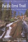 Successor to the Wilderness Press classic Pacific Crest Trail: California, this essential volume covers the PCT from the Mexican border to Tuolumne Meadows in Yosemite National Park. Complete 2-color topographic maps enhance comprehensive descriptions, including mileages and elevations. Trail descriptions and maps are divided into several sections, convenient for people who only want to hike a portion of the trail. Each section introduces up-coming scenery, possible hazards, supply locations, and mileages between major points. Includes information on the history of the trail as well as the geology and natural history you will encounter.
 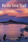 Successor to the Wilderness Press classic Pacific Crest Trail: California, this essential volume covers the PCT from Tuolumne Meadows in Yosemite National Park north to the Oregon border. Complete 2-color topographic maps enhance comprehensive descriptions, including mileages and elevations. Trail descriptions and maps are divided into several sections, convenient for people who only want to hike a portion of the trail. Each section introduces up-coming scenery, possible hazards, supply locations, and mileages between major points. Includes information on the history of the trail as well as the geology and natural history you will encounter.
 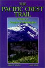 or two, this is an essential guide to the sometimes complicated logistics and navigation of a long-distance expedition. The beginning chapters provide planning basics: post-office addresses for mailing food and supplies, suggestions on when to hike which sections and what to bring, and an introduction to the geology, flora, and fauna of the region. But the heart of the guide comprises 12 chapters of trail specifics between Highway 96 in northern California and Highway 3 in British Columbia. Each section begins and ends at a highway–often at or near a town, resort, or park. Chapters contain topographic maps, prehike information (attractions to be on the lookout for, declination settings, elevation and mileage points, permit regulations, and availability of supplies), along with detailed information on navigating your way along the trail. So if you’re packing up your rucksack for a modest PCT excursion or the full-bore trek, this is one item you can’t afford to leave out.
Speak Your Mind