Cold Mountain
Pisgah National Forest

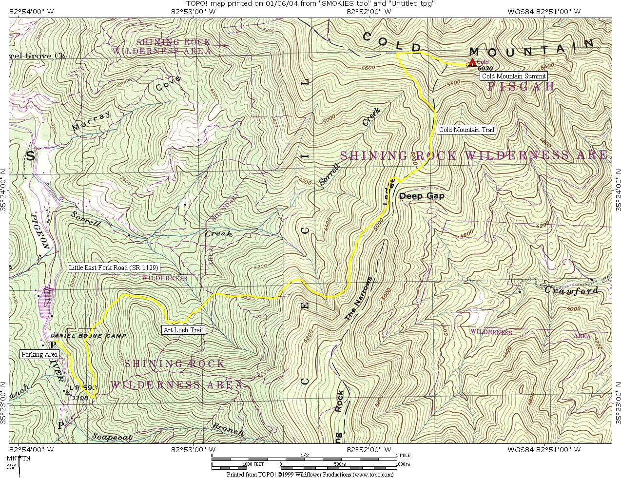
Cold Mountain at 6,030 feet is located in The Shining Rock Wilderness and is one of five peaks in this section of the Pisgah National Forest that rises over 6,000 feet. If you have seen the movie or read the 1997 best selling novel by Charles Frazier then you may be one of the many hikers that have flocked to this area in the last few years. Prior to this, only hunters and hard-core hikers spent much time on the mountain. The 10.4-mile round-trip hike to Cold Mountain is a steep and strenuous route with sections of unmarked trail and and an elevation gain of 2,800 feet from the Art Loeb trailhead at the Daniel Boone Scout Camp (SR 1129) to the summit. Sorrell Creek, a cold, clear mountain stream, is about two miles into the hike and is a nice place to take a break.
Note: This section of the Blue Ridge Parkway is closed for much of the winter depending on the weather, usually November through March. During these months, you can call 828-298-0398 for weather and road closure information. Even when the Parkway is closed, the Cold Mountain overlook is accessible from U.S. 276 exchange.
- click to see trail photos from this hike to Cold Mountain: January 6, 2004*
- click to view a detailed trip report from a backpacking trip in Pisgah National Forest : January 6, 2004* (password required)
- click to view maps of this hike to Cold Mountain: area map, detailed map, profile map, Shining Rock map of intersecting trails, Shining Rock photo of intersecting trails (password required)
- click to view a news articles about Cold Mountain: December 25, 2003 (password required)
- click for the Southeastern Destinations discussion forum
- click to access the guidebook North Carolina Hiking Trails which has details on this destination
- click for other North Carolina hiking and backpacking books
- click for other hikes in the Shining Rock Wilderness of the Pisgah National Forest
- click here to add your hike, trip report, or feedback for this destination
- note, the * indicates these items are not linked but coming soon