Granny Burrell Falls
Nantahala National Forest
Highlands Ranger District
2010 Flat Mountain Rd,
Highlands, N.C. 28741
(828) 526-3765

The National Forest Service acquired Panthertown Valley in 1989 from Duke Power in a deal coordinated by the Nature Conservancy. Surprisingly, the area is still relatively wild with no blazes on the trails and only a few primitive campsites. However there are an amazing number of waterfalls that are packed into a relatively small area and many have pools at their base which make for a great place to swim or fish. Just make sure you take a map and compass on your hike. There are many intersecting trails in the area and route finding can be difficult. On this hike, you’ll have a chance to see the major waterfalls in the valley including Warden Falls, Schoolhouse Falls and Granny Burrell Falls. The route also takes you past the Sandbar Pool and the only shelter in Panthertown Valley.
- click to see trail photos from this hike in Panthertown Valley to Granny Burrell Falls: July 26, 2003
- click to view a detailed trip report from this backpacking trip: July 26, 2003 (password required)
- click to read a trip report from this hike to the Tuckaseegee River: July 26, 2003 (password required)
- click to purchase the Nantahala and Cullasaja Gorges Trails Illustrated map which includes Panthertown
- click to view a topographical map and profile map of this hike to Granny Burrell Falls (password required)
- click to view a trail map of the Panthertown Valley trail system (password required)
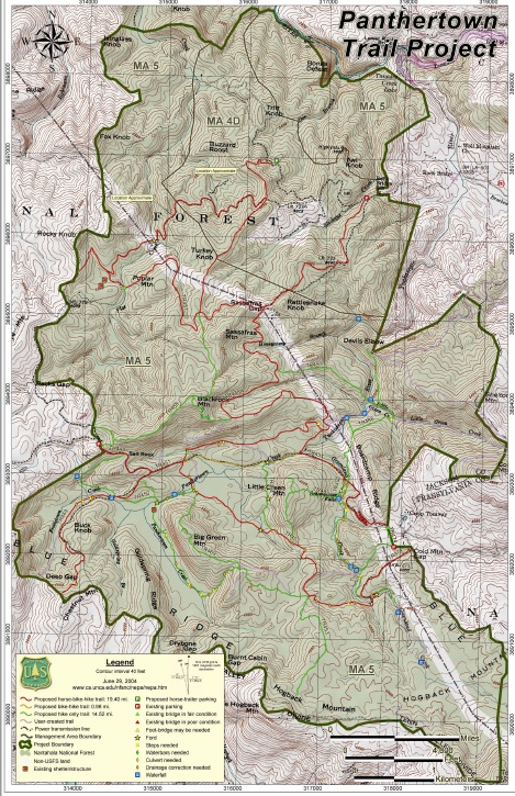
- click to see the Panthertown USFS project map
- click to see more trips to the Tuckasegee River in Panthertown Valley
- click to access the guidebook North Carolina Hiking Trails which has details on this destination
- click for other North Carolina hiking and backpacking books