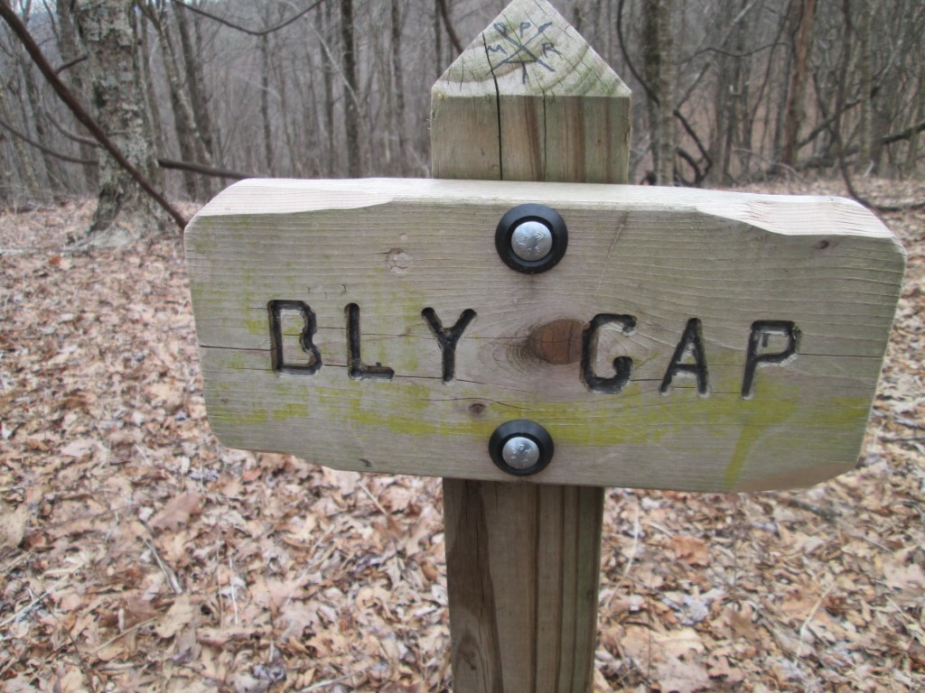
Bly Gap
Appalachian Trail Conservancy
799 West Washington Street
Harpers Ferry, WV 25425
(304) 535-6331

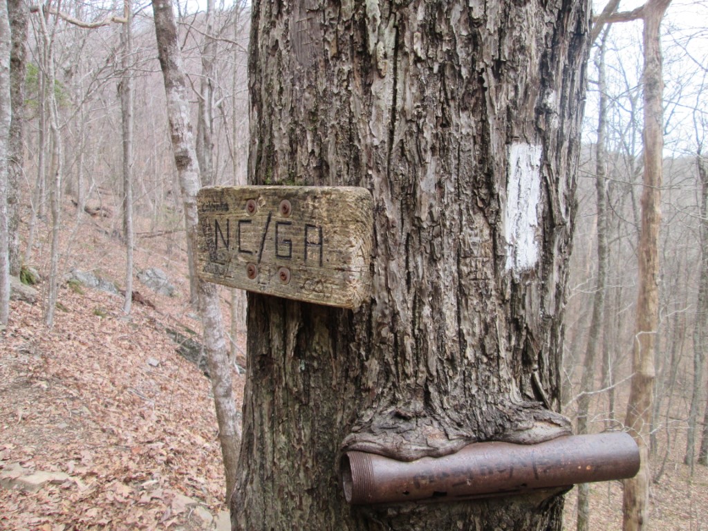
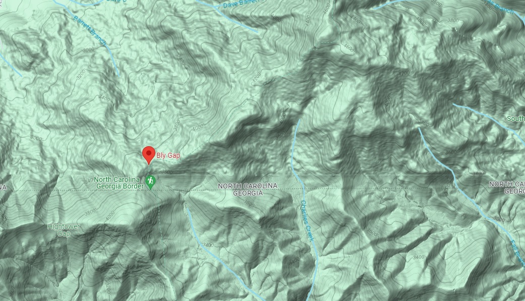
The Appalachian Trail in North Carolina has 95.5 miles of trail which includes more than 200 miles that run along the Tennessee border. Located one-tenth of a mile north of the Georgia and North Carolina border is Bly Gap which sits in a saddle with winter views to the west and east. The hike to Bly Gap is an in-and-out, backtrack trip that can be done as either a day or overnight hike.
The approach to Bly Gap starts from Blue Ridge Gap at U.S. Forest Road 72 and follows the Appalachian Trail northbound for 3.1 miles and nearly 1000 feet to a gnarly old tree that is located just past the Georgia and North Carolina state line. There is a spring to the right before you reach the ridge line that was piped when we last used it in 2015. We approached the trailhead from the west via a rough heavily rutted dirt road that absolutely requires four wheel drive. If you plan to drive to Blue Ridge Gap, approach from the west because the road from the east is even rougher and requires a river crossing.
- click for a seven minute video recap of this backpacking trip to Bly Gap on the Appalachian Trail
- click to see a video of the “Walk Over”, of us hiking out of Blue Ridge Gap, then reaching Bly Gap, and Thorton caught red handed
- click to see trail photos from this hike to the Georgia/North Carolina border on the A.T.: January 31, 2015 (password required)
- click to view a trip report of this backpacking trip on the Appalachian Trail: January 31, 2015 (password required)
- click to purchase maps for the Appalachian Trail in Georgia and North Carolina
- click for an ATC trail map from Adidas Gap to Bly Gap (password required)
- click for an ATC profile map from Sasafrass Gap to Bly Gap (password required)
- click for a Georgia Appalachian Trail overview map (password required)
- click for a Georgia Appalachian Trail profile map (password required)
- click for more information on the Appalachian Trail
- click for Appalachian Trail hiking and backpacking books
- click to access the guidebook Appalachian Trail: Georgia-North Carolina which has details on this destination
- click for other Georgia hiking and backpacking books